

Urban surface cover fine classification method and device based on remote sensing image
A technology for ground cover and fine classification, applied in the field of fine classification of urban ground cover, can solve the problem of inability to accurately identify the information of urban ground cover, and achieve the effect of improving accuracy
- Summary
- Abstract
- Description
- Claims
- Application Information
AI Technical Summary
Problems solved by technology
Method used
Image

Examples
Embodiment Construction
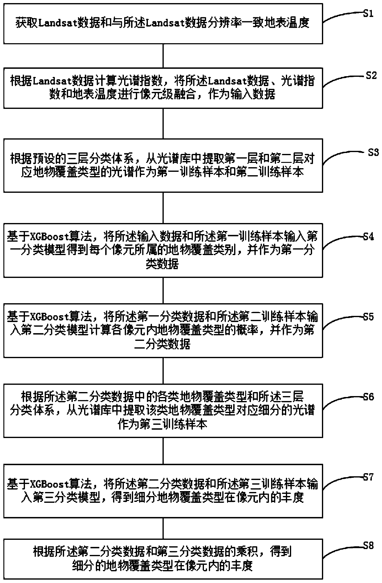
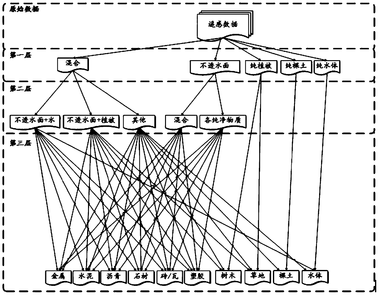
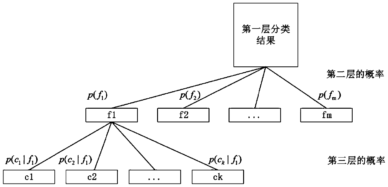
[0054] In order to make the purpose, technical solution and advantages of the present application clearer, the embodiments of the present application will be further described in detail below in conjunction with the accompanying drawings.
[0055] It should be clear that the described embodiments are only some of the embodiments of the present application, rather than all of the embodiments. Based on the embodiments in the embodiments of the present application, all other embodiments obtained by persons of ordinary skill in the art without making creative efforts belong to the protection scope of the embodiments of the present application.
[0056] The terms used in the embodiments of the present application are only for the purpose of describing specific embodiments, and are not intended to limit the embodiments of the present application. The singular forms "a", "said" and "the" used in the embodiments of this application and the appended claims are also intended to include ...
PUM
 Abstract
Description
Claims
Application Information