Automatic GIS drawing method suitable for weather forecast system
A forecasting system and weather forecasting technology, applied in structured data retrieval, special data processing applications, geographic information databases, etc., can solve problems such as no help, and achieve the effect of improving efficiency, improving performance, and improving response time.
- Summary
- Abstract
- Description
- Claims
- Application Information
AI Technical Summary
Problems solved by technology
Method used
Image


Examples
Embodiment Construction
[0036] Below in conjunction with specific embodiment, further illustrate the present invention. It should be understood that these examples are only used to illustrate the present invention and are not intended to limit the scope of the present invention. In addition, it should be understood that after reading the teachings of the present invention, those skilled in the art can make various changes or modifications to the present invention, and these equivalent forms also fall within the scope defined by the appended claims of the present application.
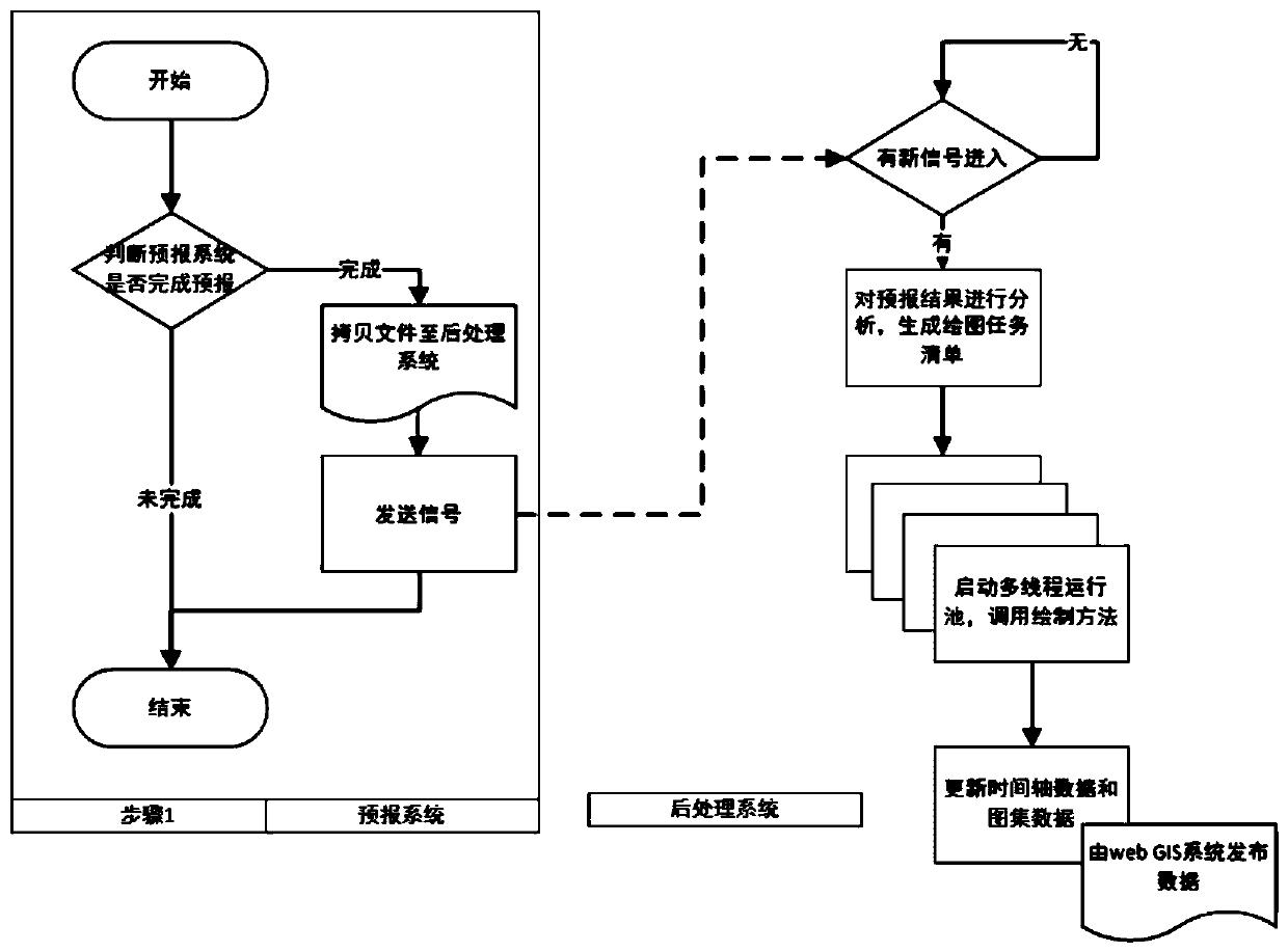
[0037] Such as figure 1 As shown, the goal of the automatic GIS drawing method applicable to the weather forecast system provided by the present invention is to automatically visualize the forecast results after the forecast system completes the output of the forecast results, update and synchronize them to the front-end page for users use. The present invention specifically comprises the following steps:
[0038] Step 1. Th...
PUM
 Abstract
Description
Claims
Application Information
 - R&D Engineer
- R&D Manager
- IP Professional
- Industry Leading Data Capabilities
- Powerful AI technology
- Patent DNA Extraction
Browse by: Latest US Patents, China's latest patents, Technical Efficacy Thesaurus, Application Domain, Technology Topic.
© 2024 PatSnap. All rights reserved.Legal|Privacy policy|Modern Slavery Act Transparency Statement|Sitemap