Method and system for determining geographic position of cell, electronic equipment and storage medium

A technology for determining the geographic location and method, which is applied in the direction of measuring devices, ground navigation, instruments, etc., can solve problems such as incomplete addresses and inability to determine the location of the target community, and achieve the effect of accurate geographic location

Inactive Publication Date: 2020-06-05
青梧桐有限责任公司
View PDF7 Cites 4 Cited by
  • Summary
  • Abstract
  • Description
  • Claims
  • Application Information

AI Technical Summary

Problems solved by technology

[0005] The invention provides a method, system, electronic equipment and storage medium for determining the geographic location of a cell, which can accurately obtai...

Method used


Image

  • Method and system for determining geographic position of cell, electronic equipment and storage medium
  • Method and system for determining geographic position of cell, electronic equipment and storage medium
  • Method and system for determining geographic position of cell, electronic equipment and storage medium

Examples


Embodiment Construction

[0054] Various exemplary embodiments of the present invention will now be described in detail with reference to the accompanying drawings. It should be noted that the relative arrangements of components and steps, numerical expressions and numerical values ​​set forth in these embodiments do not limit the scope of the present invention unless specifically stated otherwise.

[0055] The following description of at least one exemplary embodiment is merely illustrative in nature and in no way taken as limiting the invention, its application or uses.

[0056] Techniques, methods and devices known to those of ordinary skill in the relevant art may not be discussed in detail, but where appropriate, such techniques, methods and devices should be considered part of the description.

[0057] In all examples shown and discussed herein, any specific values ​​should be construed as exemplary only, and not as limitations. Therefore, other instances of the exemplary embodiment may have dif...


PUM


Abstract

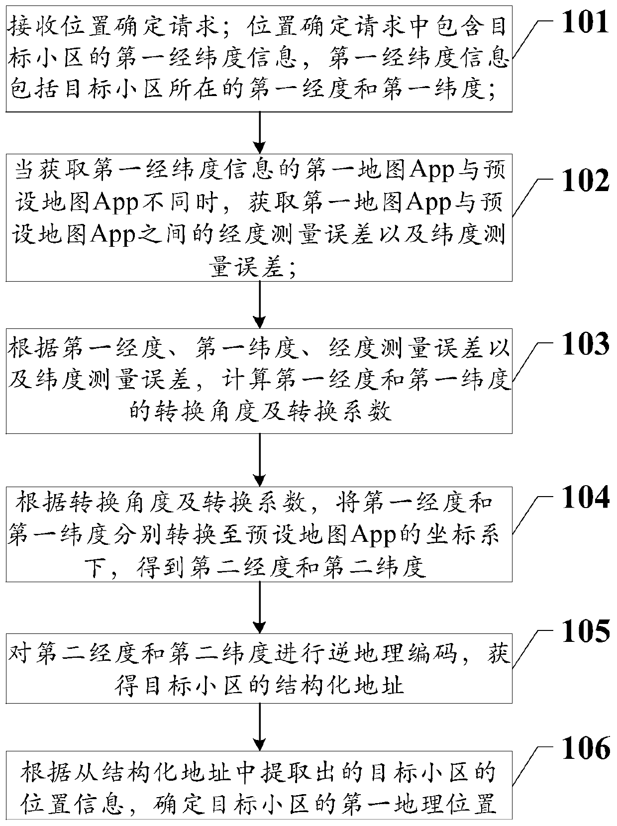
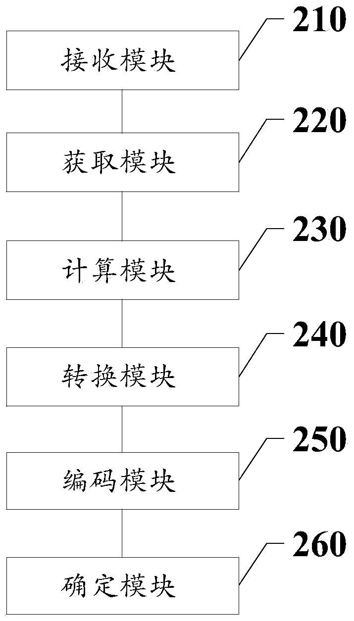
The invention discloses a method and system for determining a geographic position of a cell, electronic equipment and a storage medium. The method comprises the following steps: receiving a position determination request; when the first map App obtaining the first longitude and latitude information is different from the preset map App, obtaining a measurement error between the first map App and the preset map App; calculating a conversion angle and a conversion coefficient of the first longitude and the first latitude; respectively converting the first longitude and the first latitude into a coordinate system of the preset map App to obtain a second longitude and a second latitude; performing reverse geocoding on the second longitude and the second latitude to obtain a structured address of a target cell; and determining a first geographic position of the target cell according to the extracted position information of the target cell. Due to the fact that the first longitude and the first latitude are both converted into the coordinate system of the preset map App, a more accurate structured address can be obtained during inverse geocoding, and the geographic position of the targetcell can be obtained more accurately.

Description

technical field [0001] The present invention relates to the technical field of positioning, and more specifically, to a method, system, electronic device and storage medium for determining a geographic location of a cell. Background technique [0002] In recent years, a large number of housing rental and sales platforms have emerged. In order to improve the housing information on each rental and sales platform and the construction of real estate dictionaries, it is very important to accurately obtain the geographical location of each community. [0003] At present, the method of obtaining the geographical location information of the community is: according to the latitude and longitude information of the target community, obtain the address corresponding to the longitude and latitude information from the map app, and then extract the road information and house number information of the target community from the address. For example, the latitude and longitude information of...

Claims


Application Information

Patent Timeline
IPC IPC(8): G01C21/32G01C21/00G01C21/04
CPCG01C21/005G01C21/04G01C21/32
Inventor 朱晨晓李昭陈浩高靖崔岩卢述奇陈呈张宵
Owner 青梧桐有限责任公司
Why Eureka
Try Eureka