Terrestrial ecological investigation method based on unmanned aerial vehicle, unmanned aerial vehicle and storage medium
An unmanned aerial vehicle and ecological technology, applied in the direction of control/regulation system, non-electric variable control, instrument, etc., can solve the problem that the human workload cannot realize real-time monitoring and other problems
- Summary
- Abstract
- Description
- Claims
- Application Information
AI Technical Summary
Problems solved by technology
Method used
Image
Examples
Embodiment Construction
[0034] It should be understood that the specific embodiments described here are only used to explain the present invention, not to limit the present invention.
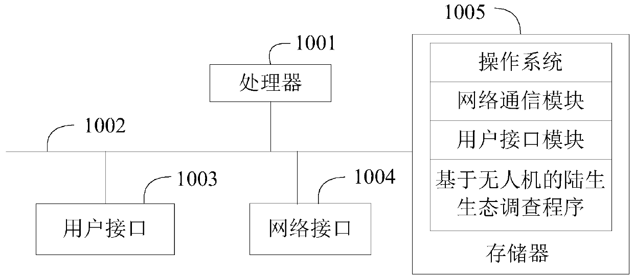
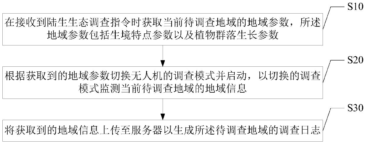
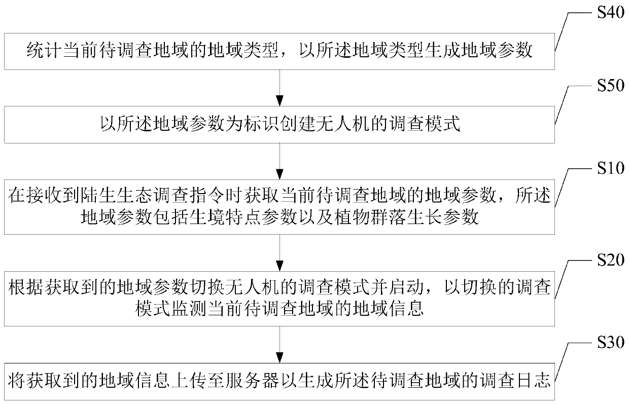
[0035] The main solution of the embodiment of the present invention is to obtain the regional parameters of the current area to be investigated when receiving the terrestrial ecological survey command, the regional parameters include habitat characteristic parameters and plant community growth parameters; The investigation mode of the man-machine is started, and the regional information of the current region to be investigated is monitored in the switched investigation mode; the obtained regional information is uploaded to the server to generate the investigation log of the region to be investigated.
[0036] Since the current terrestrial ecosystem survey operation is generally carried out by technical personnel on-the-spot inspection and then the ecological data is obtained, the human workload is limited and real-time...
PUM
 Abstract
Description
Claims
Application Information
 - R&D
- Intellectual Property
- Life Sciences
- Materials
- Tech Scout
- Unparalleled Data Quality
- Higher Quality Content
- 60% Fewer Hallucinations
Browse by: Latest US Patents, China's latest patents, Technical Efficacy Thesaurus, Application Domain, Technology Topic, Popular Technical Reports.
© 2025 PatSnap. All rights reserved.Legal|Privacy policy|Modern Slavery Act Transparency Statement|Sitemap|About US| Contact US: help@patsnap.com


