
Alignment method of lidar motion compensation position and attitude system based on optimization

An attitude system and motion compensation technology, applied to measuring devices, instruments, etc., can solve problems such as nonlinearity, accelerometer sensitivity value horizontal attitude error, filter divergence, etc.

Active Publication Date: 2020-08-25
BEIJING GREEN VALLEY TECH CO LTD
View PDF7 Cites 0 Cited by
  • Summary
  • Abstract
  • Description
  • Claims
  • Application Information

AI Technical Summary

Problems solved by technology

The maneuvering of the aircraft during the air alignment process will cause a large error in the horizontal attitude calculated by the accelerometer sensitive value, and a large initial value error will cause serious nonlinearity, and even filter divergence

Method used

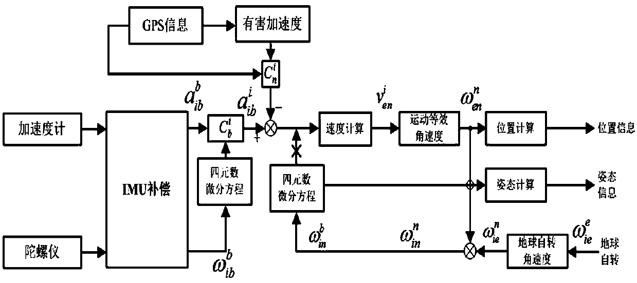
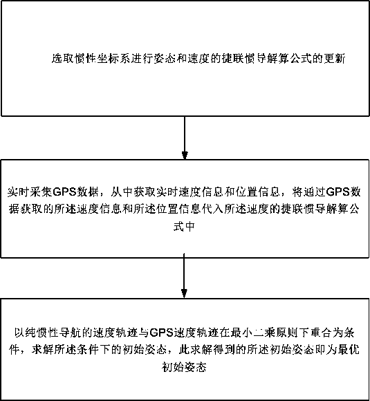
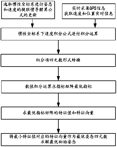

Image

  • Alignment method of lidar motion compensation position and attitude system based on optimization
  • Alignment method of lidar motion compensation position and attitude system based on optimization
  • Alignment method of lidar motion compensation position and attitude system based on optimization

Examples


Embodiment Construction

[0055] The present invention provides an alignment method based on an optimized LiDAR motion compensation position and attitude system, which can be used for the alignment of the position and attitude system in the air. Initial pose in the air.

[0056] As we all know, the inertial coordinate system (referred to as the inertial system) can be expressed by oxiyizi. The origin is the center of the earth; xi and yi are perpendicular to each other in the equatorial plane of the earth, pointing to the corresponding stars respectively, and ozi is the rotation axis of the earth. The physical quantities measured by inertial devices (gyroscopes and accelerometers) are relative to the inertial coordinate system. For example, what the gyroscope outputs is the angular velocity of the carrier coordinate system relative to the inertial coordinate system (i system). In addition, in navigation, the two most important coordinate systems are the carrier coordinate system (referred to as the c...


PUM


Abstract

The invention relates to an alignment method based on an optimized LiDAR motion compensation position and attitude system, and establishes a mathematical model that comprehensively utilizes sensitive information of inertial measurement units and GPS measurement information. The mathematical model can utilize sensitive motion information of inertial measurement units and GPS measurement information. The position and velocity information is calculated by pure inertial navigation, and the initial attitude is regarded as an independent quantity to be sought in the navigation calculation, and the optimal initial attitude information at a certain time point is obtained by using the optimization method, so that the IMU can be in the initial attitude. The variance between the velocity trajectory of pure inertial navigation and GPS velocity trajectory is the smallest. The invention has the advantages of high alignment precision, fast speed and strong robustness, and can be used for aerial alignment in an inertial navigation coordinate system or an inertial measurement system.

Description

technical field [0001] The invention relates to the technical field of LiDAR air alignment, in particular to an optimization-based LiDAR motion compensation position and attitude system alignment method. Background technique [0002] Position and attitude system (POS) is a key technology in the field of high-precision aerial remote sensing and earth observation, which is used to compensate the motion error of the carrier aircraft during the imaging process. The air alignment is an important part of the initial alignment technology of the position and attitude system. This technology can help the position and attitude system to complete emergency tasks and improve the system's response speed, so that the position and attitude system can not complete the ground (for example: natural disasters) Surveillance, military missions, etc.) to achieve air alignment with initial alignment. [0003] In the process of air alignment, position and velocity information are often directly ob...

Claims


Application Information

Patent Timeline
Patent Type & Authority Patents(China)
IPC IPC(8): G01C25/00
CPCG01C25/005
Inventor 陈婷婷
Owner BEIJING GREEN VALLEY TECH CO LTD
Learn More