Field data acquisition system and method for land quality geological survey

A data acquisition system and geological survey technology, applied in geographic information databases, data processing applications, structured data retrieval, etc., can solve problems such as error-prone, difficult to save, and low sampling efficiency, so as to improve efficiency and accuracy, and improve integrity Accuracy and quality, to achieve the effect of all-round monitoring

Pending Publication Date: 2020-08-25
重庆市地质矿产勘查开发局川东南地质大队
View PDF7 Cites 4 Cited by
  • Summary
  • Abstract
  • Description
  • Claims
  • Application Information

AI Technical Summary

Problems solved by technology

This kind of sample collection management method is backward, the sampling efficiency is low, and it takes a long time, which is likely to cause delays in the construction period, and the paper sample information is not easy to save. Once damaged, it is not easy to sa

Method used


Image

  • Field data acquisition system and method for land quality geological survey
  • Field data acquisition system and method for land quality geological survey
  • Field data acquisition system and method for land quality geological survey

Examples


Embodiment 1

[0059] This embodiment provides a land quality geological survey field data acquisition system, including a user terminal, a management terminal and a cloud platform, and the user terminal and the management terminal communicate with the cloud platform respectively;

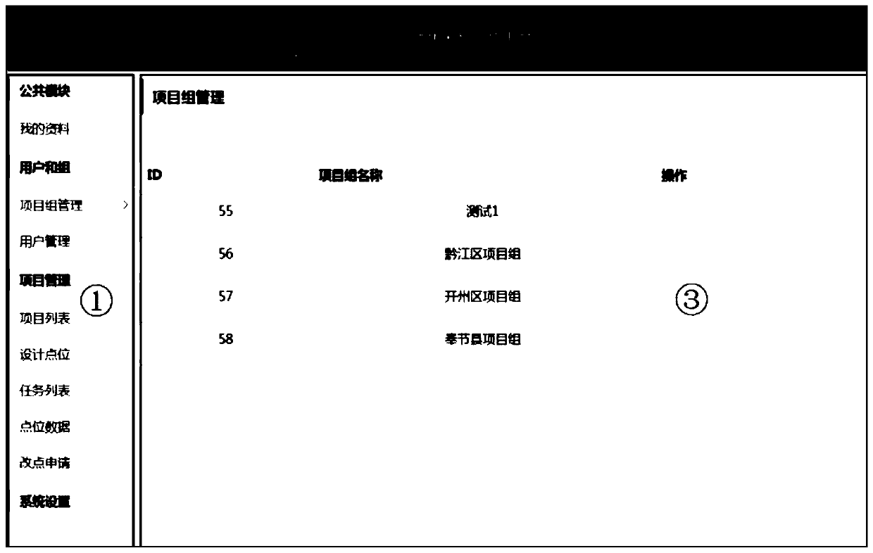
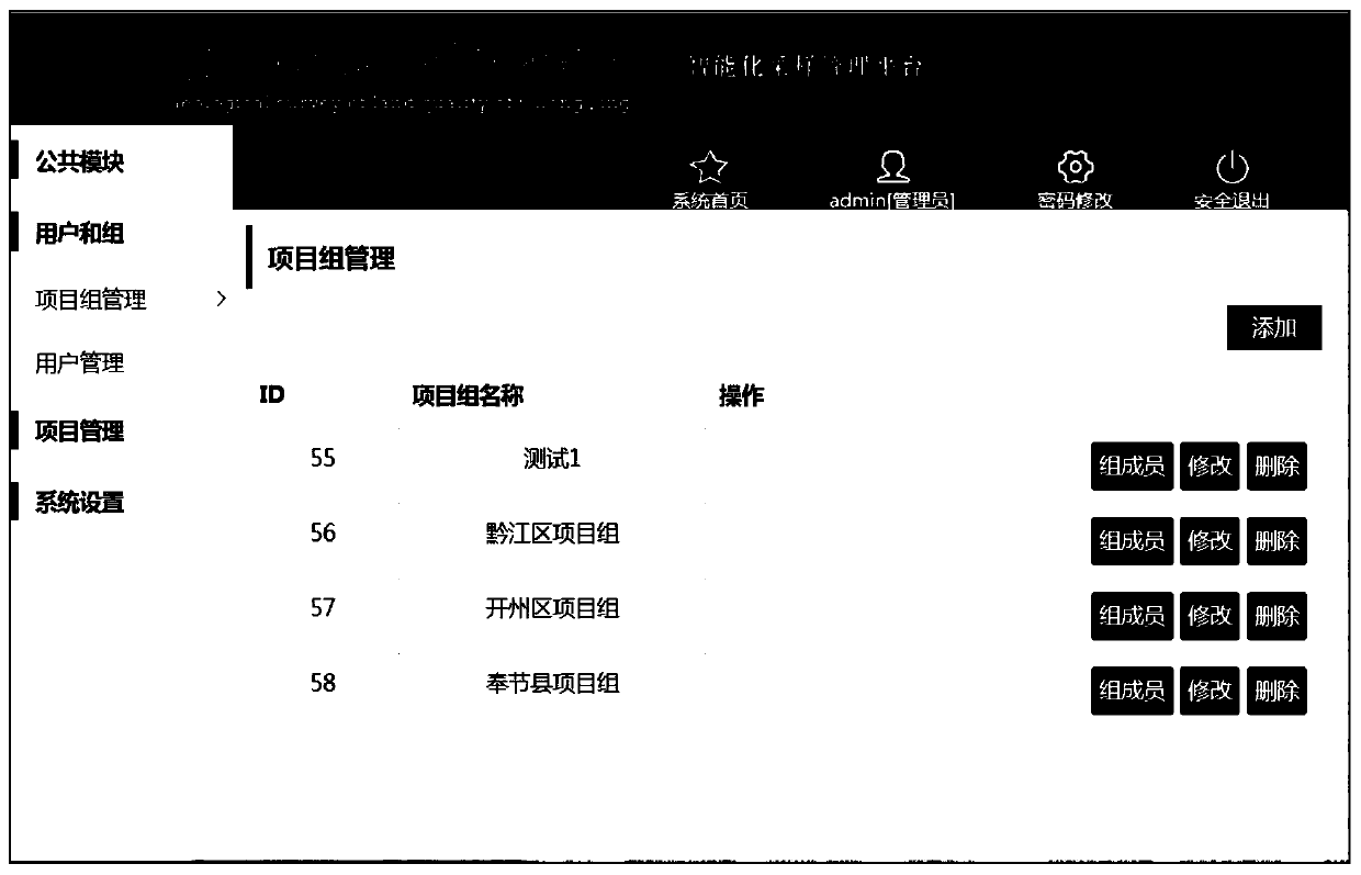
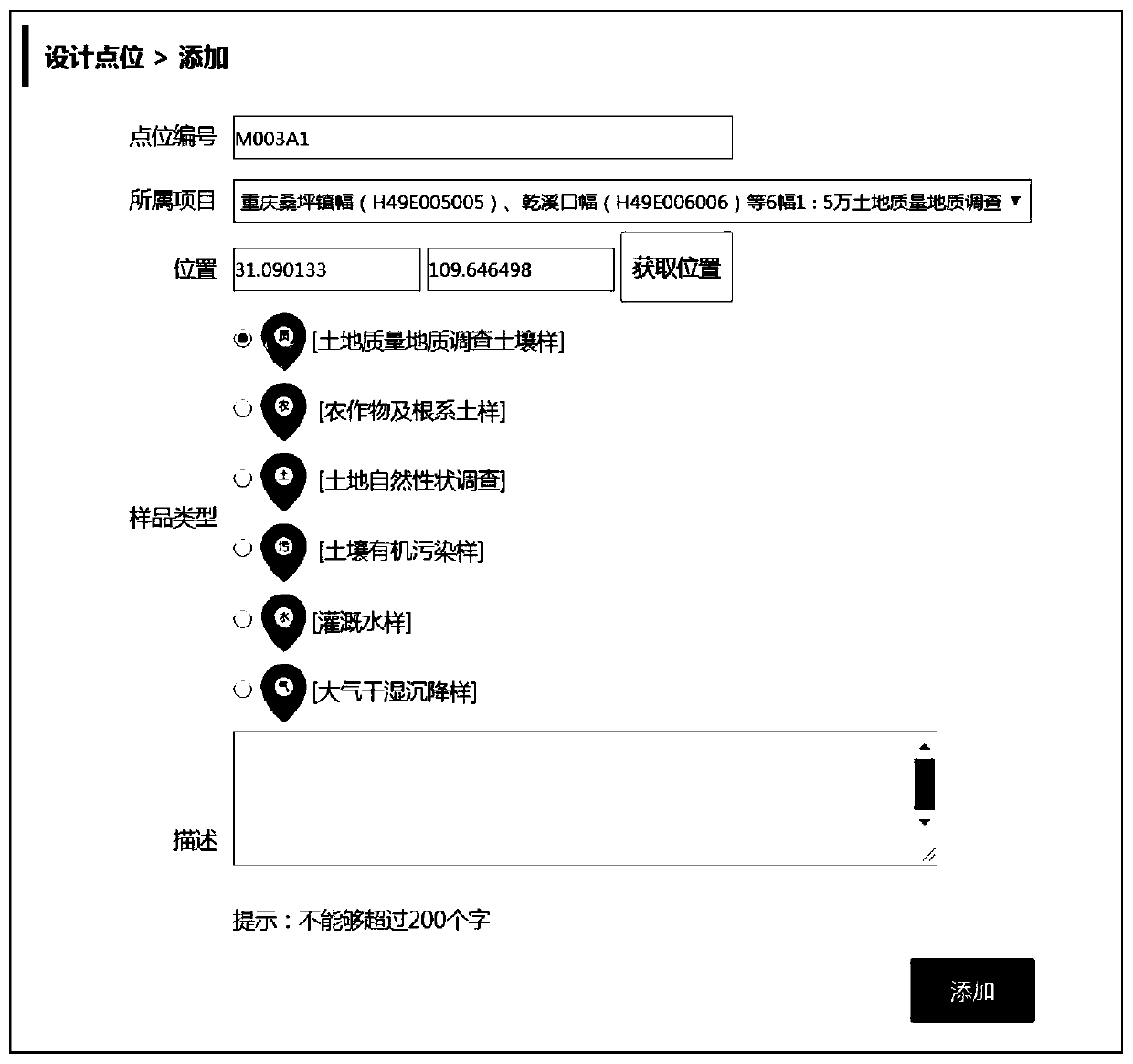
[0060] The management terminal is used to set the project, the sampling point of the project and the sampling task of the project, and each sampling task includes one or more sampling points;

[0061] The cloud platform is used to obtain the corresponding sampling personnel according to the sampling task, and send the sampling task to the user terminal corresponding to the sampling personnel;

[0062] The user terminal is used to display the sampling task to the sampling personnel, obtain the collection data and trajectory data when the sampling personnel perform the sampling task, and upload the collection data and trajectory data to the cloud platform;

[0063] The cloud platform is used to generate a track map...

Embodiment 2

[0103] This embodiment provides a method for collecting field data for land quality geological survey, which is suitable for the field data collection system for land quality geological survey described in Embodiment 1, such as Figure 16 shown, including the following steps:

[0104] S1, the management terminal sets the project, the sampling point of the project and the sampling task of the project, and each sampling task includes one or more sampling points;

[0105] S2, the cloud platform obtains the corresponding sampling personnel according to the sampling task, and sends the sampling task to the user terminal corresponding to the sampling personnel;

[0106] S3, the user terminal displays the sampling task to the sampling personnel, obtains the collection data and trajectory data when the sampling personnel perform the sampling task, and uploads the collection data and trajectory data to the cloud platform;

[0107] S4, the cloud platform generates a track map according...


PUM


Abstract

The invention belongs to the technical field of computer internet, and particularly relates to a field data acquisition system and method for land quality geological survey, and the system comprises auser terminal, a management terminal and a cloud platform; the management terminal sets a project, a sampling point position and a sampling task; the cloud platform obtains corresponding sampling personnel according to the sampling task and sends the sampling task to the sampling personnel; the user terminal displays a sampling task to sampling personnel, acquires acquired data and track data, and uploads the acquired data and the track data to the cloud platform; the cloud platform generates a track chart according to the track data, and sends the acquired data and the track chart to the management terminal; and the management terminal displays the acquired data and the track chart to a manager for the manager to check and monitor. According to the system and method, informatization management is carried out on the field soil sample collection process, omnibearing monitoring of the sampling process is realized, the efficiency and precision of land quality geological survey work are improved, and the integrity and quality of land quality sample information collection are improved.

Description

technical field [0001] The invention belongs to the technical field of computer internet, and in particular relates to a field data acquisition system and method for geological survey of land quality. Background technique [0002] The current high-intensity predatory development has seriously degraded the soil, which is mainly reflected in the decline of farmland soil nutrients, nutrient imbalance, and local heavy metals exceeding the standard. Therefore, carrying out land and soil quality evaluation research is of great significance to the standardized management, effective use and protection of land resources, and to ensuring food security. [0003] In the current land quality survey process, traditional methods are generally used for sample data collection and information management. That is, manually carry tools such as camera tools, handheld GPS, paper record forms, topographic maps, etc. to collect soil samples and record sample information on paper, and manage sample...

Claims


Application Information

Patent Timeline
IPC IPC(8): G06Q10/06G06F16/29G06Q50/26
CPCG06Q10/06395G06F16/29G06Q50/26
Inventor 邓海刘明瓒严明书贾中民龚媛媛周皎李瑜杨乐超谭林何忠庠
Owner 重庆市地质矿产勘查开发局川东南地质大队
Why Eureka
Try Eureka