

Method for drawing ship distance line in real time based on reality augmentation system
A reality augmentation and real-time rendering technology, applied in image data processing, 3D modeling, instruments, etc., can solve the problems of not being able to accurately reflect the real-time distance between two points, and not be able to display the distance in real time, so as to achieve better display effect, Effects with followability and intuitive observation
- Summary
- Abstract
- Description
- Claims
- Application Information
AI Technical Summary
Problems solved by technology
Method used
Image

Examples
Embodiment Construction
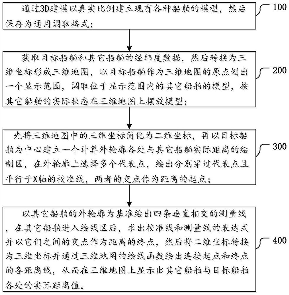
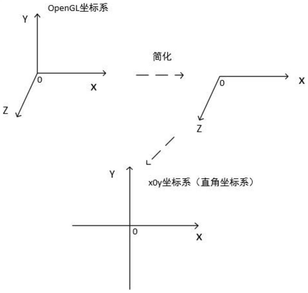
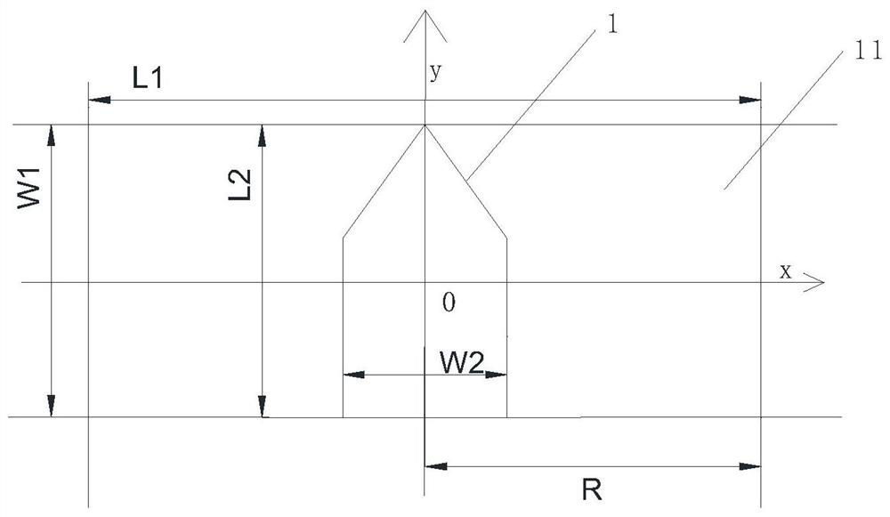
[0030] The following describes in detail how to generate a three-dimensional map based on the known latitude and longitude information, and at the same time display the actual distance between the target ship and other ships in the three-dimensional map.
[0031] Such as figure 1 As shown, in one embodiment of the present invention, a method for real-time drawing of ship distance lines based on a reality augmentation system is disclosed, and the specific steps are as follows:
[0032] Step 100, establish models of various existing ships with real scales through 3D modeling, and then save them as a general retrieval format;
[0033] The 3D modeling software can be any existing software, where the model at least has the external dimension data scaled down to the actual size of the corresponding ship, so that the accurate model can be displayed on the 3D map in the later stage, and then the accurate model can be calculated. distance value.
[0034] The general call format in th...
PUM
 Abstract
Description
Claims
Application Information