Unmanned aerial vehicle for topographic surveying and mapping

A technology of terrain surveying and unmanned aerial vehicles, applied in the direction of motor vehicles, aircraft parts, aircraft indicating devices, etc., can solve the problems of unable to protect propellers, surveying and mapping of blind areas of terrain, unable to realize soft landing functions, etc.

Inactive Publication Date: 2020-10-20
安徽二水测绘院有限公司
View PDF7 Cites 9 Cited by
  • Summary
  • Abstract
  • Description
  • Claims
  • Application Information

AI Technical Summary

Problems solved by technology

[0005] The purpose of the present invention is to provide an unmanned aerial vehicle for terrain surveying and mapping to solve the technical problems in the prior art that the propeller cannot be protected, the soft landing function cannot be realized, and the blind area of ​​the terrain cannot be surveyed and mapped.

Method used


Image

  • Unmanned aerial vehicle for topographic surveying and mapping
  • Unmanned aerial vehicle for topographic surveying and mapping
  • Unmanned aerial vehicle for topographic surveying and mapping

Examples


Embodiment Construction

[0035] The following will be combined with Figure 1 to Figure 7 The present invention is described in detail, and the technical solutions in the embodiments of the present invention are clearly and completely described. Apparently, the described embodiments are only some of the embodiments of the present invention, not all of them. Based on the embodiments of the present invention, all other embodiments obtained by persons of ordinary skill in the art without making creative efforts belong to the protection scope of the present invention.

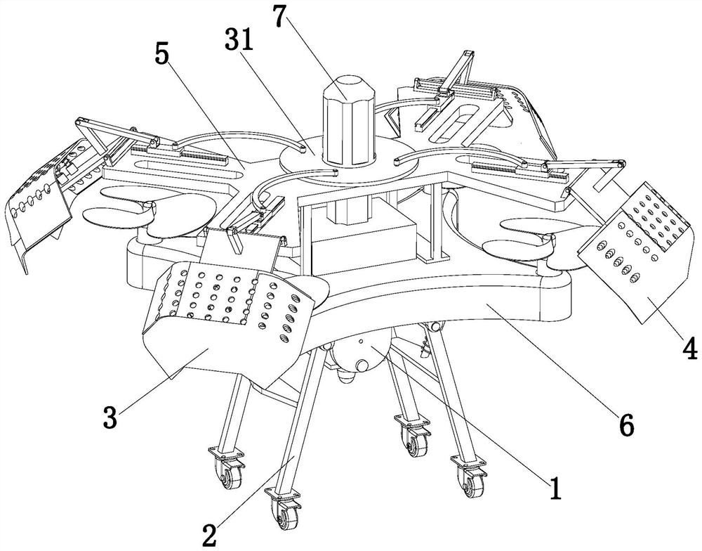
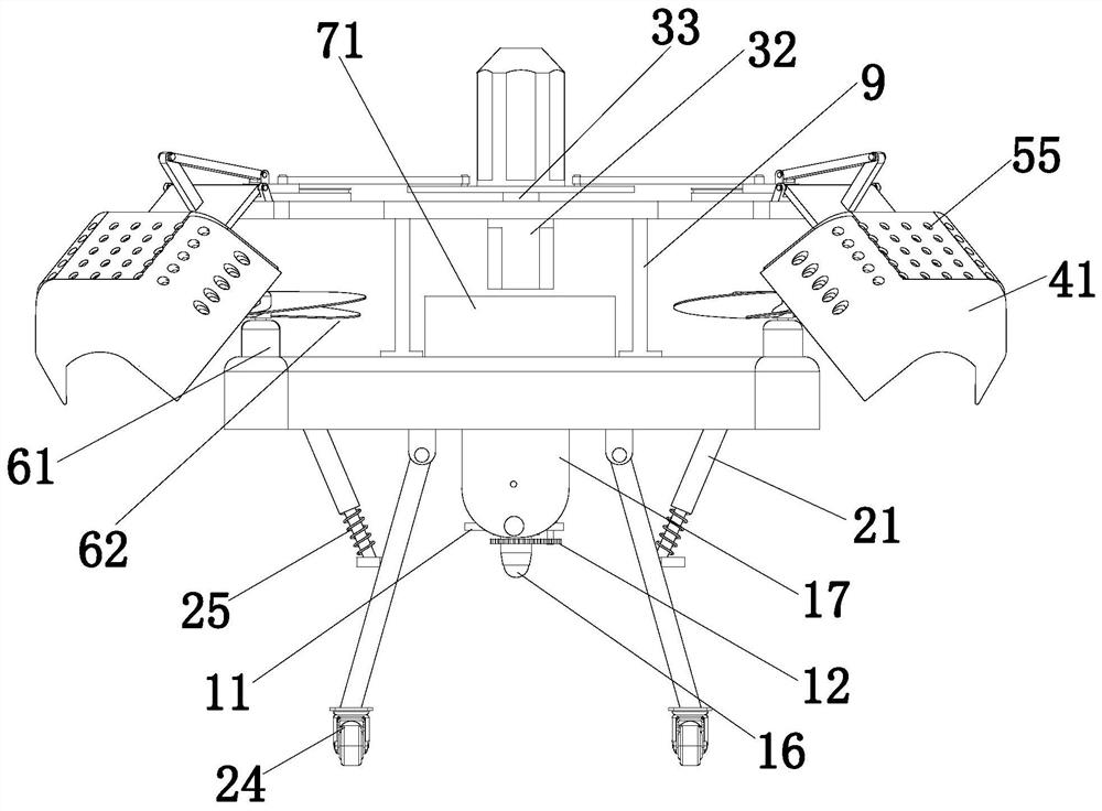
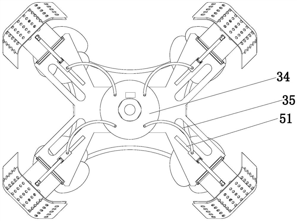
[0036] The present invention provides a kind of unmanned aerial vehicle for terrain surveying and mapping through improvement, such as Figure 1-Figure 7 As shown, it includes the UAV body 6, and also includes a multi-angle detection mechanism 1, a buffer soft landing mechanism 2, a protective mechanism 3, a mounting frame 9 and a carrying platform 5 arranged on the top of the UAV body 6; through the multi-angle detection mechanism 1. The...


PUM


Abstract

The invention relates to an unmanned aerial vehicle for topographic surveying and mapping, which belongs to the technical field of surveying and mapping devices. The unmanned aerial vehicle comprisesan unmanned aerial vehicle body, a multi-angle detection mechanism, a buffer soft landing mechanism, a protection mechanism, a mounting frame and a carrying platform. Four rotating arms distributed ina matrix mode are arranged on the edge of the top of the unmanned aerial vehicle body. A propeller is arranged at the top end of each rotating arm. The protection mechanism comprises a driving assembly and four propeller protection assemblies arranged at the top of the carrying platform, and each propeller protection assembly comprises a protection cover, a buffer assembly, a mounting base and aconnecting plate. According to the invention, the horizontal angle and the pitching angle of the detection head can be adjusted through the multi-angle detection mechanism; the rugged terrain can be conveniently surveyed and mapped by the detection head, all the propellers can be protected through the protection mechanism, collision between the propellers and birds is avoided, and the situation that normal use of the propellers is affected due to the fact that the propellers directly collide with the outside can be avoided.

Description

technical field [0001] The invention relates to the technical field of surveying and mapping devices, in particular to an unmanned aerial vehicle for terrain surveying and mapping. Background technique [0002] Topographic surveying and mapping refers to the operation of surveying and mapping topographic maps, that is, the work of measuring the projected positions and elevations of objects and terrain on the earth's surface on the horizontal plane, reducing them to a certain scale, and drawing them into topographic maps with symbols and notes. The surveying and mapping of the map basically adopts the method of aerial photogrammetry, and the aerial photo is mainly used for indoor mapping. With the continuous development of science and technology, advanced digital aerial photogrammetry technology has been widely used in the surveying and mapping geographic information industry, and my country's topographic surveying and mapping industry has also made great progress in the fiel...

Claims


Application Information

Patent Timeline
Patent Type & Authority Applications(China)
IPC IPC(8): B64C39/02B64C25/62B64D45/00B64D47/00
CPCB64C39/02B64C25/62B64D45/00B64D47/00
Inventor 王兴东
Owner 安徽二水测绘院有限公司
Why Eureka
Try Eureka