A risk assessment method for UAV operation based on satellite-based ads-b data

An ADS-B, operational risk technology, applied in data processing applications, complex mathematical operations, instruments, etc., can solve problems such as lack of impact kinetic energy and the actual weight of UAVs is not considered

Active Publication Date: 2022-06-28
XIHUA UNIV
View PDF5 Cites 0 Cited by
  • Summary
  • Abstract
  • Description
  • Claims
  • Application Information

AI Technical Summary

Problems solved by technology

[0015] (3) In the risk to the ground, the actual weight of the UAV is not considered, and the consideration of the impact kinetic energy is lacking

Method used


Image

  • A risk assessment method for UAV operation based on satellite-based ads-b data
  • A risk assessment method for UAV operation based on satellite-based ads-b data
  • A risk assessment method for UAV operation based on satellite-based ads-b data

Examples


Embodiment Construction

[0094] In order to make the objectives, technical solutions and advantages of the present invention clearer, the present invention will be described in further detail below according to the accompanying drawings and examples.

[0095] A UAV operation risk assessment method based on satellite-based ADS-B data, comprising the following steps;

[0096] S1: Extract the data of the satellite-based ADS-B, and analyze the data. Obtain the flight speed, latitude and longitude, flight altitude, attitude and heading data of the drone.

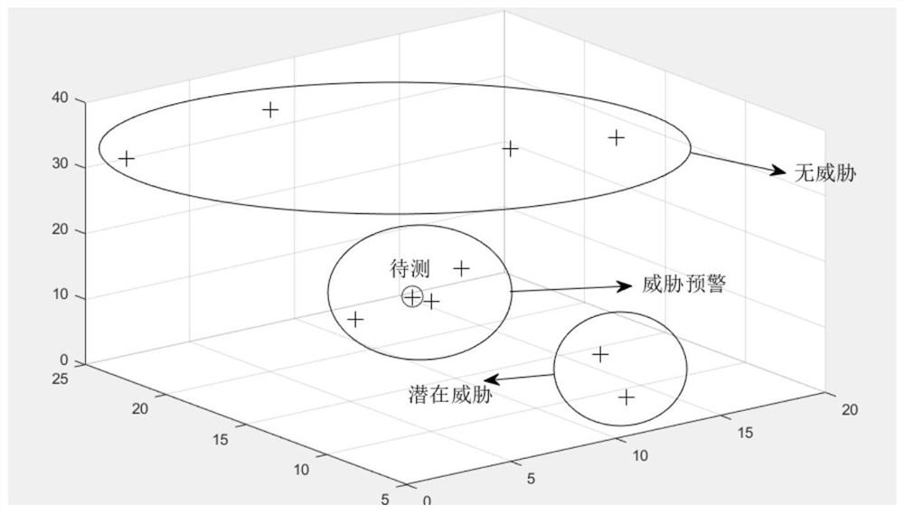
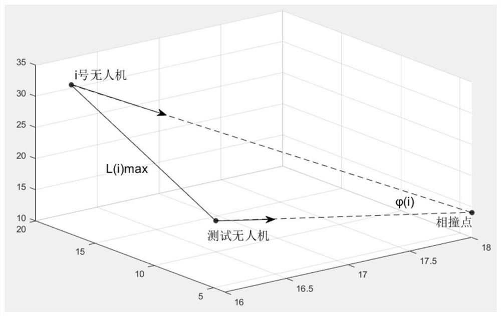
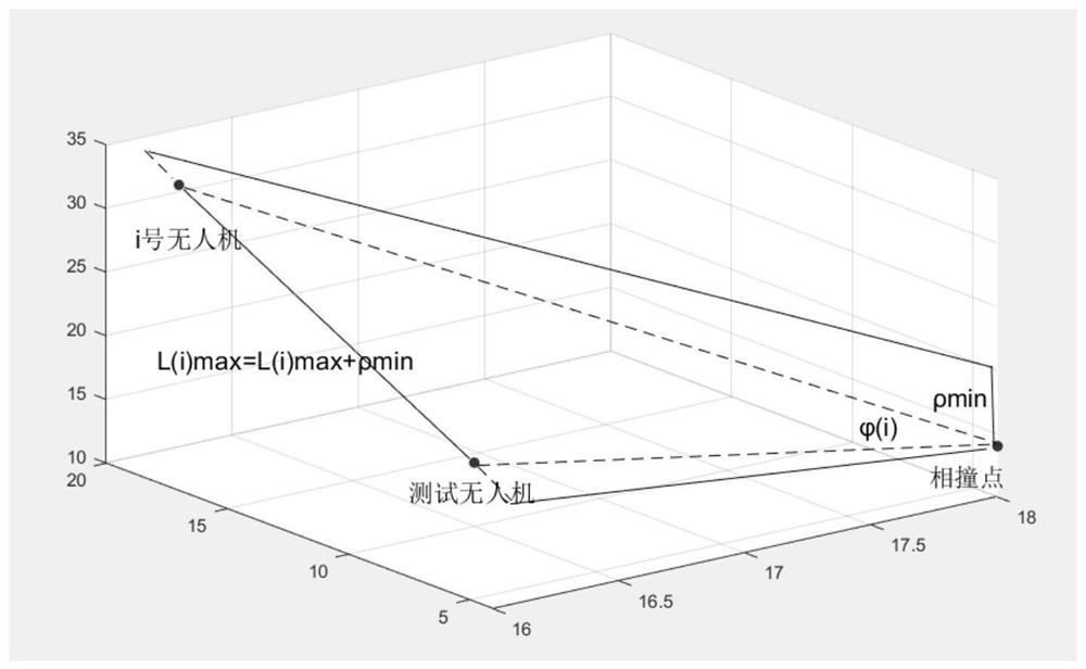
[0097] S2: "empty-empty" risk assessment, the process is as follows Figure 4 shown;

[0098] S21: Set No. 0 UAV as the UAV to be evaluated, there are N UAVs in the airspace, and the labels are 1, 2, 3...n. The satellite-based ADS-B device, the extraction coordinate is 0 (x 0 , y 0 ,z 0 ), 1(x 1 , y 1 ,z 1 ), 2(x 2 , y 2 ,z 2 )......n(x n , y n ,z n ). Calculate the Euclidean distance between drone 0 (the drone to be tested) and other dro...


PUM


Abstract

The invention discloses a risk assessment method for unmanned aerial vehicles based on satellite-based ADS-B data, including: using satellite-based ADS-B equipment, the flight path of the unmanned aerial vehicle in the area that cannot be covered by ordinary land-based ADS-B equipment is carried out Extract and obtain the UAV's flight speed, latitude and longitude, flight altitude, attitude, and heading data; evaluate the operational risk of the UAV fuselage based on the UAV's attitude and position data. Based on the UAV speed and obstacle information, the UAV's ground risk and air risk are assessed. The advantages of the present invention are: two types of operational risk assessments of "air-air" and "air-ground" can be obtained, avoiding unnecessary consideration of obstacle threats based on historical flight accident data, and comprehensively determining the threat degree of obstacles, It is closer to the actual situation of UAV operation.

Description

technical field [0001] The invention relates to the technical field of drone supervision, in particular to a method for assessing the operation risk of drones based on satellite-based ADS-B data. Background technique [0002] With the opening of low-altitude airspace, the UAV industry has also experienced a blowout growth, resulting in an increase in the density of low-altitude airspace, posing a certain threat to the safety of low-altitude airspace. Therefore, the supervision of drones has gradually been paid attention to. At present, the military and civilian departments have increased the control of drones. Among them, the technology of using the airborne ADS-B system to control the UAV is gradually mature. Due to the narrow coverage of the ground-based ADS-B system, it is impossible to monitor UAVs flying in special areas (oceans, deserts, mountains, canyons, etc.) in real time. Therefore, it is impossible to assess the risk situation of UAV flying in special areas. ...

Claims


Application Information

Patent Timeline
Patent Type & Authority Patents(China)
IPC IPC(8): G06F17/10G06Q10/06
CPCG06F17/10G06Q10/0635
Inventor 张学军郝鹏唐立
Owner XIHUA UNIV
Why Eureka
Try Eureka