
Method for optimizing public bicycle station layout by applying GPS data of mobile phone
A technology of public bicycles and GPS data, which is applied to the station layout design of urban public bicycles and the optimization field of existing public bicycle stations. It can solve the problem of lack of OD matrix, no detection of passenger traffic mode, uncertain construction conditions of bicycle stations, etc. question
- Summary
- Abstract
- Description
- Claims
- Application Information
AI Technical Summary
Problems solved by technology
Method used
Image

Examples
Embodiment
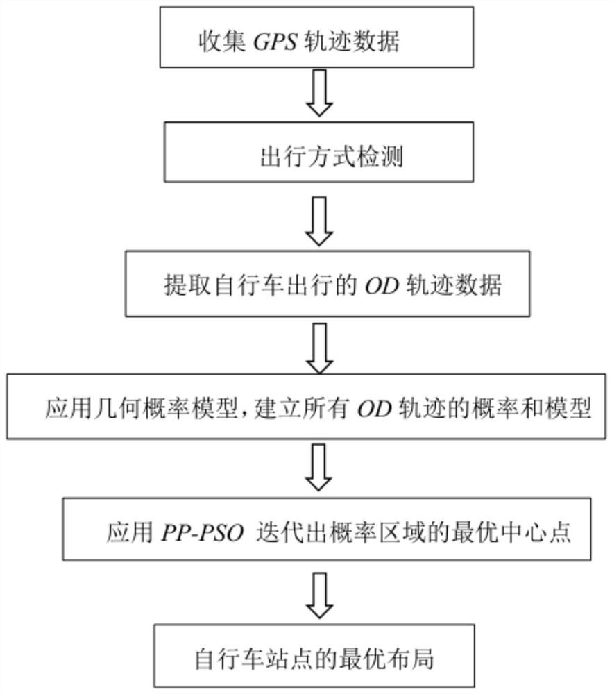
[0053] Example: see figure 1 , figure 2 , a method of applying GPS data to optimize the layout of a public bike station, the method comprising the following steps:
[0054] (1) In order to more accurately identify the starting and ending points of bicycle users, this paper collects GPS trajectory data of some representative citizens for a period of time through operators;
[0055] (2) Divide the collected trajectory data into stay trajectories and moving trajectories, and divide the moving trajectories into 5 types of trajectories such as train, subway, car, bicycle, and walking through the random forest model;
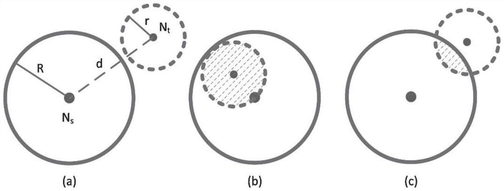
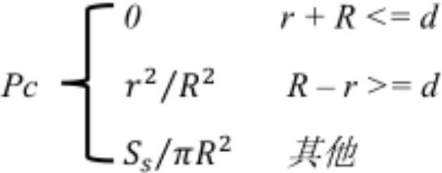
[0056] (3) Extract the OD of all bicycle trips, and apply the geometric probability model to establish the probability and model of all OD trajectories;
[0057] (4) According to the actual situation, set the planned number of public bicycle stations in the area and the radius of each probability area, and apply the predator-prey particle swarm algorithm (PP-PSO) t...
PUM
 Abstract
Description
Claims
Application Information