High-precision three-dimensional map and two-dimensional grid map synchronous construction method

A technology of three-dimensional map and grid map, applied in the field of robotics, can solve the problems of time discount for drawing maps, limited information of two-dimensional grid map, collision with robot chassis, etc.

Active Publication Date: 2020-12-11
STATE GRID ANHUI ULTRA HIGH VOLTAGE CO
View PDF8 Cites 6 Cited by
  • Summary
  • Abstract
  • Description
  • Claims
  • Application Information

AI Technical Summary

Problems solved by technology

However, this technology requires very high motor precision, so the technical threshold has been raised
In addition, the algorithm used in this technology has high requirements on the performance of the computer, which greatly reduces the time it takes to draw the map
Finally, the technique cannot directly generate 2D raster maps
[0004] A grid map creation method proposed in patent number CN201310363428.8 is only a map based on the X-Y two-dimensional plane coordinate system, and does not take into account the three-dimensional height of the actual navigation robot. May collide with the robot chassis or other locations
Secondly, the amount of information contained in a single two-dimensional grid map is extremely limited, and it cannot be well understood by humans intuitively.

Method used


Image

  • High-precision three-dimensional map and two-dimensional grid map synchronous construction method
  • High-precision three-dimensional map and two-dimensional grid map synchronous construction method
  • High-precision three-dimensional map and two-dimensional grid map synchronous construction method

Examples


Embodiment Construction

[0081] Specific embodiments of the present invention will be described in detail below in conjunction with the accompanying drawings. It should be understood that the specific embodiments described here are only used to illustrate and explain the present invention, and are not intended to limit the present invention.

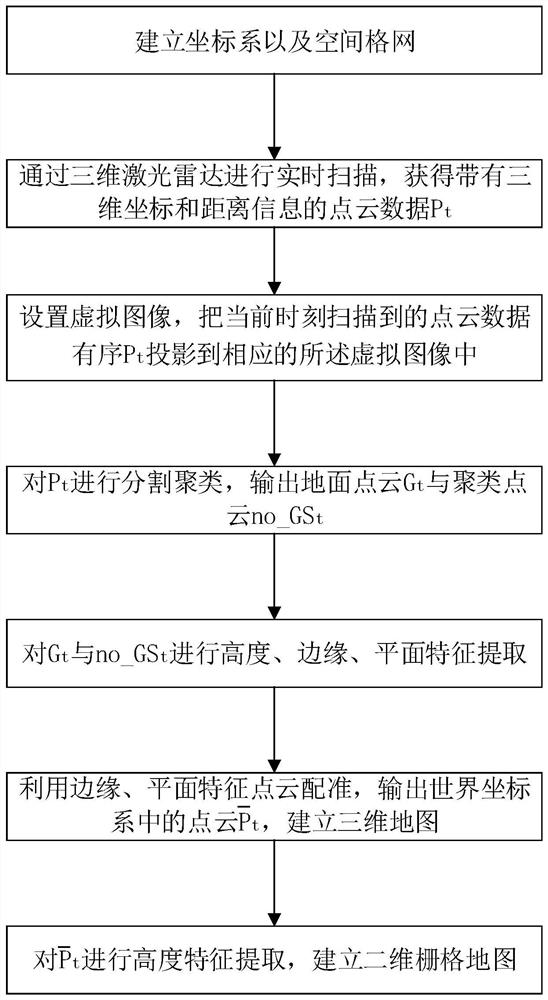
[0082] figure 1 A flow chart showing a method for synchronously constructing a high-precision three-dimensional map and a two-dimensional grid map according to an embodiment of the present invention, please refer to figure 1 , the implementation steps of a method for synchronously constructing a high-precision three-dimensional map and a two-dimensional grid map proposed by the present invention are as follows:

[0083] A coordinate system and a spatial grid are established, and the coordinate system includes a world coordinate system and a lidar coordinate system.

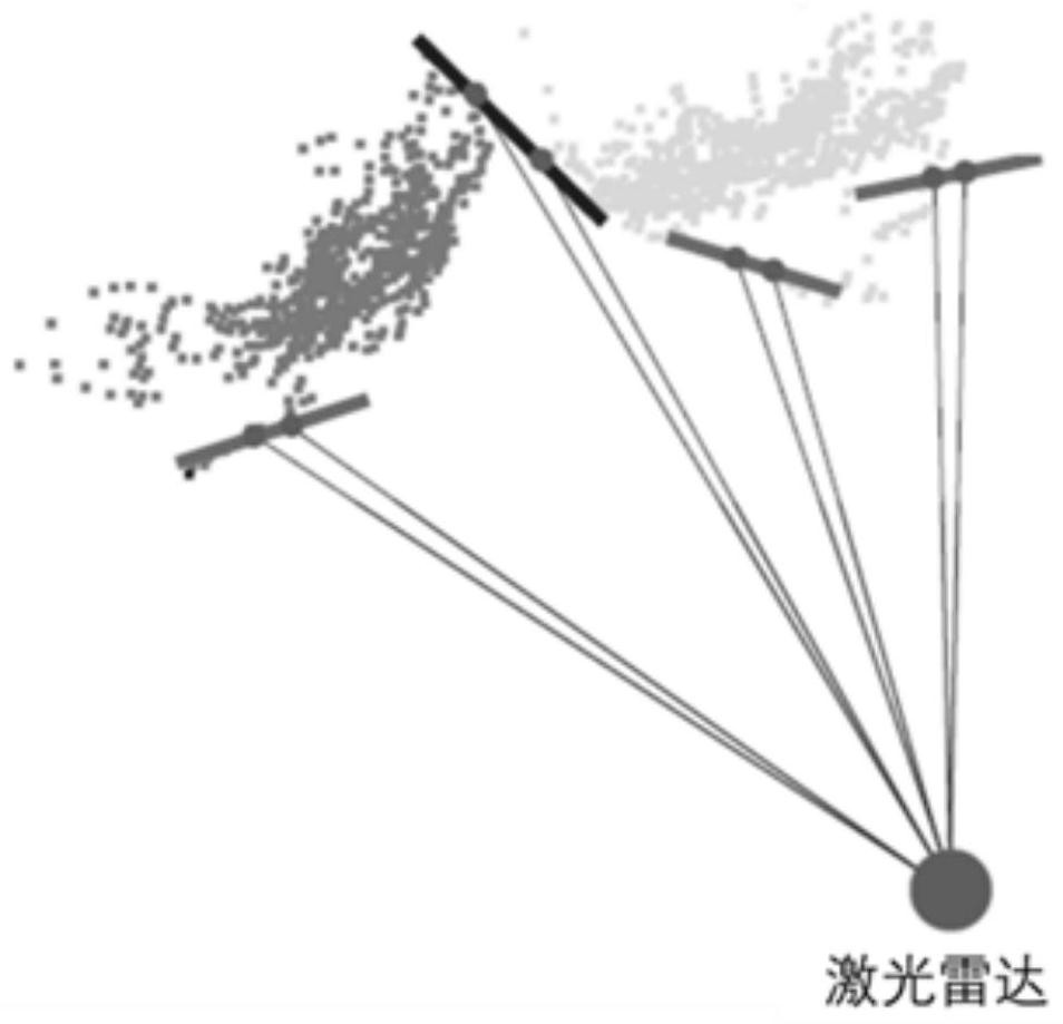
[0084] Install and fix the 16-line three-dimensional laser radar on the navigation robot, an...


PUM


Abstract

The invention relates to the field of robots, and discloses a high-precision three-dimensional map and two-dimensional grid map synchronous construction method, which comprises the following steps of:orderly storing point cloud data scanned by a three-dimensional laser radar; segmenting the ground points and the non-ground points and performing clustering processing on the non-ground points; extracting height, edge and plane features from the ground points and the clustered point clouds; utilizing edge and plane feature point cloud registration to establish a three-dimensional point cloud map; and performing height feature extraction on the point cloud in the world coordinate system, and establishing a two-dimensional grid map. The invention provides a real-time three-dimensional mappingmethod, and a two-dimensional grid map is synchronously constructed based on the height characteristics of a navigation robot, so that the method can be directly applied to navigation and positioningscenes of the robot.

Description

technical field [0001] The invention relates to the field of robots, in particular to a method for synchronously constructing a high-precision three-dimensional map and a two-dimensional grid map. Background technique [0002] With the continuous improvement of the level of robot technology, robots have gradually shown important uses in various industries. The main task of a mobile robot is to use its own sensors to perceive the surrounding environment in an unknown and complex environment, establish an environmental map through the sampling of the environment by the sensor, and realize its own positioning and navigation. Therefore, the establishment of an environmental map is the prerequisite for mobile robots to realize autonomous navigation actions. Figure 1 On the one hand, it can help the robot cooperate with its own sensors for real-time precise positioning, and it can also be used for subsequent navigation. [0003] Patent No. CN201710598881.5 can use a first-line l...

Claims


Application Information

Patent Timeline
Patent Type & Authority Applications(China)
IPC IPC(8): G06T7/11G06T7/13G06T7/136G06T7/30G06T17/05G06K9/62
CPCG06T7/11G06T7/13G06T7/30G06T7/136G06T17/05G06T2207/10028G06F18/23
Inventor 黄杰何果曾德龙董翔宇杨瑞金奚纯朱俊汪太平魏南李永熙杨波刘鑫张飞尚伟伟
Owner STATE GRID ANHUI ULTRA HIGH VOLTAGE CO
Why Eureka
Try Eureka