

Multilayer ConvLSTM sea surface temperature prediction calculation method based on remote sensing data
A technology of remote sensing data and calculation methods, applied in the direction of prediction, calculation, data processing applications, etc., can solve problems such as poor results, achieve high prediction accuracy, quick use, and reduce manual effects
- Summary
- Abstract
- Description
- Claims
- Application Information
AI Technical Summary
Problems solved by technology
Method used
Image

Examples
Embodiment Construction
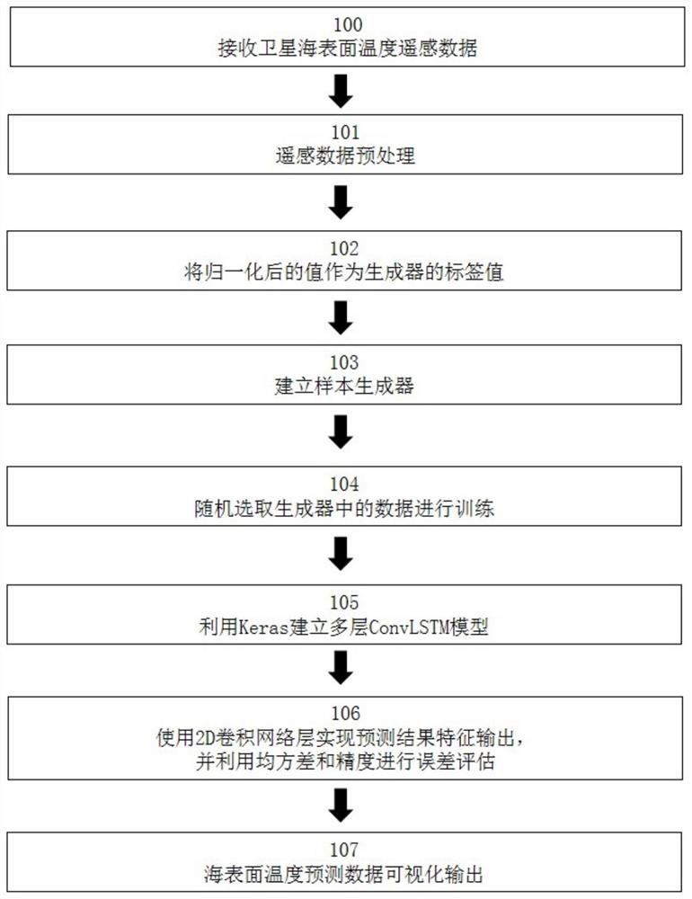
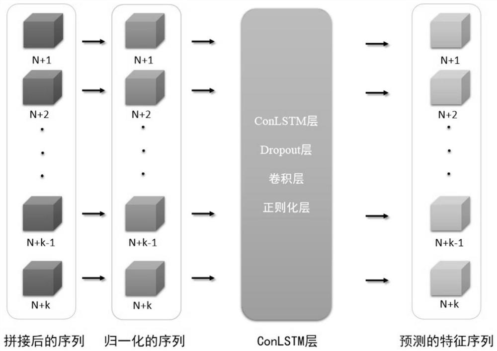
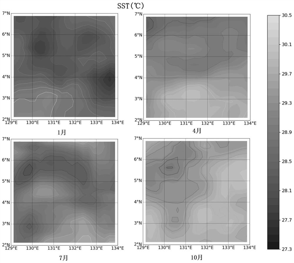
[0037] The embodiments of the present invention are described in detail below in conjunction with the accompanying drawings: this embodiment is implemented on the premise of the technical solution of the present invention, and detailed implementation methods and specific operating procedures are provided, but the protection scope of the present invention is not limited to the following the described embodiment.
[0038] With the rapid development of global science and technology, countries are competing to launch their own remote sensing satellites. With the continuous increase of "star sources", remote sensing information technology provides an effective means of multi-source and multi-scale spatio-temporal information for humans to understand the ocean world, and provides abundant data for ocean temperature monitoring, forecasting and scientific research. Especially in the acquisition of long-term global ocean temperature data, it has advantages that cannot be replaced by co...
PUM
 Abstract
Description
Claims
Application Information