

Terrain section data thinning method, device and equipment
A terrain section and terrain data technology, applied in geographic information databases, details involving 3D image data, image data processing, etc., can solve the problems of increasing manpower input, time-consuming and labor-intensive, etc.
- Summary
- Abstract
- Description
- Claims
- Application Information
AI Technical Summary
Problems solved by technology
Method used
Image

Examples
Embodiment Construction
[0079] The technical solutions of the present invention will be further described in detail below in conjunction with the accompanying drawings and specific embodiments.
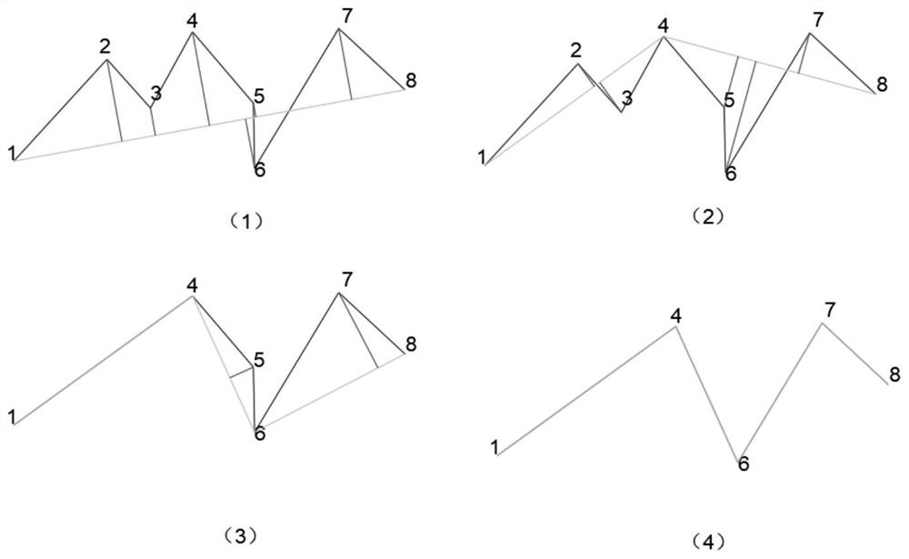
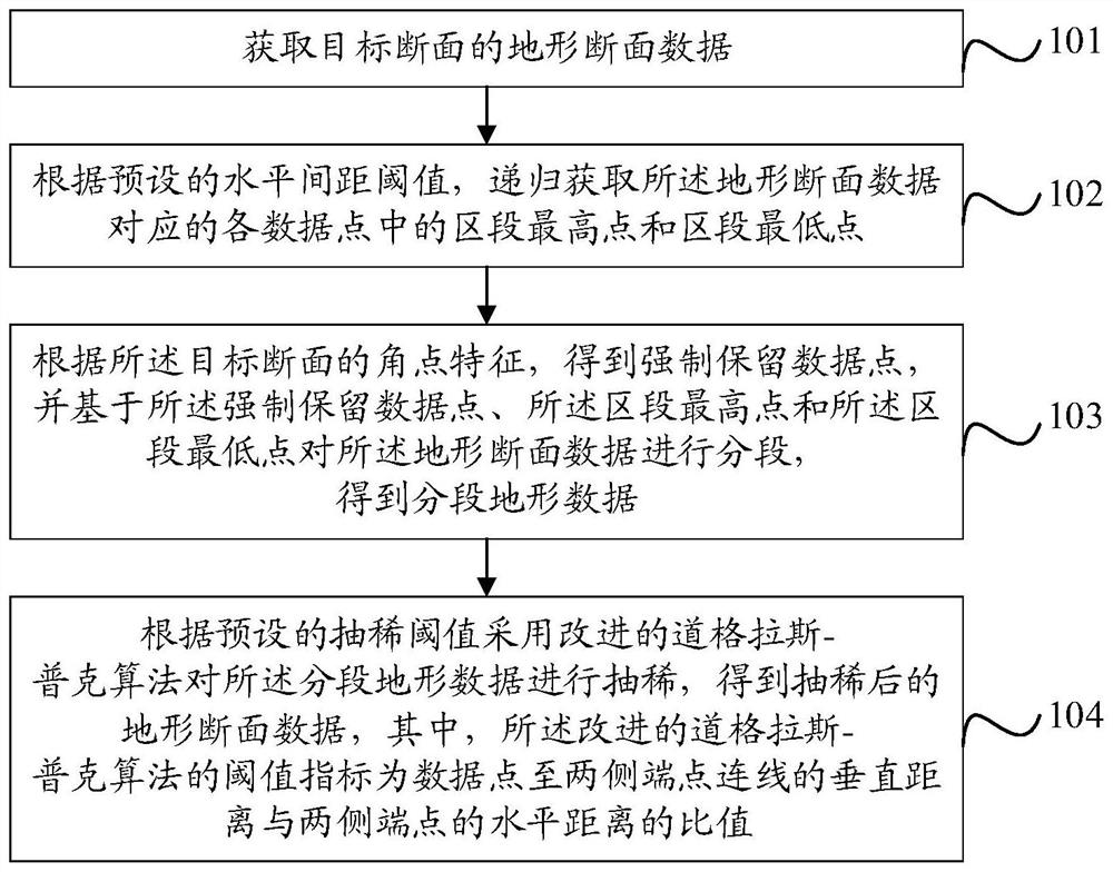
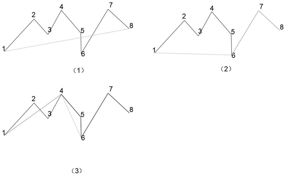
[0080] figure 2 It is a flowchart of a method for implementing a thinning method for terrain section data in an embodiment of the present invention. The method is suitable for thinning polyline data of engineering terrain sections, especially bridge topographic sections, such as figure 2 shown, including:
[0081] Step 101. Obtain terrain section data of a target section.
[0082] In this embodiment, first obtain the digital terrain model (DTM, Digital Terrain Model) of the target section in the BIM model, GIS model or laser point cloud model, and use the sectional technology to obtain the sectional ground line data of the target section, and further generate terrain section data. When originally collecting BIM model data, GIS model data or laser point cloud model data, a large amount of repeated data is...
PUM
 Abstract
Description
Claims
Application Information