Ground feature contour extraction method based on ground laser point cloud

A laser point cloud and contour extraction technology, applied in the direction of optical devices, measuring devices, instruments, etc., can solve the problems of difficult to reflect the three-dimensional information of the building, the large amount of calculation in the feature matching process, and the time-consuming internal work, etc., to improve The effect of urban measurement efficiency, high accuracy of contour extraction, and improved automation

Active Publication Date: 2021-04-02
湖南航天智远科技有限公司
View PDF8 Cites 22 Cited by
  • Summary
  • Abstract
  • Description
  • Claims
  • Application Information

AI Technical Summary

Problems solved by technology

Fourth, it has low requirements on the external environment. The 3D laser scanner itself has good stability and does not need to preset special measurement targets and marks. It can complete fast and accurate detection of target objects in complex scenes and spaces no matter in day or night. Grid scanning measurement has a wide range of applications; fifth, it can combine multi-source sensors to collect data, not only to obtain the point coordinates of the target surface, but also to collect corresponding texture and color information, so that the scanning system can obtain a more comprehensive picture of the measured object Information, the modeling results are more refined and close to the real, which improves the application value of 3D laser scanning in engineering, but there are still obvious areas for improvement in the application of 3D laser scanning to the extraction of ground object outlines;
The traditional single-point measurement method is low in efficiency and labor-intensive in collecting data, and it is difficult to reflect the three-dimensional information of the building, which does not meet the requirements of high efficiency; while the photogrammetry and remote sensing methods extract the outline of the building through satellite and aerial images. The layout of ground control points is complex and the task is heavy. The feature extraction and feature matching process of data processing requires a large amount of calculation, which takes a long time in the office and has a low degree of automation. The results cannot reflect the real 3D information and cannot meet the requirements of modern surveying and mapping;
[0007] Third, it is extremely difficult and complicated to build a general and feasible feature contour extraction in the existing technology. In the early stage, it was generally based on the measurement of a single point. Because the extraction rules are all based on manual establishment, it takes a lot of time and resources. Moreover, errors are prone to occur, resulting in poor portability; the existing technology focuses on the collection of single-point data, and the ground object contour extraction technology of ground laser point cloud is immature and cannot meet the needs of the industry. At the same time, ground laser point cloud exists Weak interactive performance, low degree of intelligence, low scalability, slow extraction speed, low extraction accuracy of ground object contours, etc.

Method used


Image

  • Ground feature contour extraction method based on ground laser point cloud
  • Ground feature contour extraction method based on ground laser point cloud
  • Ground feature contour extraction method based on ground laser point cloud

Examples


Embodiment Construction

[0058] The technical scheme of the ground object contour extraction method based on the ground laser point cloud provided by the present invention will be further described below in conjunction with the accompanying drawings, so that those skilled in the art can better understand the present invention and implement it.

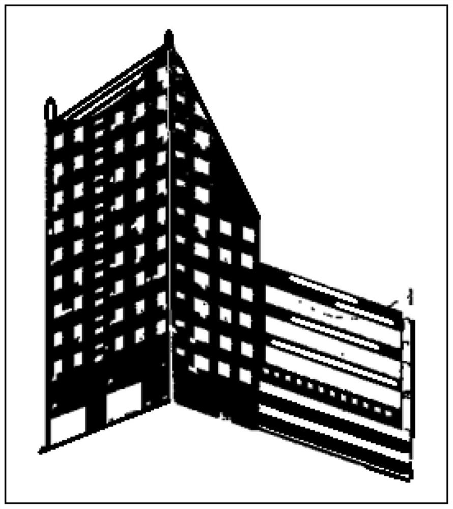
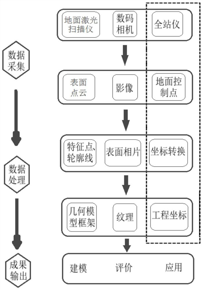
[0059] The terrestrial 3D laser scanning system has broken through the traditional single-point measurement method, and has unique and obvious advantages in the efficiency of data collection and the comprehensive acquisition of information. With the rapid improvement of the performance of terrestrial 3D laser scanners in recent years, the use of point cloud data to achieve 3D reconstruction applications is increasing, and it has been widely used in engineering measurement. Ground three-dimensional laser scanning technology has become the main means of urban surveying. This invention is based on ground fixed and mobile three-dimensional scanning methods, combine...


PUM


Abstract

According to a ground feature contour extraction method based on a ground laser point cloud provided by the invention, surface-based space measurement breaking through a traditional single-point measurement mode is introduced into urban measurement application, and the urban measurement efficiency is improved. As the most important space entity of a city, the three-dimensional information of ground objects, especially buildings, is the important basic geographic information of the city and has important application value. The whole scanning process is high in data acquisition efficiency, ground control points do not need to be specially arranged, scanning measurement is slightly influenced by the external environment, and the measurement precision is high. Not only is automation degree ofbuilding space data acquisition improved, but also scanned point cloud can express real three-dimensional information and detail structure of a building in detail. Accurate contour information is acquired by means of the point cloud data, and a three-dimensional model of the building is reconstructed. The method has the advantages of high interaction performance, high intelligent degree, high expandability, high extraction speed, high contour extraction precision and the like.

Description

technical field [0001] The invention relates to a method for extracting the contours of ground objects from point clouds, in particular to a method for extracting contours of ground objects based on ground laser point clouds, and belongs to the technical field of contour extraction of ground objects. Background technique [0002] With the progress of society and the development of science and technology, people's cognition of their own living environment needs more accurate description and scene reconstruction, digitize the spatial information of interest and establish a database to provide services for planning management and other aspects of the real world. The growth of this demand is complementing the development of the surveying and mapping industry. After decades of development, surveying and mapping has developed from traditional surveying and mapping to digital surveying and mapping, and then to information-based surveying and mapping. The target of surveying and mapp...

Claims


Application Information

Patent Timeline
Patent Type & Authority Applications(China)
IPC IPC(8): G01B11/24
CPCG01B11/24
Inventor 扆亮海何克慧
Owner 湖南航天智远科技有限公司
Why Eureka
Try Eureka