Intelligent drawing method for surface water body based on wide-view-field high-resolution No.6 satellite image

A satellite image, high-scoring technology, applied in neural learning methods, maps/plans/charts, water resource assessment, etc., can solve problems such as the lack of intelligent mapping methods for surface water bodies, achieve good application potential, improve efficiency, and improve efficiency and the effect of precision

Active Publication Date: 2021-06-11
CHINA INST OF WATER RESOURCES & HYDROPOWER RES
View PDF6 Cites 4 Cited by
  • Summary
  • Abstract
  • Description
  • Claims
  • Application Information

AI Technical Summary

Benefits of technology

This patented technology allows researchers to efficiently analyze different areas within their country's boundaries through remotely detected sensor data collected from various sources like satellite imagery or aerial images obtained over time. By analyzing these datasets they found that there were many small holes between two points where no rainwater was flowing during one period of observation. These holes caused significant errors when trying to determine whether certain features are associated with specific parts (such as river banks) or other important structures such as lakes). To address this issue, it proposes combining methods called Ground Water System Pattern Model(GWSM), which uses deep learning techniques to accurately identify water border lines around them without any missing pixels. It also suggests creating maps made up of connected components along edges indicating how well each part of the body should be covered underground. Overall, GWDMP provides technical means for improving understanding and detection of environmental issues related to flooding events.

Problems solved by technology

This patented technical problem addressed in this patents relates to improving the accuracy and efficiency of extracting surface water bodies (such as sea ice) from remotely observed astronomy datasets due to limited space availability at different locations around China's borders or lack of accessibility during exploration operations. Current techniques involve manual processing steps that require significant effort and take up valuable crew hours.

Method used


Image

  • Intelligent drawing method for surface water body based on wide-view-field high-resolution No.6 satellite image
  • Intelligent drawing method for surface water body based on wide-view-field high-resolution No.6 satellite image
  • Intelligent drawing method for surface water body based on wide-view-field high-resolution No.6 satellite image

Examples


Embodiment Construction

[0068] Exemplary embodiments of the present invention will now be described in detail with reference to the accompanying drawings. It should be understood that the implementations shown and described in the drawings are only exemplary, intended to explain the principle and spirit of the present invention, rather than limit the scope of the present invention.

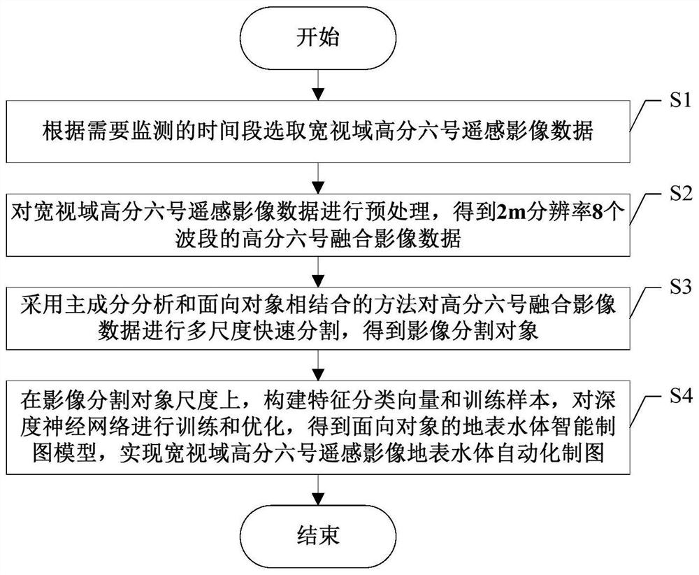
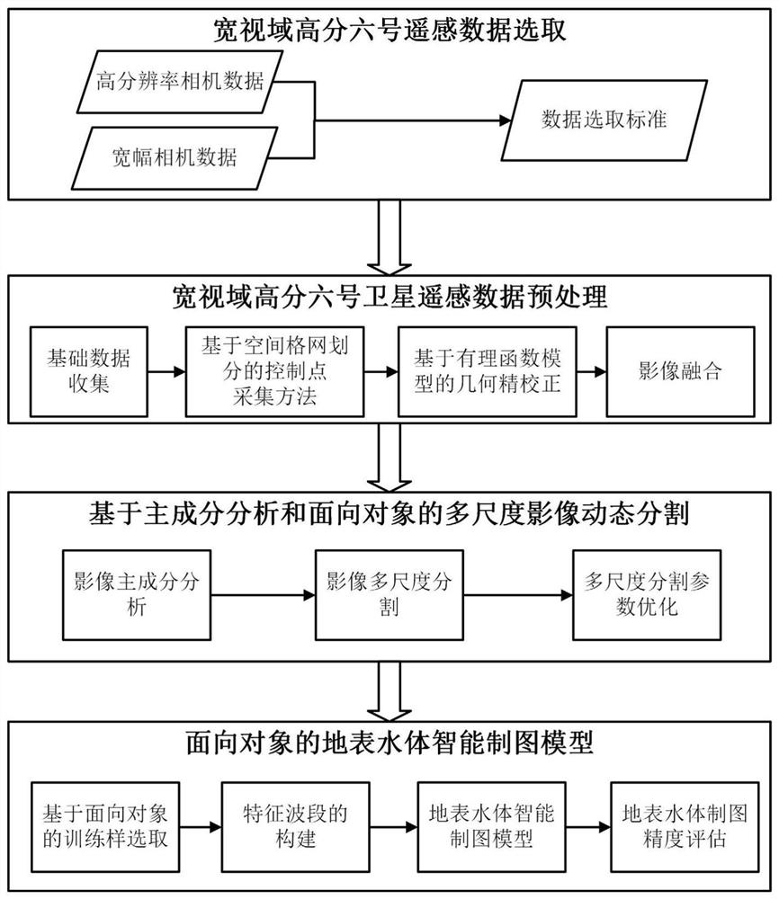
[0069] The embodiment of the present invention provides a wide-field Gaofen-6 satellite image intelligent mapping method for surface water bodies, such as Figure 1 ~ Figure 2 Commonly shown, including the following steps S1-S4:

[0070] S1. Select the wide-field Gaofen-6 remote sensing image data according to the time period that needs to be monitored.

[0071] In the embodiment of the present invention, according to the time period that needs to be monitored, select the appropriate wide-view field Gaofen-6 remote sensing image data from the China Resources Satellite Center website, which includes 2-meter panchromatic / ...


PUM


Abstract

The invention discloses an intelligent drawing method for a surface water body based on a wide-view-field high-resolution No.6 satellite image, which comprises the following steps: on the basis of selecting high-quality wide-view-field Gaofen-6 remote sensing image data, obtaining wide-view-field 2m-resolution eight-waveband Gaofen-6 fused image data based on a grid division geometric fine correction and image fusion method; carrying out image multi-scale rapid segmentation based on principal component analysis and object-oriented combination, constructing a feature classification vector on the scale of a segmented object, selecting a water body/non-water body training sample with relatively high spatial-temporal representativeness based on a spatial grid, and constructing an object-oriented deep neural network-based surface water body intelligent mapping model for wide-view-field high-resolution No.6 remote sensing image surface water body automatic drawing is realized. The invention mainly improves the efficiency and precision of geometric fine correction, multi-scale segmentation and surface water body intelligent extraction of the wide-view-field image, and has good application potential in flood monitoring, river and lake supervision and water ecology investigation.

Description


Claims


Application Information

Patent Timeline
Owner CHINA INST OF WATER RESOURCES & HYDROPOWER RES
Why Eureka
Try Eureka