Building feature learning method for incremental data of remote sensing image
A remote sensing image and incremental data technology, applied in the field of surveying and mapping science, can solve the problems of heavy storage burden, model maintenance cost, lack of, and little attention to building detection model cognitive performance, etc. The effect of expanding and updating, improving model feature expression and extraction capabilities
- Summary
- Abstract
- Description
- Claims
- Application Information
AI Technical Summary
Problems solved by technology
Method used
Image


Examples
Embodiment Construction
[0028] In order to have a clearer understanding of the technical features, purposes and effects of the present invention, the specific implementation manners of the present invention will now be described in detail with reference to the accompanying drawings.
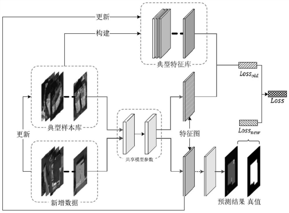
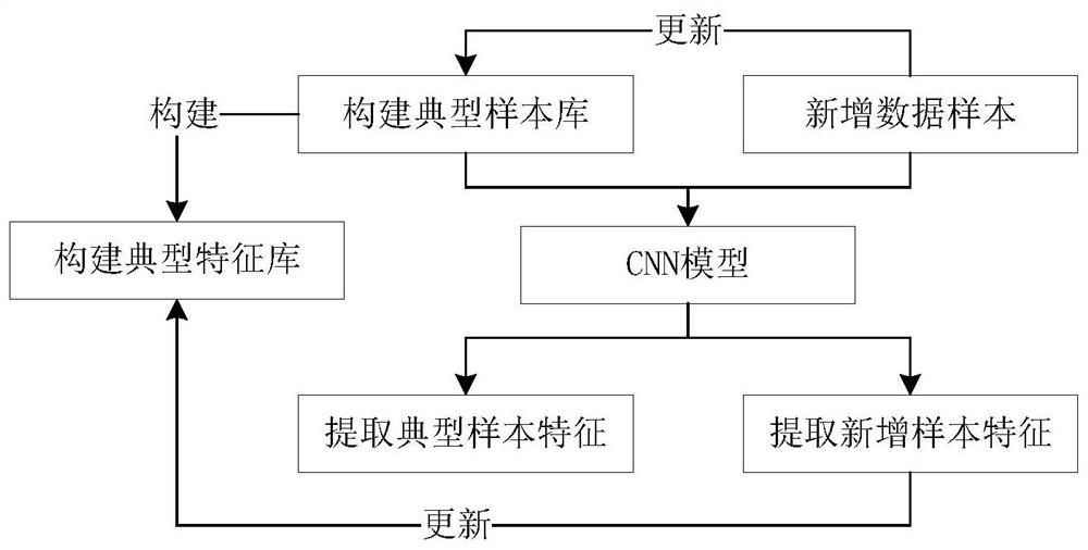
[0029] Please refer to figure 1 and figure 2 , the invention discloses a building feature learning method for remote sensing image incremental data, comprising the following steps:
[0030] S1. Perform data preparation, screen and cut high-resolution remote sensing images with a size of 800×800 from the initial stock data as samples, and build a typical sample library;
[0031] S2. Based on the CNN initial model parameters, input typical samples and building label images with the same range, extract the features of buildings in remote sensing images through a series of convolution and pooling operations, and construct typical features corresponding to the typical sample library library;
[0032] Set the upper limit ...
PUM
 Abstract
Description
Claims
Application Information