

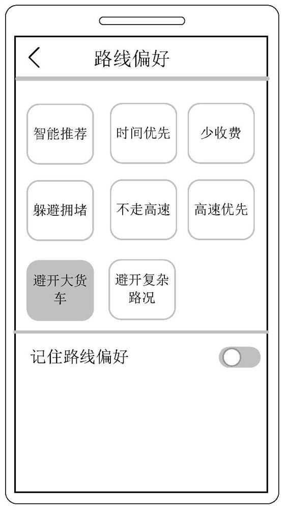
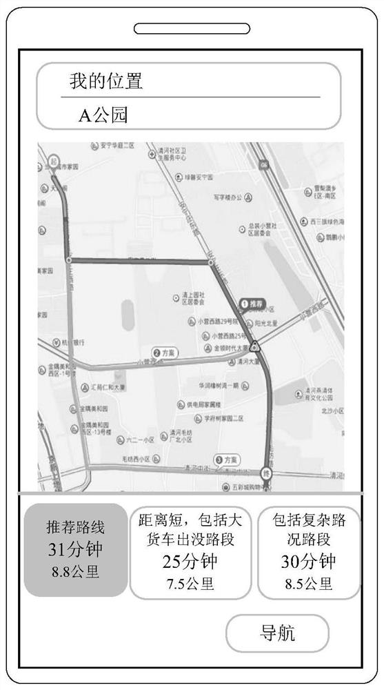
Navigation route determination method and device
A navigation route and determination method technology, applied in the field of intelligent transportation, can solve problems such as poor driving experience of users, and achieve the effect of optimizing the navigation route
- Summary
- Abstract
- Description
- Claims
- Application Information
AI Technical Summary
Problems solved by technology
Method used
Image

Examples
Embodiment 3
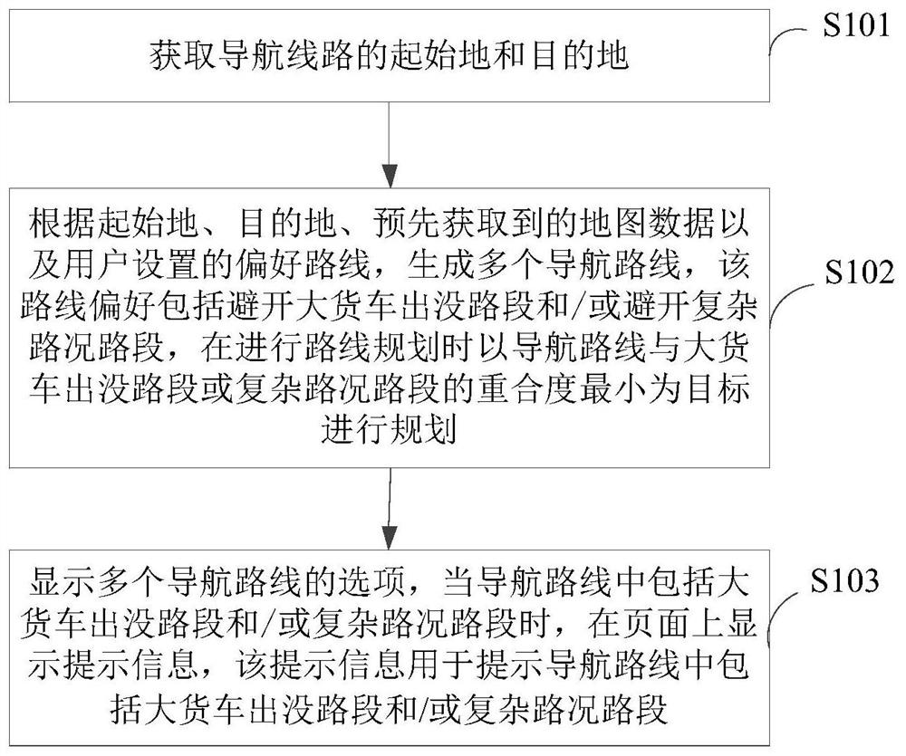
[0115] In the third embodiment, each road section in the map has a second identification, correspondingly, it is necessary to identify the road sections in the map to determine which road sections are complex road conditions, Figure 7 The flow chart of the method for determining the road section with complex road conditions provided by Embodiment 4 of the present invention, as shown in Figure 7 As shown, the method provided in this embodiment includes the following steps.
[0116] S401. Obtain the average vehicle speed of each road section in the map during off-peak hours.
[0117] Due to the large traffic flow during the peak period, many road sections will be congested, causing the vehicles to travel slowly. This embodiment excludes the peak period, and only obtains the average vehicle speed of each road section in the off-peak period, which can be obtained by field measurement with a special test vehicle, and can also It can be obtained by collecting data of different na...
PUM
 Abstract
Description
Claims
Application Information