Navigation method and device, computer equipment and storage medium

A navigation method and computer program technology, which are applied in directions such as navigation, measuring devices, surveying and mapping, and navigation, etc., can solve the problems of difficult to provide personalized service solutions accurately, easy to obstruct the line of sight, and loss of vehicle position.

Pending Publication Date: 2021-09-03
BEIJING WANJI TECH
View PDF10 Cites 2 Cited by
  • Summary
  • Abstract
  • Description
  • Claims
  • Application Information

AI Technical Summary

Problems solved by technology

[0003] Because the tunnel is a closed space scenario, the GNSS signal in the tunnel is usually weak or disappears, which makes the position of the vehicle entering the tunnel lost, and it is difficult to determine the identity of the vehicle in the tunnel. Based on this, it is difficult to accurately provide personalized service solutions in the tunnel For each vehicle in the tunnel, the light i

Method used


Image

  • Navigation method and device, computer equipment and storage medium
  • Navigation method and device, computer equipment and storage medium
  • Navigation method and device, computer equipment and storage medium

Examples


Example Embodiment

[0072] In order to make the purpose, technical solutions and advantages of the present application, the present application will be described in further detail below with reference to the accompanying drawings and examples. It should be understood that the specific embodiments described herein are intended to explain the present application and is not intended to limit the present application.
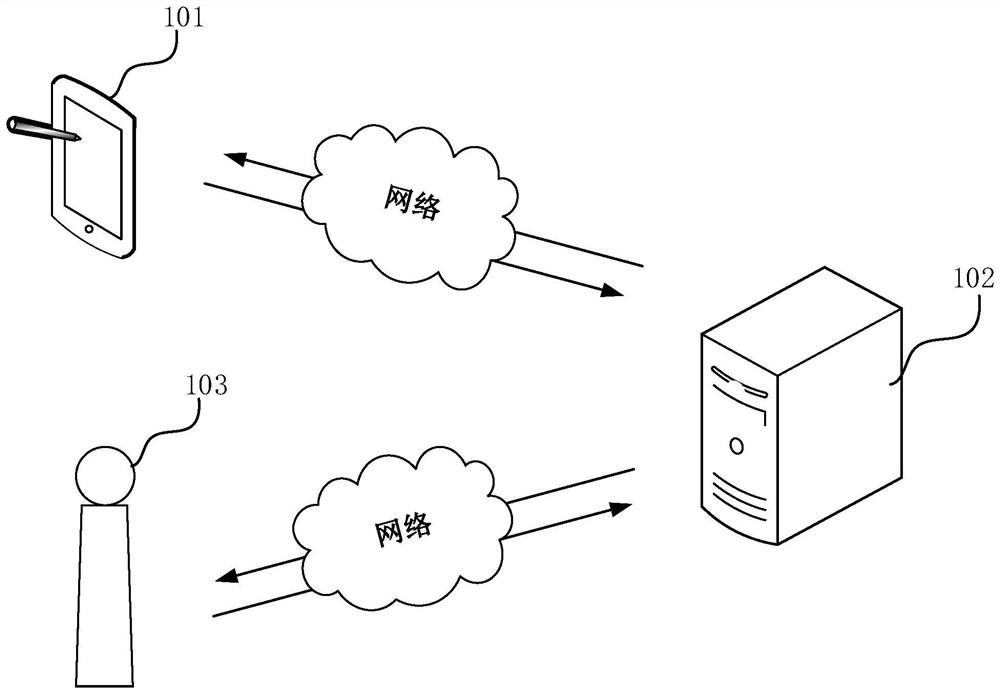
[0073] The navigation method provided herein can be applied to figure 1 The application environment is shown. The application environment can include client 101, server 102, and road side base station 103, wherein client 101 and road side base station 103 can communicate with server 102 over a network. The above client 101 can be an electronic device such as a mobile phone, a tablet, iPad, and a vehicle controller, and can also be an APP software mounted on the electronic device. The server 102 can be implemented with a stand-alone server or a server cluster consisting of multiple servers....


PUM


Abstract

The invention relates to a navigation method and device, computer equipment and a storage medium. The method comprises the steps that if a target vehicle enters a geographic range corresponding to a high-precision map of a target tunnel, the high-precision map is displayed in a map navigation page, and a first content element corresponding to the target vehicle and a second content element corresponding to an adjacent vehicle are displayed on the high-precision map in a bird's-eye view angle in an overlapping mode, wherein the measurement precision of the high-precision map is greater than a preset precision threshold value; and the adjacent vehicle is a vehicle within a preset range around the target vehicle, the first content element and the second content element are acquired based on sensing information of a roadside base station arranged in the target tunnel, and the roadside base station is initialized based on the high-precision map. By adopting the method, the user can be better assisted in driving at the tunnel.

Description

technical field [0001] The present application relates to the technical field of terminal interaction, in particular to a navigation method, device, computer equipment and storage medium. Background technique [0002] With the improvement of people's living standards, vehicles such as cars are becoming more and more popular. When traveling by car, the map APP (Application) is an indispensable tool. It can not only plan driving routes, but also query the distribution of tunnels and bridges on expressways, which has brought great benefits to people's work and life. convenient. [0003] Because the tunnel is a closed space scenario, the GNSS signal in the tunnel is usually weak or disappears, which makes the position of the vehicle entering the tunnel lost, and it is difficult to determine the identity of the vehicle in the tunnel. Based on this, it is difficult to accurately provide personalized service solutions in the tunnel For each vehicle in the tunnel, the light in the...

Claims


Application Information

Patent Timeline
IPC IPC(8): G01C21/00G01S19/46G01S13/86
CPCG01C21/3804G01S19/46G01S13/86
Inventor 时兵兵李智房颜明孟令钊董航郭虹宇
Owner BEIJING WANJI TECH
Why Eureka
Try Eureka