Eureka AIR delivers breakthrough ideas for toughest innovation challenges, trusted by R&D personnel around the world.

Automatic land class interpretation method based on low-frequency error elimination

A low-frequency error and land type technology, applied in the field of remote sensing image processing, can solve the problems of increasing uncertainty and post-processing burden, and achieve the effect of fast results and accurate remote sensing graphics.

Pending Publication Date: 2021-11-12
苏州九宇遥感科技有限公司
View PDF0 Cites 0 Cited by
  • Summary
  • Abstract
  • Description
  • Claims
  • Application Information

AI Technical Summary

Problems solved by technology

[0003] The star sensor is the sensor with the highest precision on the star, but due to the influence of precession, nutation, low-frequency error, etc., its accuracy will be greatly affected, and the low-frequency error component can reach tens to tens of arcseconds, and the error Difficult to eliminate on-orbit, generally can be eliminated through post-processing, which greatly increases the burden of uncertainty and post-processing

Method used


Image

  • Automatic land class interpretation method based on low-frequency error elimination
  • Automatic land class interpretation method based on low-frequency error elimination
  • Automatic land class interpretation method based on low-frequency error elimination

Examples


Embodiment Construction

[0015] The following will clearly and completely describe the technical solutions in the embodiments of the present invention with reference to the accompanying drawings in the embodiments of the present invention. Obviously, the described embodiments are some of the embodiments of the present invention, but not all of them. Based on the embodiments of the present invention, all other embodiments obtained by persons of ordinary skill in the art without making creative efforts belong to the protection scope of the present invention.

[0016] It should be understood that when used in this specification and the appended claims, the terms "comprising" and "comprises" indicate the presence of described features, integers, steps, operations, elements and / or components, but do not exclude one or Presence or addition of multiple other features, integers, steps, operations, elements, components and / or collections thereof.

[0017] It should also be understood that the terminology used ...


PUM


Abstract

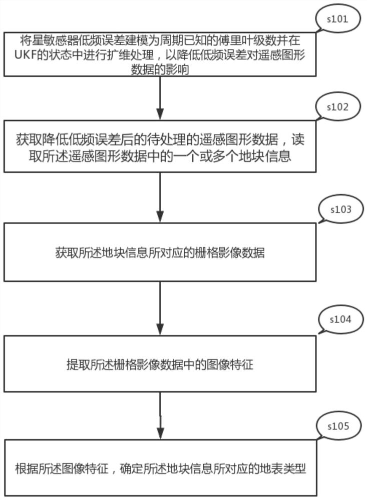
The invention provides an automatic land class interpretation method based on low-frequency error elimination, which comprises the following steps of: modeling a low-frequency error of a star sensor into a Fourier series with a known period, and carrying out dimension expansion processing in a UKF (Unscented Kalman Filter) state so as to reduce the influence of the low-frequency error on remote sensing graphic data; obtaining to-be-processed remote sensing graphic data after low-frequency errors are reduced, reading one or more pieces of land parcel information in the remote sensing graphic data, obtaining grid image data corresponding to the land parcel information, extracting image features in the grid image data, and determining the earth surface type corresponding to the land parcel information according to the image features. By eliminating the low-frequency error, the obtained remote sensing graph is more accurate, so that the result obtained by land class interpretation is quicker and more accurate.

Description

technical field [0001] The invention relates to the technical field of remote sensing image processing, in particular to a method for automatic interpretation of terrain types based on low-frequency error elimination. Background technique [0002] In modern earth observation satellites, the accuracy of attitude determination directly affects the quality of remote sensing image processing, and post-event attitude processing can often obtain higher attitude determination accuracy, so it is very important for remote sensing satellites to be able to perform post-event attitude determination with high precision. [0003] The star sensor is the sensor with the highest precision on the star, but due to the influence of precession, nutation, low-frequency error, etc., its accuracy will be greatly affected, and the low-frequency error component can reach tens to tens of arcseconds, and the error It is difficult to eliminate on-orbit, and generally can be eliminated through post-proce...

Claims


Application Information

Patent Timeline
IPC IPC(8): G06K9/00G06K9/40G06K9/46
Inventor 张过
Owner 苏州九宇遥感科技有限公司
Why Eureka
Eureka Blog
Learn More