

Road network matching method combining human interaction and active learning
A technology of active learning and human interaction, applied in complex mathematical operations, structured data retrieval, instruments, etc., and can solve problems such as mismatching
- Summary
- Abstract
- Description
- Claims
- Application Information
AI Technical Summary
Problems solved by technology
Method used
Image

Examples
Embodiment Construction
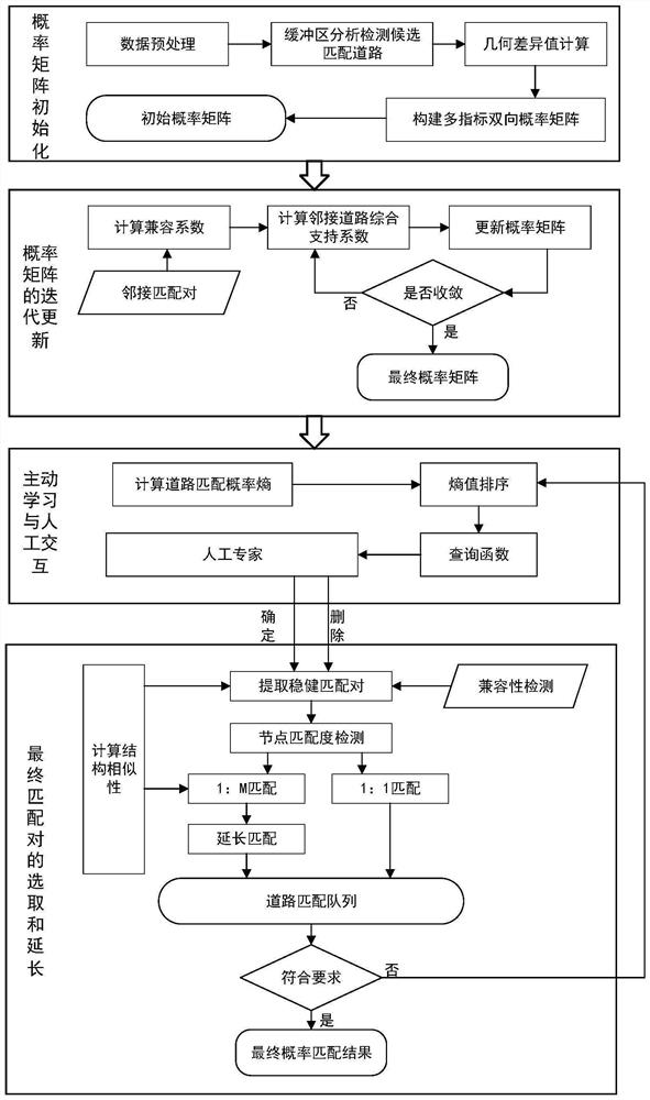
[0081] The present invention will be further described below in conjunction with drawings and embodiments.
[0082] 1. Working principle:
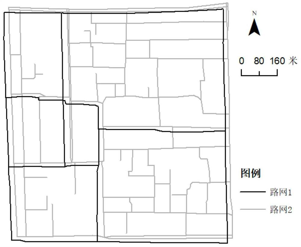
[0083] refer to figure 1 , main processing flow and principle of the present invention are:
[0084] 1. Construction of the initial probability matrix:
[0085] Perform necessary preprocessing work on the original data, such as projection transformation, topological relationship consistency detection, etc. In road matching, the more similar the geometric features are, the higher the matching probability is. After the candidate matching pairs are extracted by buffer analysis, the method constructs the initial probability matrix through the geometric similarity of the candidate matching pairs.
[0086]By inserting virtual nodes to make the lengths of the corresponding road segments of the candidate matching pairs equal, the average distance of the nodes is calculated, which represents the geographical similarity of the two roads; describ...
PUM
 Abstract
Description
Claims
Application Information