Scenic spot security monitoring method and system
A technology for security monitoring and scenic spots, applied in transmission systems, closed-circuit television systems, televisions, etc., can solve the problems of scenic spots and tourist losses
- Summary
- Abstract
- Description
- Claims
- Application Information
AI Technical Summary
Problems solved by technology
Method used
Image
Examples
Embodiment 1
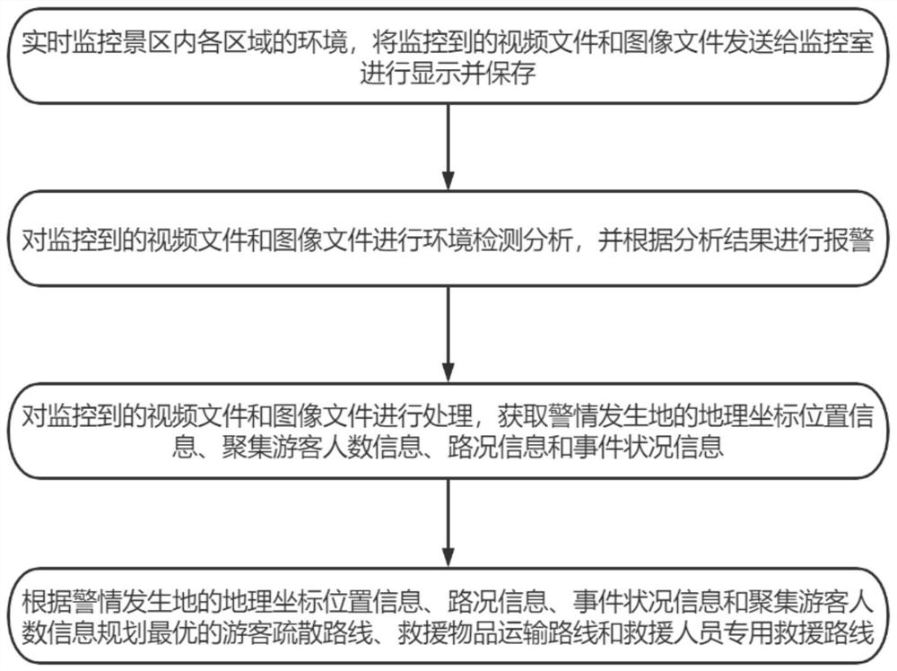
[0039] For ease of understanding, see figure 1 , an embodiment of a scenic spot security monitoring method provided in the first aspect of the present application, comprising the following steps:
[0040] Monitor the environment of each area in the scenic area in real time, and send the monitored video files and image files to the monitoring room for display and storage;
[0041] Carry out environmental detection and analysis on the monitored video files and image files, and give an alarm according to the analysis results;
[0042] Process the monitored video files and image files, and obtain the geographical coordinates and position information of the place where the police situation occurred, the number of tourists gathered, the road condition information and the event status information;
[0043] According to the geographical coordinate location information, road condition information, event status information and the number of tourists gathering information of the locatio...
Embodiment 2
[0047] For ease of understanding, see figure 1, as a further improvement of Embodiment 1, the optimal tourist evacuation route refers to the shortest safe evacuation route for tourists in each area of the scenic spot to arrive at the exit. Planning the optimal evacuation route for tourists specifically includes the following steps: locating the geographical coordinate position of the place where the police situation occurred; planning a safe evacuation route away from the geographical coordinate position of the place where the police situation occurred. Specifically, according to the geographical coordinates of other tourists, the safe evacuation routes for all the exits are planned, and then the distance between the points at a certain distance on each route and the geographic coordinates of the location where the police situation occurs is calculated. When the distance to the place of occurrence is less than the preset value, the route is deleted, and the remaining routes ...
Embodiment 3
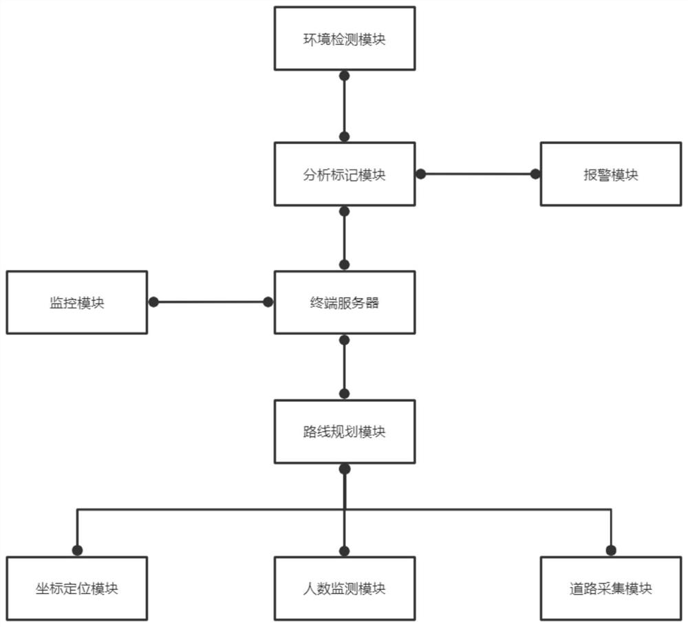
[0051] For ease of understanding, see figure 2 , an embodiment of a scenic spot security monitoring system provided in the second aspect of the application, including:
[0052] The monitoring module is used to monitor the environment and tourists in each area of the scenic spot;
[0053] The terminal server is used to receive and display the monitoring video files and image files and store them, perform environmental detection and analysis on the monitored video files and image files, and generate analysis results;
[0054] Alarm module, used for alarming according to the analysis result;
[0055] The coordinate positioning module is used to locate and obtain the geographical coordinate position of the place where the police situation occurs;
[0056] The number of people monitoring module is used to obtain the number of tourists gathered at the place where the police incident occurred;
[0057] The road collection module is used to obtain road condition information of e...
PUM
 Abstract
Description
Claims
Application Information
 - R&D
- Intellectual Property
- Life Sciences
- Materials
- Tech Scout
- Unparalleled Data Quality
- Higher Quality Content
- 60% Fewer Hallucinations
Browse by: Latest US Patents, China's latest patents, Technical Efficacy Thesaurus, Application Domain, Technology Topic, Popular Technical Reports.
© 2025 PatSnap. All rights reserved.Legal|Privacy policy|Modern Slavery Act Transparency Statement|Sitemap|About US| Contact US: help@patsnap.com


