Portable surveying instrument for geological survey

A geological survey and mapping instrument technology, applied in the field of surveying and mapping instruments, can solve the problems of inaccurate surveying and mapping results and easy damage of surveying and mapping instruments, and achieve the effects of saving space, good protection effect, and improving mobile convenience

Inactive Publication Date: 2022-03-01
黄代文
View PDF0 Cites 0 Cited by
  • Summary
  • Abstract
  • Description
  • Claims
  • Application Information

AI Technical Summary

Problems solved by technology

[0005] Aiming at the deficiencies of the prior art, the present invention provides a portable surveying and mapping instrument for geological survey, which solves the problem that the surveying and mapping instrument is easily damaged and the surveying and mapping results are easy to be inaccurate on uneven ground

Method used


Image

  • Portable surveying instrument for geological survey
  • Portable surveying instrument for geological survey
  • Portable surveying instrument for geological survey

Examples


Embodiment Construction

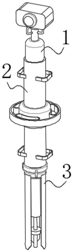
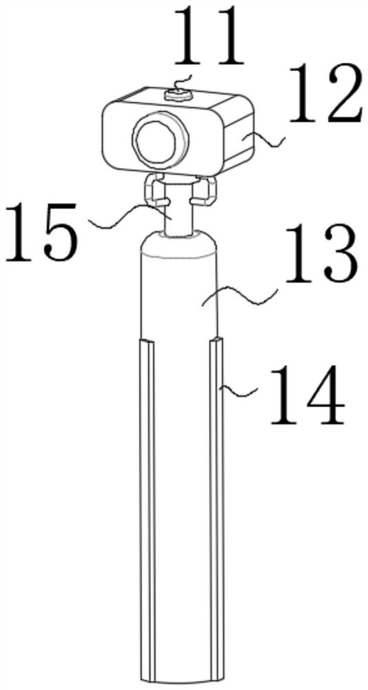
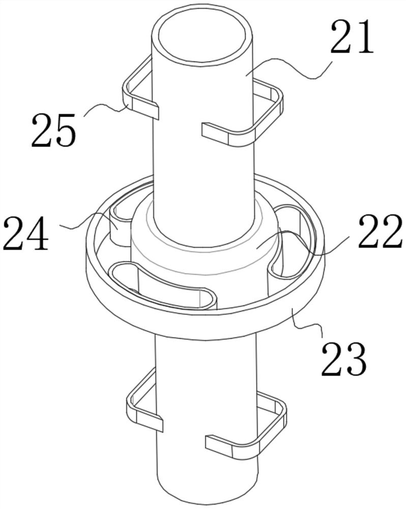
[0030] use Figure 1-Figure 6 A portable surveying instrument for geological survey according to an embodiment of the present invention is described as follows.

[0031] Such as Figure 1-Figure 6 As shown, a portable surveying and mapping instrument for geological survey of the present invention includes a surveying and mapping device 1, and the purpose of setting the surveying and mapping device 1 is to ensure the surveying and mapping effect. The purpose is to ensure that the surveying and mapping effect will not be affected after the device is dumped, and the bottom of the surveying and mapping device 1 is flexibly connected to the top of the installation device 2, and the bottom of the installation device 2 is provided with a fixing device 3. The purpose of setting the fixing device 3 is In order to improve its stability, the bottom of the installation device 2 is fixedly connected with the top of the fixing device 3 .

[0032] The surveying and mapping device 1 include...


PUM


Abstract

The invention belongs to the field of surveying instruments, and particularly relates to a portable surveying instrument for geological survey, which comprises a surveying device, a mounting device is arranged at the bottom of the surveying device, the bottom of the surveying device is movably connected with the top of the mounting device, and a fixing device is arranged at the bottom of the mounting device. The bottom of the mounting device is fixedly connected with the top of the fixing device, the surveying and mapping device comprises a fixing column, an adjusting device is arranged at the top of the fixing column, the top of the fixing column is fixedly connected with the bottom of the adjusting device, a main body is arranged at the top of the adjusting device, and the top of the adjusting device is fixedly connected with the bottom of the main body. A gradienter is arranged at the top of the main body, and the top of the main body is fixedly connected with the bottom of the gradienter, aiming at the defects in the prior art, the invention provides the portable surveying instrument for geological survey, and the problems that the surveying instrument is easy to damage, and the surveying result is easy to be inaccurate on the uneven ground are solved.

Description

technical field [0001] The invention belongs to the field of surveying and mapping instruments, in particular to a portable surveying and mapping instrument for geological survey. Background technique [0002] Geological exploration can be understood as geological work in a broad sense. It is based on the needs of economic construction, national defense construction, and scientific and technological development, using geological exploration methods such as surveying and mapping, geophysical prospecting, geochemical prospecting, drilling, pit exploration, sampling testing, and geological remote sensing. , Investigation and research work on geological conditions such as rocks, stratum structures, minerals, groundwater, and landforms in a certain area. When conducting geological and mineral surveys, it is often necessary to carry various surveying and mapping instruments to survey and map the geological and mineral forms. Most of the current surveying and mapping instruments re...

Claims


Application Information

Patent Timeline
Patent Type & Authority Applications(China)
IPC IPC(8): F16M11/04F16M11/12F16M11/24G01C15/00
CPCF16M11/04F16M11/12F16M11/242G01C15/00
Inventor 黄代文
Owner 黄代文
Why Eureka
Try Eureka