River depth measuring device for land surveying and mapping

A technology for depth measurement and river ditch, which is applied in the directions of measuring devices, surveying and navigation, open-air water source survey, etc. The effect of small friction

Inactive Publication Date: 2022-07-05
王凤
View PDF0 Cites 0 Cited by
  • Summary
  • Abstract
  • Description
  • Claims
  • Application Information

AI Technical Summary

Problems solved by technology

[0005] In order to solve the deficiencies in the prior art, the present invention proposes a device for measuring the depth of a river for land surveying and mapping; it solves the problem that when measuring the depth of a river, it is often used to measure only one point, and some rivers are deeper and the water flow is more rapid. , It is difficult to keep the measuring tool in a vertical state during measurement. When the measuring tool is in an inclined state, the depth of the river can be calculated according to the length read on the measuring tool and the angle between the measuring tool and the vertical direction, but the bottom of the channel is not all flat , there is a certain slope, which makes the calculated depth of the river inaccurate

Method used


Image

  • River depth measuring device for land surveying and mapping
  • River depth measuring device for land surveying and mapping
  • River depth measuring device for land surveying and mapping

Examples


Embodiment Construction

[0031] In order to make it easy to understand the technical means, creation features, achieved goals and effects of the present invention, the present invention will be further described below with reference to the specific embodiments.

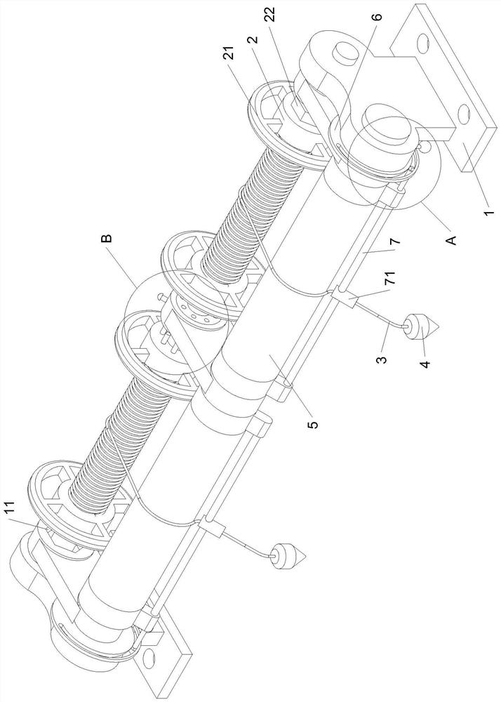
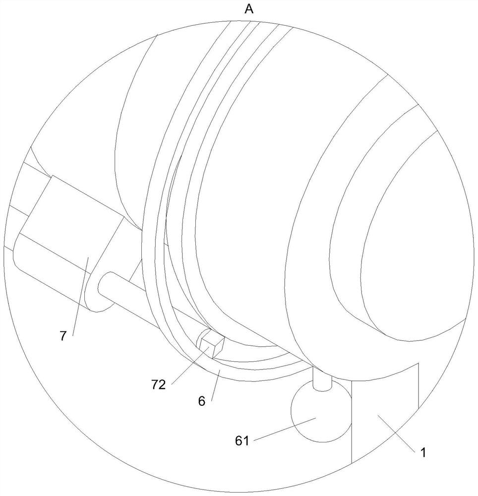
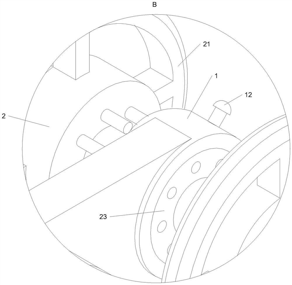
[0032] The embodiment of the present invention provides a river ditch depth measuring device for land surveying and mapping, which solves the problem that it is difficult to keep the measuring tool in a vertical state during measurement in a river with a deep depth and a rapid water flow. The length and the angle between the measuring tool and the vertical direction can be used to calculate the depth of the gully, but the bottom of the gully is not all flat, and there is a certain slope, which makes the calculated depth of the gully inaccurate technical problems;

[0033] The technical solution in the embodiment of the present invention is to solve the above-mentioned technical problem, and the general idea is as follows: by setting a pair of ...


PUM


Abstract

The invention belongs to the technical field of land surveying and mapping, and particularly relates to a river depth measuring device for land surveying and mapping. The winding drum is rotationally mounted at the top of the fixed seat; a pair of cotton ropes are arranged, the cotton ropes are wound on the winding drum, and one end of each cotton rope is fixedly connected with the winding drum; the plumb bob is fixedly connected with the other end of the rope; in order to solve the problems that a measuring tool is difficult to keep in a vertical state during measurement in a deep river with urgent water flow, the depth of the river is calculated according to the length read on the measuring tool and the included angle between the measuring tool and the vertical direction when the measuring tool is in an inclined state, but the bottom of the river mostly has a certain gradient, and the measuring tool is inconvenient to measure. And the calculated depth of the river ditch is not accurate. According to the invention, through the arrangement of the pair of ropes, the depth of two points in the river can be measured at the same time, the terrain of the river can be judged, multi-point measurement can be carried out according to the terrain at the bottom of the river, and the depth of the river can be accurately measured.

Description

technical field [0001] The invention belongs to the technical field of land surveying and mapping, in particular to a river trench depth measuring device for land surveying and mapping. Background technique [0002] Land surveying and mapping refers to the use of computer technology, optoelectronic technology, network communication technology, space science, and information science as the basis, with global positioning system (GPS), remote sensing (RS), and geographic information system (GIS) as the core technology, and the ground has been For some feature points and boundaries, graphics and location information reflecting the current situation on the ground can be obtained by means of measurement, which can be used for planning, design and administrative management of engineering construction. River ditch depth measurement is also an important measurement item in land surveying and mapping. [0003] When measuring the depth of a river ditch, the measuring tools used can of...

Claims


Application Information

Patent Timeline
Patent Type & Authority Applications(China)
IPC IPC(8): G01C13/00
CPCG01C13/008Y02A90/30
Inventor 王凤
Owner 王凤
Why Eureka
Try Eureka