Earthquake forecasting method and device based on remote sensing data, equipment and medium
A technology of remote sensing data and abnormal data, which is applied in the field of satellite image processing to achieve the effect of improving accuracy and recognition accuracy
- Summary
- Abstract
- Description
- Claims
- Application Information
AI Technical Summary
Problems solved by technology
Method used
Image
Examples
Embodiment Construction
[0059] In order to more clearly understand the above objects, features and advantages of the present invention, the solution of the present invention will be described in further detail below. It should be noted that the embodiments of the present invention and the features in the embodiments may be combined with each other under the condition of no conflict.
[0060] Many specific details are set forth in the following description to facilitate a full understanding of the present invention, but the present invention can also be implemented in other ways different from those described herein; obviously, the embodiments in the description are only a part of the embodiments of the present invention, and Not all examples.
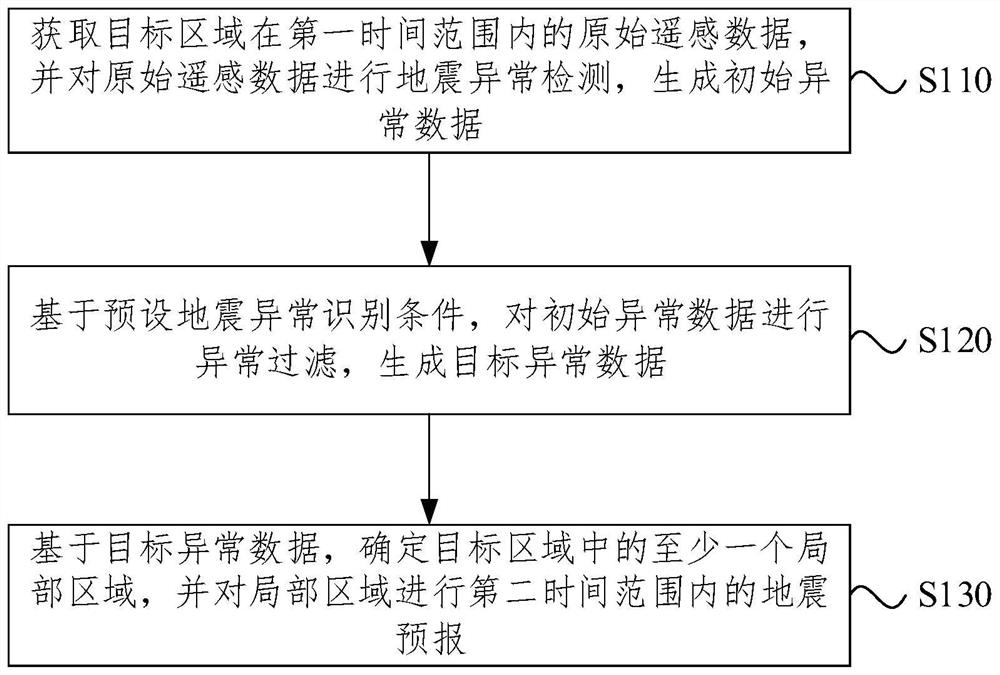
[0061] The earthquake prediction method based on remote sensing data provided by the embodiment of the present invention is mainly applicable to the scenario of monitoring and forecasting possible earthquake activities and the scenario of evaluating the earthq...
PUM
 Abstract
Description
Claims
Application Information
 - R&D
- Intellectual Property
- Life Sciences
- Materials
- Tech Scout
- Unparalleled Data Quality
- Higher Quality Content
- 60% Fewer Hallucinations
Browse by: Latest US Patents, China's latest patents, Technical Efficacy Thesaurus, Application Domain, Technology Topic, Popular Technical Reports.
© 2025 PatSnap. All rights reserved.Legal|Privacy policy|Modern Slavery Act Transparency Statement|Sitemap|About US| Contact US: help@patsnap.com


