Aerial photography flight device for land protection monitoring

A flying device, land technology, applied in the field of land protection monitoring equipment, can solve the problems of long time, waste, trouble, etc.

Pending Publication Date: 2022-08-02
宋志超
View PDF0 Cites 2 Cited by
  • Summary
  • Abstract
  • Description
  • Claims
  • Application Information

AI Technical Summary

Problems solved by technology

[0003] At present, when staff use drones to record and record monitoring data on land, due to the large land area, drones need to last for a long time, and the existing drone systems dedicated to land only have one to two hours of battery life. The time for aerial photography is often not enough, and it needs to be charged immediately. However, most of the existing charging methods are in the form of fixed charging piles, or return-to-air charging. Because when the monitored land is irregular mountainous terrain, it is more troublesome to set up fixed charging piles, and return-to-air charging waste more time

Method used


Image

  • Aerial photography flight device for land protection monitoring
  • Aerial photography flight device for land protection monitoring
  • Aerial photography flight device for land protection monitoring

Examples


Embodiment 1

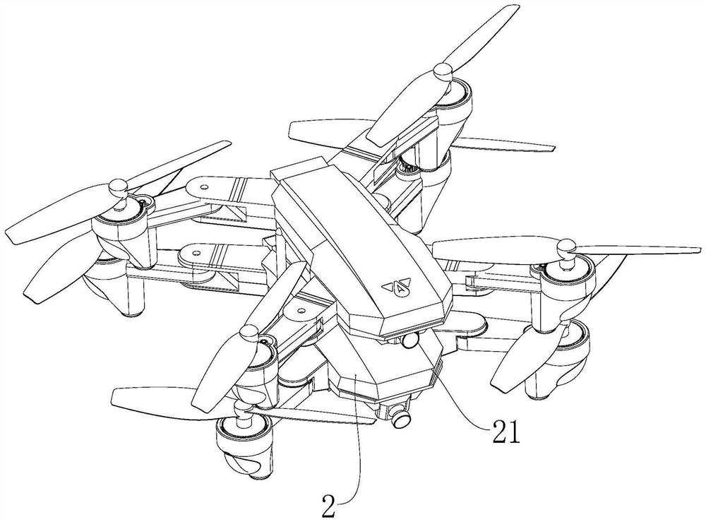
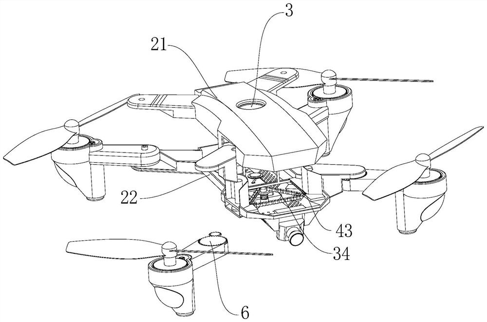
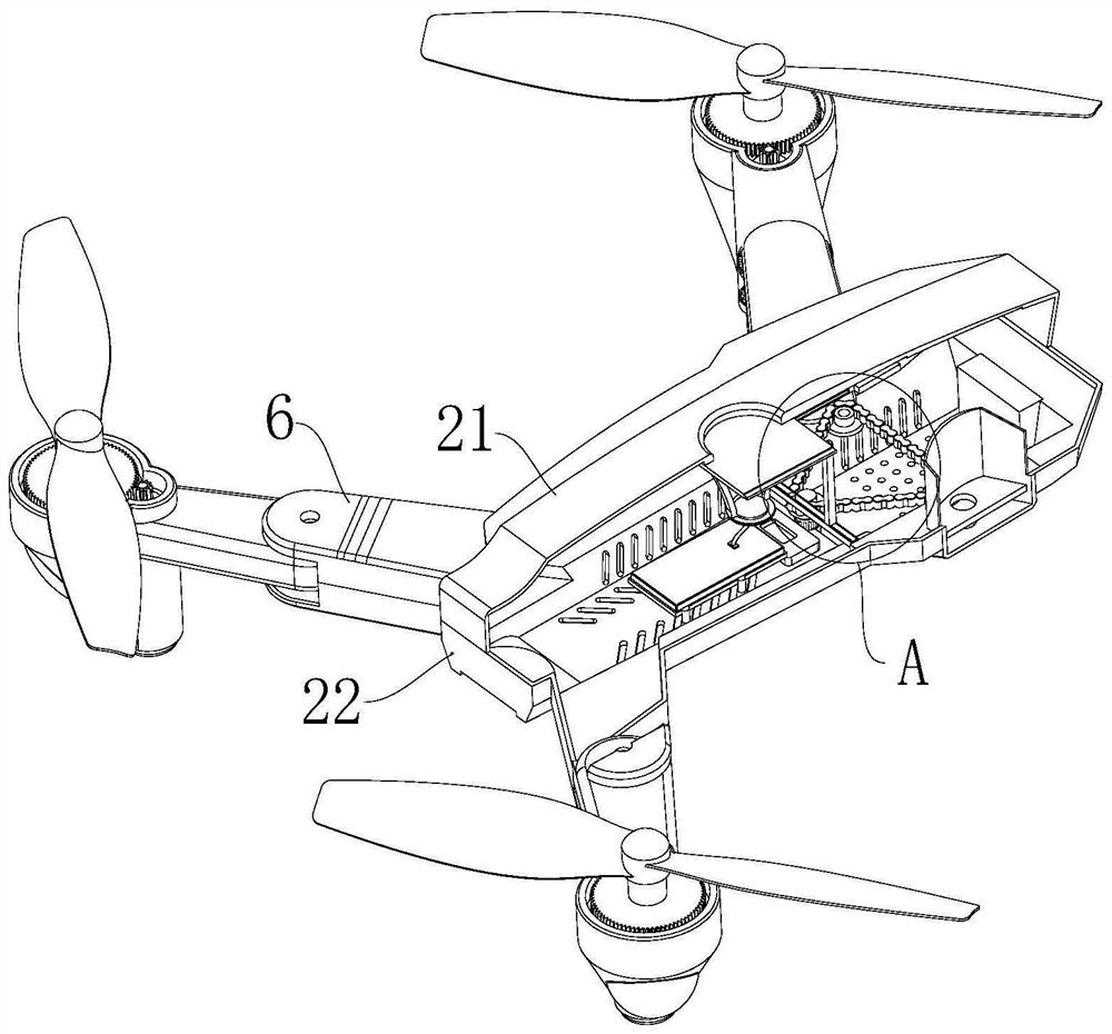
[0031] see Figure 1-8 , the present invention provides a technical solution: an aerial photography flight device for land protection monitoring, comprising a sub-machine 2, the outer wall of the sub-machine 2 can be connected with the main machine, and the sub-machine 2 is provided with a charging component for charging with the main machine 3. The sub-machine 2 is located on the side of the charging assembly 3 and is provided with a circuit board 7 for controlling the sub-machine 2. The main machine is connected to the sub-machine 2 through the card and connection, so that the two machines are fixed in the air, and the main machine is connected to the sub-machine through the charging cable. The charging component 3 in the 2 is electrically connected, so as to achieve the purpose of charging the handset 2 in the air, thereby preventing the handset 2 from returning to the flight in the case of no power, saving time, and charging in time can continue to complete the shooting. T...


PUM


Abstract

The invention discloses an aerial photography flight device for land protection monitoring, the aerial photography flight device comprises a sub-aircraft, the outer wall of the sub-aircraft can be connected with a master aircraft, when the sub-aircraft is in a low-power condition, the sub-aircraft sends a signal to a terminal, and a ground worker sends the master aircraft to the sub-aircraft site when receiving the signal well, so that the ground worker can take off the aerial photography flight device; the child machine stops at an original position and hovers in the air after sending out a signal, when the capturing module on the mother machine captures the capturing module on the child machine, aerial clamping and connection with the child machine are completed, the opening and closing assembly on the child machine opens the charging port of the upper machine shell, the mother machine enables a charging wire to go deep into the connecting cylinder and be electrically connected with the connector, and then the child machine stops in the air after sending out the signal. And after charging connection, the delay module delays to transmit a command to the control module under pre-programming, so that the control module is matched with the contraction assembly to drive the wings to retract, the purpose of air charging is achieved, the trouble that the sub-aircraft returns to charge under the condition of low power supply is avoided, and the working efficiency is improved.

Description

technical field [0001] The invention relates to the technical field of land protection monitoring equipment, in particular to an aerial photography flying device for land protection monitoring. Background technique [0002] UAV remote sensing technology is different from traditional satellite remote sensing. It uses low-altitude flight to quickly and intelligently obtain high-resolution image information of ground objects, and can realize data processing, 3D modeling and application analysis. In recent years, urban expansion has been rapid. The proportion of compensation for demolition and relocation has increased, and illegal construction and land occupation have occurred frequently. In order to effectively curb illegal land construction and further strengthen land supervision, drone aerial photography is used to realize dynamic monitoring of land use, which can quickly and accurately complete the pilot area. The investigation of the illegal situation of land in China makes...

Claims


Application Information

Patent Timeline
Patent Type & Authority Applications(China)
IPC IPC(8): B64C27/08B64C1/30B64C37/00B64C39/02
CPCB64C27/08B64C1/30B64C37/00B64C39/024B64U50/34B64U10/10Y02T50/60
Inventor 宋志超李现娜刘超
Owner 宋志超
Why Eureka
Try Eureka