Method for eliminating imaging error of undulating the earth's surface
A technology of undulating ground and imaging errors, applied in seismic signal processing and other directions, can solve problems such as interference, large imaging errors, and poor adaptability of phase shift methods to velocity changes, achieve high imaging accuracy, adapt to changes in velocity, and achieve absorption The effect of borders
- Summary
- Abstract
- Description
- Claims
- Application Information
AI Technical Summary
Problems solved by technology
Method used
Image
Examples
Embodiment Construction
[0041] The implementation steps of extrapolation using this method are:
[0042] ① Firstly, the seismic data needing wave field extrapolation, such as Figure 7 The data shown is input and sorted, and the original wave field data is transformed from the time domain to the frequency domain by using the fast Fourier transform (FFT);
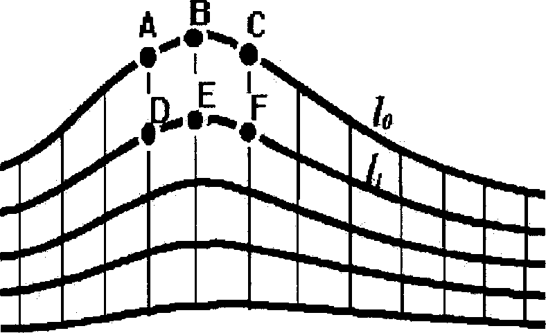
[0043] ② if Image 6 The area between the undulating surface surface and the extrapolation target surface is shown in the extrapolation grid division, L1 is the starting undulating surface surface, L2 is the first extrapolation surface, and L3 is the second extrapolation surface , and so on, Ln is the n-1th extrapolation surface until it reaches the target surface of wave field extrapolation;
[0044] ③ According to the subdivided extrapolated grid, use the following formula:
[0045] E. T m T =0
[0046] Calculate the extrapolation operators corresponding to the nth extrapolation surface to the n+1th extrapolation su...
PUM
 Abstract
Description
Claims
Application Information
 - R&D
- Intellectual Property
- Life Sciences
- Materials
- Tech Scout
- Unparalleled Data Quality
- Higher Quality Content
- 60% Fewer Hallucinations
Browse by: Latest US Patents, China's latest patents, Technical Efficacy Thesaurus, Application Domain, Technology Topic, Popular Technical Reports.
© 2025 PatSnap. All rights reserved.Legal|Privacy policy|Modern Slavery Act Transparency Statement|Sitemap|About US| Contact US: help@patsnap.com


