
Method for passive approximate localization using frequency modulation and software defined radio

a frequency modulation and software defined radio technology, applied in wave based measurement systems, instruments, measurement devices, etc., can solve problems such as disadvantages for users, land vehicles are especially prone to slipping, and gps signals are unreliable or unavailabl

Inactive Publication Date: 2018-12-11
KUMAR PIYUSH +3
View PDF3 Cites 0 Cited by
  • Summary
  • Abstract
  • Description
  • Claims
  • Application Information

AI Technical Summary

Problems solved by technology

However, on most occasions GPS signals can be unreliable or unavailable.
Additionally, land vehicles are especially prone to accidental or deliberated GPS interference, which can be disadvantageous to the user.
However, these methods require expensive hardware for prototyping, a complex time synchronization step, one or more directional antennas, and / or omnidirectional antennas or have problems with multipath.
However, SNR and SCS have relatively high computational complexity which is disadvantageous.

Method used


Image

  • Method for passive approximate localization using frequency modulation and software defined radio
  • Method for passive approximate localization using frequency modulation and software defined radio
  • Method for passive approximate localization using frequency modulation and software defined radio

Examples


Embodiment Construction

[0014]All illustrations of the drawings are for the purpose of describing selected versions of the present invention and are not intended to limit the scope of the present invention.

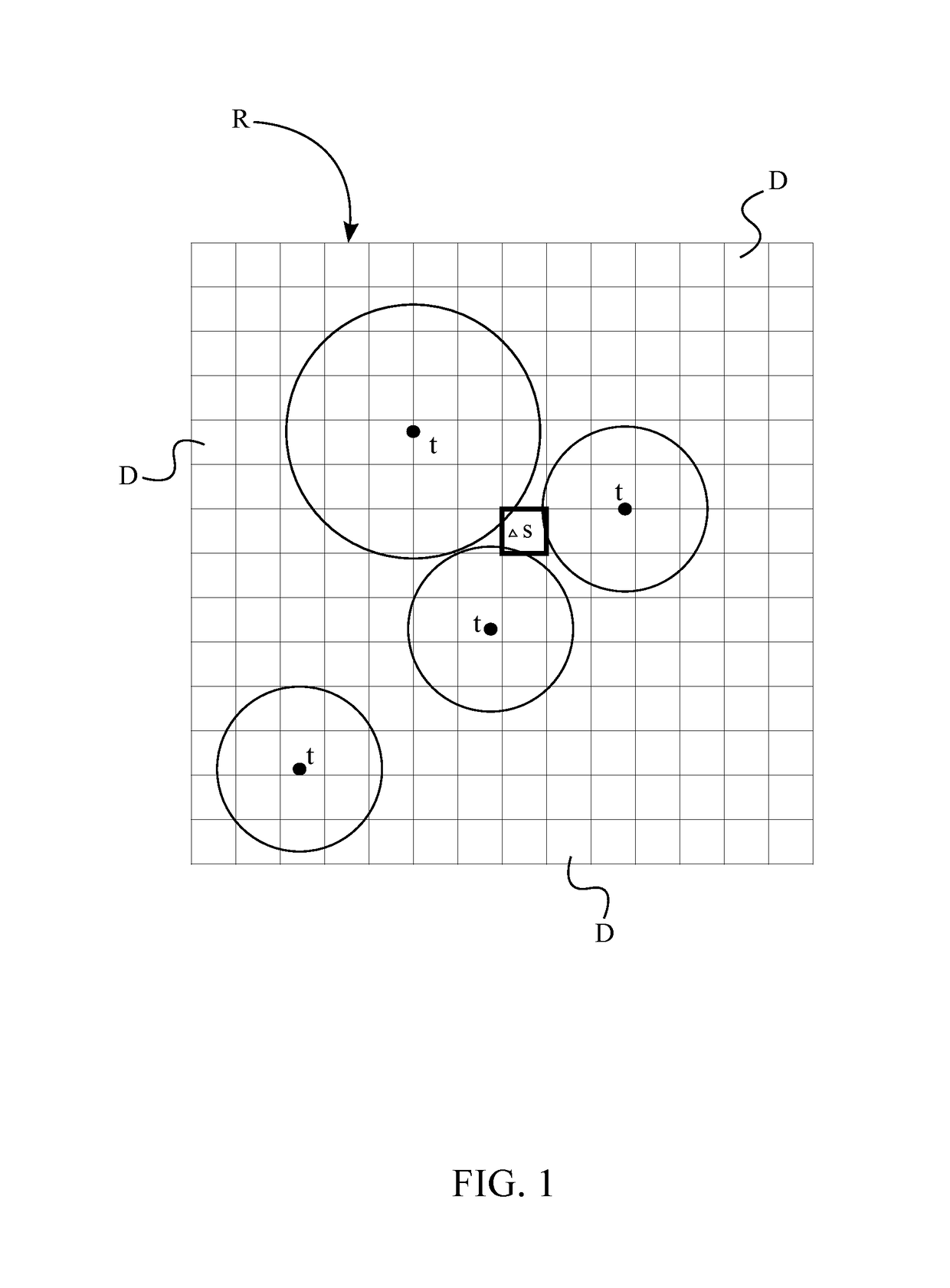
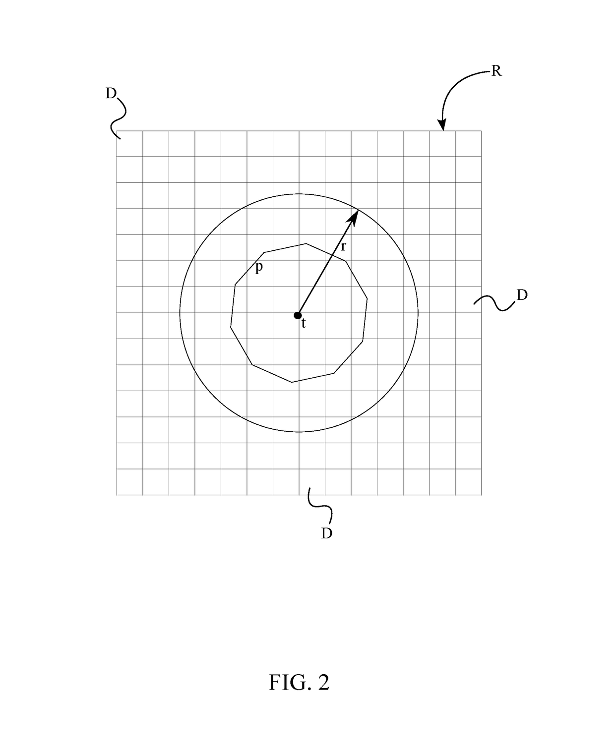
[0015]The present invention introduces a coarse and passive localization system for Global Positioning System (GPS) denied and / or GPS degraded environments. More specifically, the present invention localizes within a considerably large area without the use of GPS in the presence of noisy GPS signals. In contrast to traditional localization systems that work in the absence of GPS, the present invention is capable of producing localization results with average errors of less than five miles, without requiring an explicit fingerprinting or crowdsourcing approach. Moreover, the system introduced by the present invention is cost-effective and has comparatively low computational complexity. To minimize costs, the present invention is mainly dependent on signal strength acquired using a cheap software defined r...


PUM


Abstract

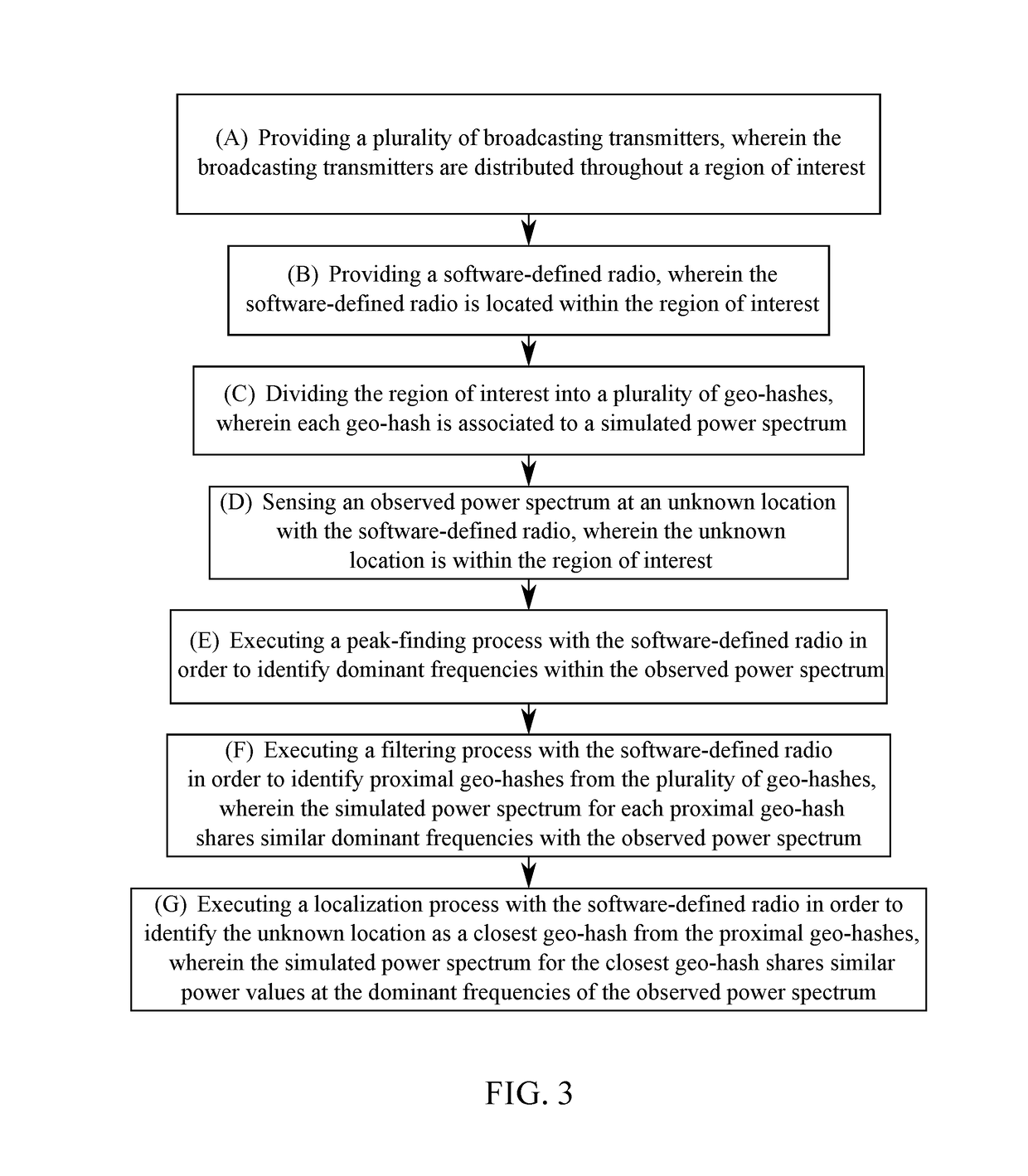
A method for localizing for GPS denied environments is provided with a plurality of broadcasting transmitters and a software-defined radio (SDR). A pre-processing stage and a query phase is executed for localizing an unknown location. The results from the preprocessing stage are made available to the query stage. A simulated power spectrum is computed for a region of interest during the pre-processing phase via the plurality of broadcasting transmitters. A transmitter location, a radius of influence, and a power contour plot of each of the plurality of broadcasting transmitters are used for computing the simulated power spectrum. Next, a peak-finding process, a filtering process, and a localization process is executed during the query phase in order to identify the unknown location.

Description

[0001]The current application claims a priority to the U.S. Provisional Patent application Ser. No. 62 / 222,996 filed on Sep. 24, 2015. The current application is filed on Sep. 26, 2016 while Sep. 24, 2016 was on a weekend.FIELD OF THE INVENTION[0002]The present invention relates generally to a system and apparatus for determining a location, more particularly to a method for analyzing the power spectra of frequency modulation (FM) signals to find the physical location of a user. When the present invention is being used, a simulated map of the area is generated, and the simulated map is correlated to locally acquired signal information to a specific location.BACKGROUND OF THE INVENTION[0003]Global Positioning System (GPS) technology has become an integral part of our daily activities. However, on most occasions GPS signals can be unreliable or unavailable. Additionally, land vehicles are especially prone to accidental or deliberated GPS interference, which can be disadvantageous to t...

Claims


Application Information

Patent Timeline
Patent Type & Authority Patents(United States)
IPC IPC(8): G01S5/02
CPCG01S5/0226G01S5/0252G01S5/02521
Inventor KUMAR, PIYUSHMUKHERJEE, TATHAGATAPASILIAO, JR., EDUARDO L.XU, LIQIN
Owner KUMAR PIYUSH
Learn More