Remote sensing of structure damage

a technology of remote sensing and damage, applied in the field of remote sensing of damage, can solve problems such as lethally wounding a potential enemy combatant, and achieve the effects of improving the triage process, improving the estimation of material quantities needed, and improving processes

Active Publication Date: 2019-07-16
USAA
View PDF28 Cites 15 Cited by
  • Summary
  • Abstract
  • Description
  • Claims
  • Application Information

AI Technical Summary

Benefits of technology

[0003]Advancements in machine vision to classify objects, identify features, extract data, and drive automated decision regarding an object may be used to improve processes. Disclosed herein are methods, systems, and devices that provide insight into the damage intensity, damage indicators, damaged material, and the dimensions of damage area on a structure. In an example, measurements made on a 2D image may be augmented by using image context and external databases to estimate the height of features in structures. In another example, 2D estimations of linear distance and area may be used to determine 3D models to improve the estimation of material quantities needed for reconstruction of damaged objects. This information may be used after damage has occurred on a local or large scale event. Methods discussed herein may improve the triage process of locating material and contractor resources for reconstruction.

Problems solved by technology

In combat zones, they are often used to surveille an area, damage a structures, or lethally wound a potential enemy combatant.

Method used


Image

  • Remote sensing of structure damage
  • Remote sensing of structure damage
  • Remote sensing of structure damage

Examples


Embodiment Construction

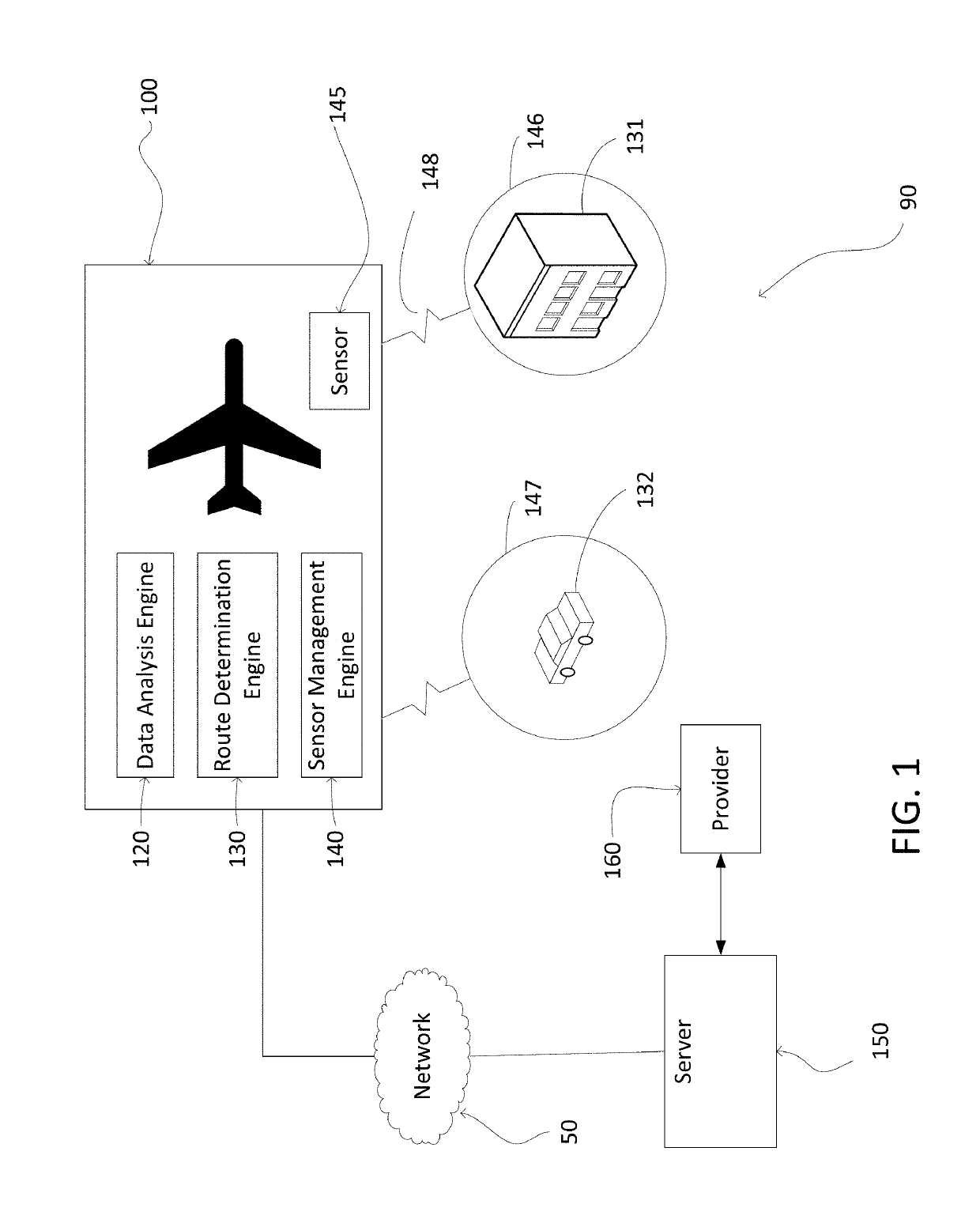
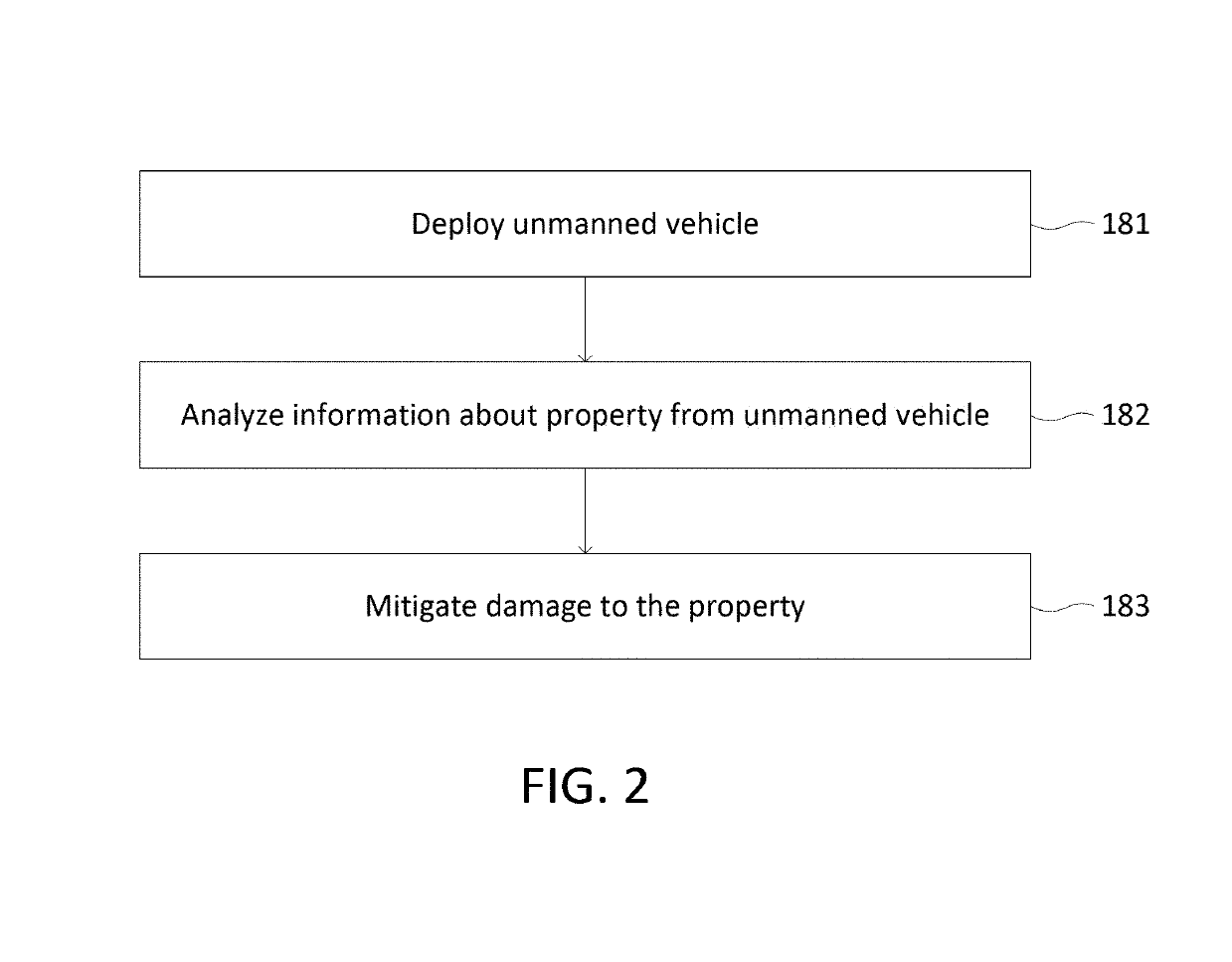
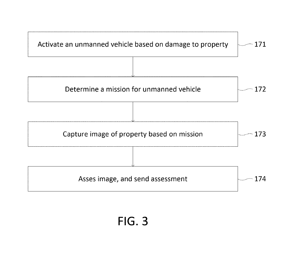
[0026]Unmanned vehicles may be used to survey a property in response to or in anticipation of damage to the property. For example, an unmanned vehicle may analyze information about the property and based on the information determine the state (e.g., damage) of the property. This disclosure relates at least in part to identifying how unmanned vehicles may facilitate delivery of a service, such as claims processing.

[0027]FIG. 1 illustrates an exemplary system 90 associated with unmanned vehicle surveillance of a property. Unmanned vehicle 100 includes sensor 145, data analysis engine 120, route determination engine 130, and sensor management engine 140. Unmanned vehicle 100 may be communicatively connected with network 50 and server 150. A business (e.g., an insurance provider) may own or have control of unmanned vehicle 100, network 50, or server 150. Structure 131 (e.g., a commercial building or home) is located in area 146 and vehicle 132 (e.g., an automobile, motorcycle, or boat) ...


PUM


Abstract

Unmanned vehicles can be terrestrial, aerial, nautical, or multi-mode. Unmanned vehicles may be used to survey a property in response to or in anticipation of damage to an object. Methods, systems, and devices may be used to determine damage information associated with structures (objects) in aerial images obtained by an unmanned vehicle, or other source. The damage information may include intensity of damage of a structure in an image.

Description

RELATED APPLICATIONS[0001]This application is a continuation-in-part U.S. patent application Ser. No. 15 / 008,043, entitled “Systems and Methods for Unmanned Vehicle Management,” filed Jan. 27, 2016. The contents of the above-referenced application are incorporated by reference herein in its entirety.BACKGROUND OF THE INVENTION[0002]Unmanned vehicles (e.g., unmanned aerial vehicles) are known for their use in combat zones. In combat zones, they are often used to surveille an area, damage a structures, or lethally wound a potential enemy combatant. The use of unmanned vehicles can go far beyond the aforementioned examples, especially outside of a combat zone and in a commercial setting. Businesses of all sorts are now developing innovative ways to use unmanned vehicles to benefit their business.SUMMARY[0003]Advancements in machine vision to classify objects, identify features, extract data, and drive automated decision regarding an object may be used to improve processes. Disclosed he...

Claims


Application Information

Patent Timeline
Patent Type & Authority Patents(United States)
IPC IPC(8): G06T7/00G06T7/90H04N7/18
CPCG06T7/0085H04N7/183G06T2207/30184H04N7/185G06T7/13
Inventor FARNSWORTH, ANTHONY SCOTTVOUTOUR, TEDDY JOSEPH EDMONDALLEN, MICHAEL J.NEWMARK, JORDAN A.SWAIN, KATHLEEN L.GINGRICH, JESS W.CASTIGLIONE, ANTHONY G.
Owner USAA
Why Eureka
Try Eureka