

Automatic delineation agricultural field management zones using remote sensing and field data
a technology of remote sensing and field data, applied in image data processing, instruments, character and pattern recognition, etc., can solve the problems of complex computation, difficult to define field management zones, and difficult to execute human-like tasks
- Summary
- Abstract
- Description
- Claims
- Application Information
AI Technical Summary
Benefits of technology
Problems solved by technology
Method used
Image

Examples
Embodiment Construction
[0035]Reference will now be made in detail to the preferred embodiments of the present invention, examples of which are illustrated in the accompanying drawings.
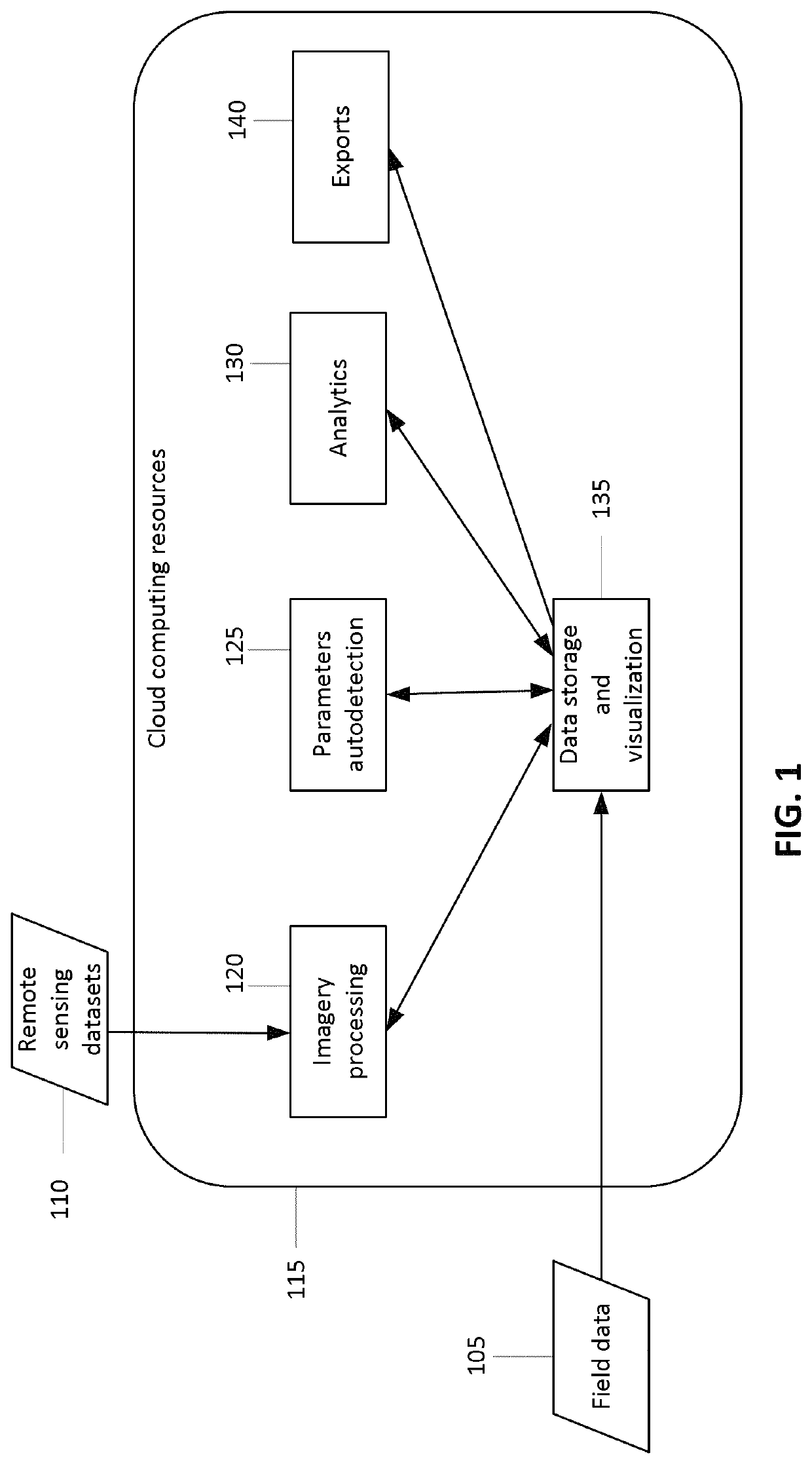
[0036]FIG. 1 illustrates high-level modules of the system with a logical division based on types of supported operations. As shown in FIG. 1, the system is developed based on the capabilities of cloud computing resources 115, which are a placeholder of any cloud computing platform with cloud-based web services, storages, queues, servers, security and so on. Field data 105 and remote sensing datasets 110 are used as inputs.
[0037]Field data input 105 includes directly field-related data such as boundary and the metadata about history of seeded crops and about related agricultural operations. Remote sensing datasets input 110 includes but not limited to open-sourced (ex: NASA Landsat mission, ESA Sentinel mission) and proprietary (such as Planet Skysat mission, Planet RapidEye, AirBus Pleiades) images from remote sensing provid...
PUM
 Abstract
Description
Claims
Application Information