
Mobile unit location system for automatically reporting to a central controller and subscriber the proximity of mobile units to a destination

Inactive Publication Date: 2002-02-07
IBM CORP
View PDF0 Cites 141 Cited by
  • Summary
  • Abstract
  • Description
  • Claims
  • Application Information

AI Technical Summary

Problems solved by technology

Proximity information between two or more objects or customer / server providers are not available in many cases where at least one of these objects is not fixed but in motion.
If the proximity information is not available, there is always an uncertainty about the location of the mobile unit.
Hence, the customer cannot anticipate the timely arrival of the server.

Method used


Image

  • Mobile unit location system for automatically reporting to a central controller and subscriber the proximity of mobile units to a destination
  • Mobile unit location system for automatically reporting to a central controller and subscriber the proximity of mobile units to a destination
  • Mobile unit location system for automatically reporting to a central controller and subscriber the proximity of mobile units to a destination

Examples


Embodiment Construction

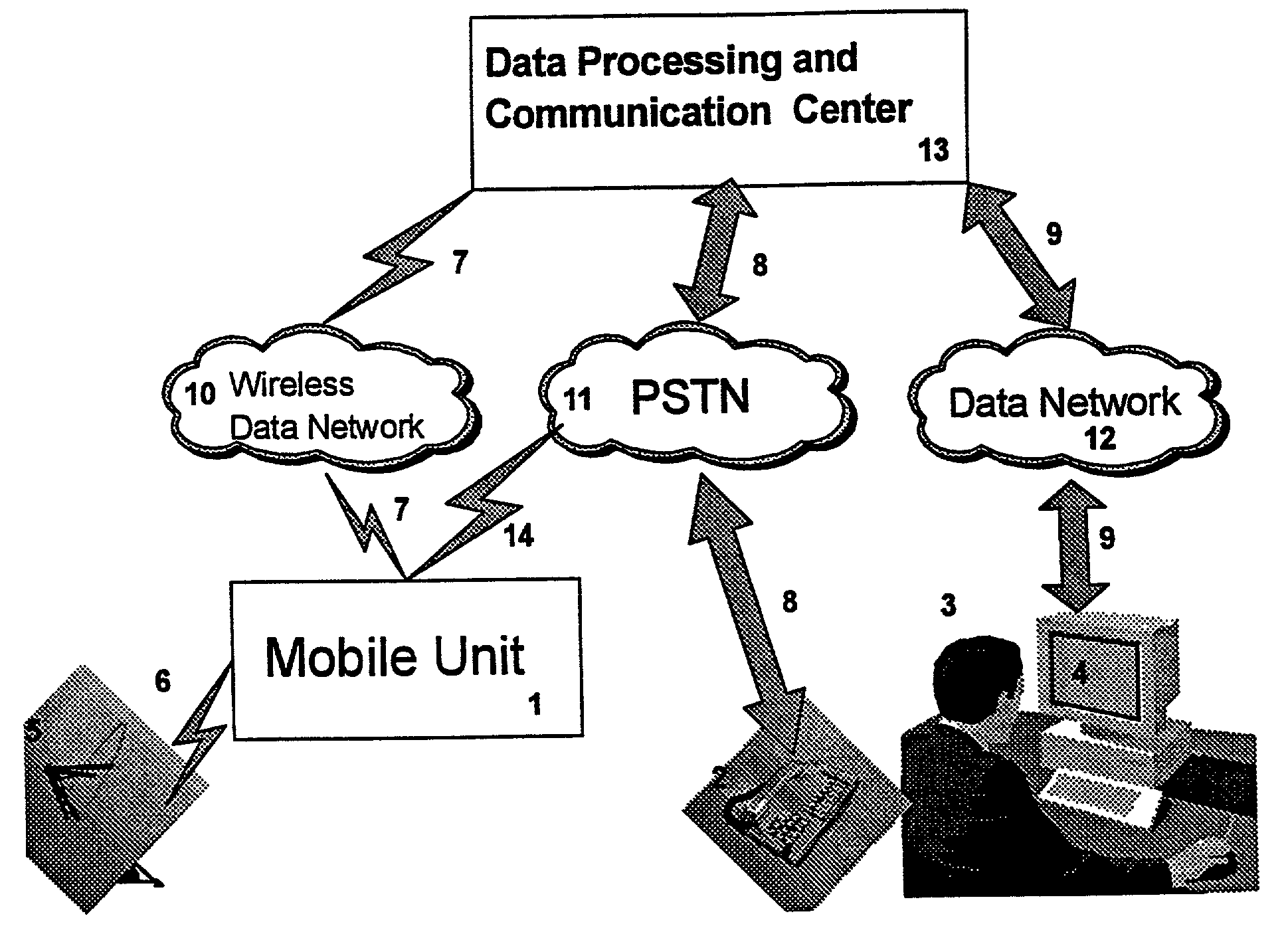
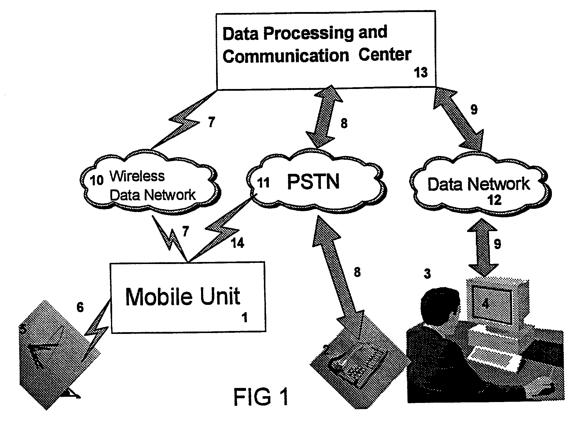
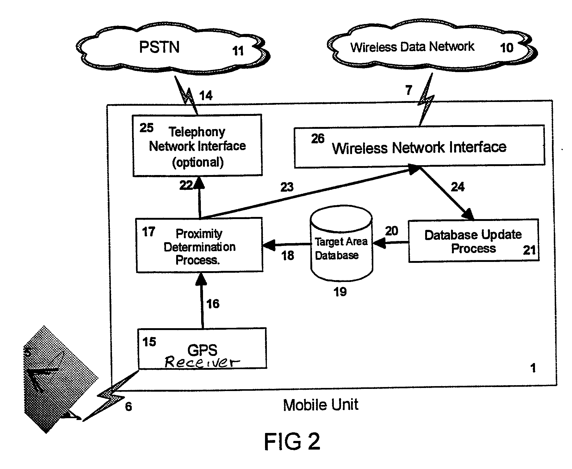
[0015] The invention described herein accomplishes the above-described need by monitoring the location of the moving vehicle via a location determination device such as a GPS receiver, comparing the location of the mobile unit to the location of the customer by using a proximity criterion, and initiating a phone call (or other notification calling means) to the customer whenever the proximity criterion is satisfied.

[0016] A user of this system (subscriber) sends his / her location information and a telephone number where he / she can be reached to the mobile unit through a communication center. When the mobile unit enters into a region where the proximity criteria is satisfied, it sends a signal to the communication center to notify the user that its location is close enough to the user. The user is notified by notification means, preferably by telephone, about the location of the mobile unit and the user is prepared to receive service.

[0017] In the invention described here, the custome...


PUM


Abstract

A system and method for providing proximity notification to subscribers of a distributed system. The system includes mobile units having location receivers and stored information regarding target subscribers wherein upon a mobile unit reaching a given proximity criteria, the target subscriber is notified.

Description

[0001] 1. Technical Field[0002] The present invention relates to a distributed navigation and proximity notification system and method, and in particular, a system and method for sending subscriber location information to mobile units and notify subscribers when the mobile unit approaches the subscriber's proximity.[0003] 2. Description of Related Art[0004] Finding the locations of moving objects and the use of the information thereof have always attracted attention. Navigators used numerous techniques or devices to determine locations, including compasses, motion of stars, death reckoning by using maps, radio signaling, etc. Global Positioning System (GPS) is the latest technology in navigation and location determination. Generally, the GPS uses satellites which send precisely-timed radio signals which are received by GPS receivers. Based on the reception of the radio signals and the timing information therein, the GPS receivers then determine the latitude, longitude and the elevat...

Claims


Application Information

Patent Timeline
IPC IPC(8): H04L29/08H04W4/02
CPCH04W4/02H04L67/18H04W4/023H04L67/52
Inventor DOGANATA, YURDAER N.KARUV, BAHADIR S.TANTAWI, ASSER N.THALASINOS, ERIC
Owner IBM CORP
Learn More