Passive geostationary satellite position determination

Inactive Publication Date: 2006-10-12
LOCKHEED MARTIN CORP
View PDF5 Cites 20 Cited by
  • Summary
  • Abstract
  • Description
  • Claims
  • Application Information

AI Technical Summary

Benefits of technology

[0006] Accordingly, the present invention provides for accurate determination of the three-dimensional position of a satellite. In this regard, the satellite may, for example, be a geostationary satellite in geosynchronous orbit having a SBAS payload onboard. In accordance with the present invention, the position of the satellite is determined based on differences in arrival times at a master station of a time stamped message that is uplinked from the master station to the satellite, rebroadcast to a number of geographically diverse receiver stations, and retransmitted from the receiver stations to the master st

Problems solved by technology

Use of the current SBAS ranging signal improves availability of ranging signals, but results in degraded positional accuracy for

Method used


Image

  • Passive geostationary satellite position determination
  • Passive geostationary satellite position determination
  • Passive geostationary satellite position determination

Examples


Example

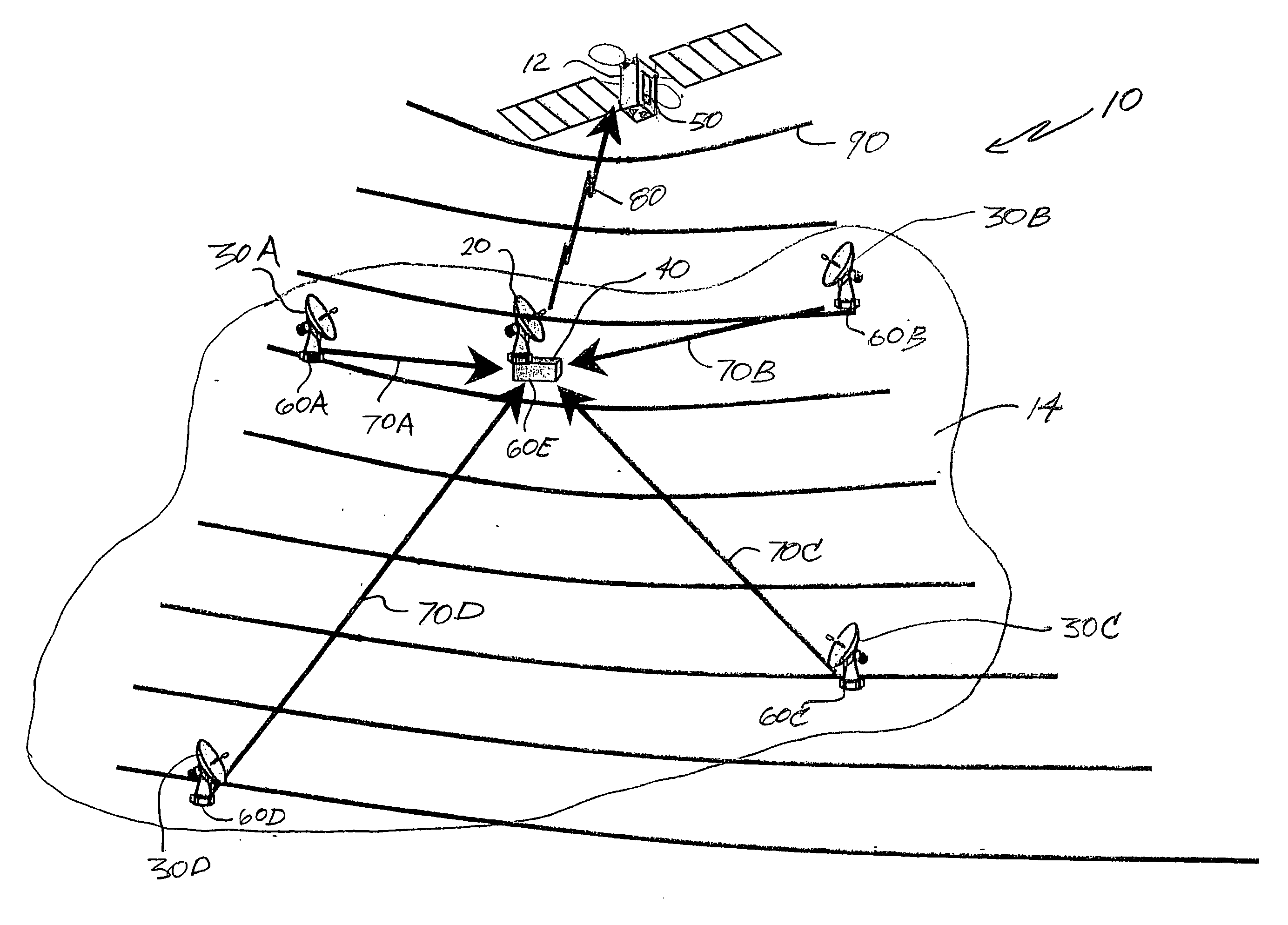
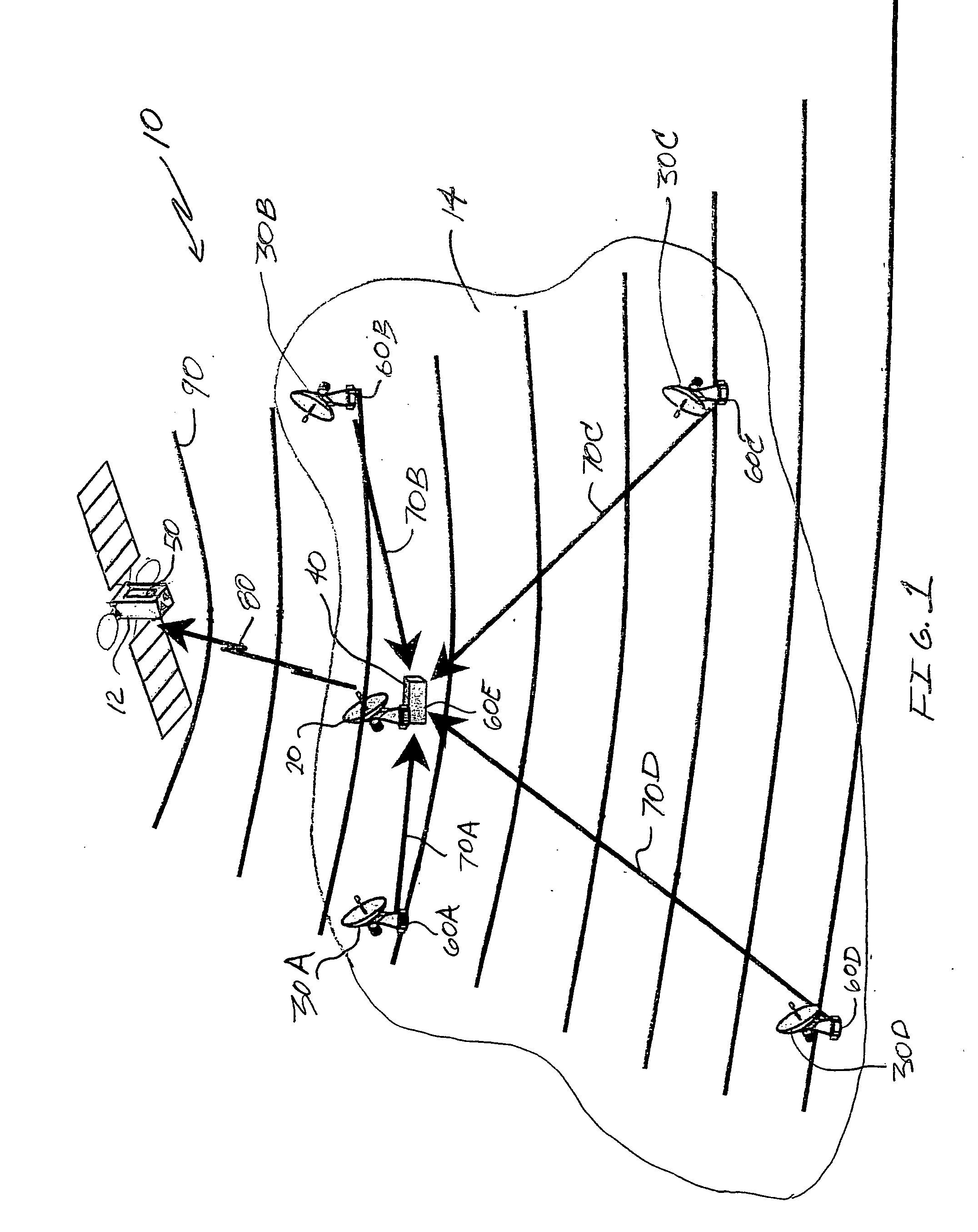
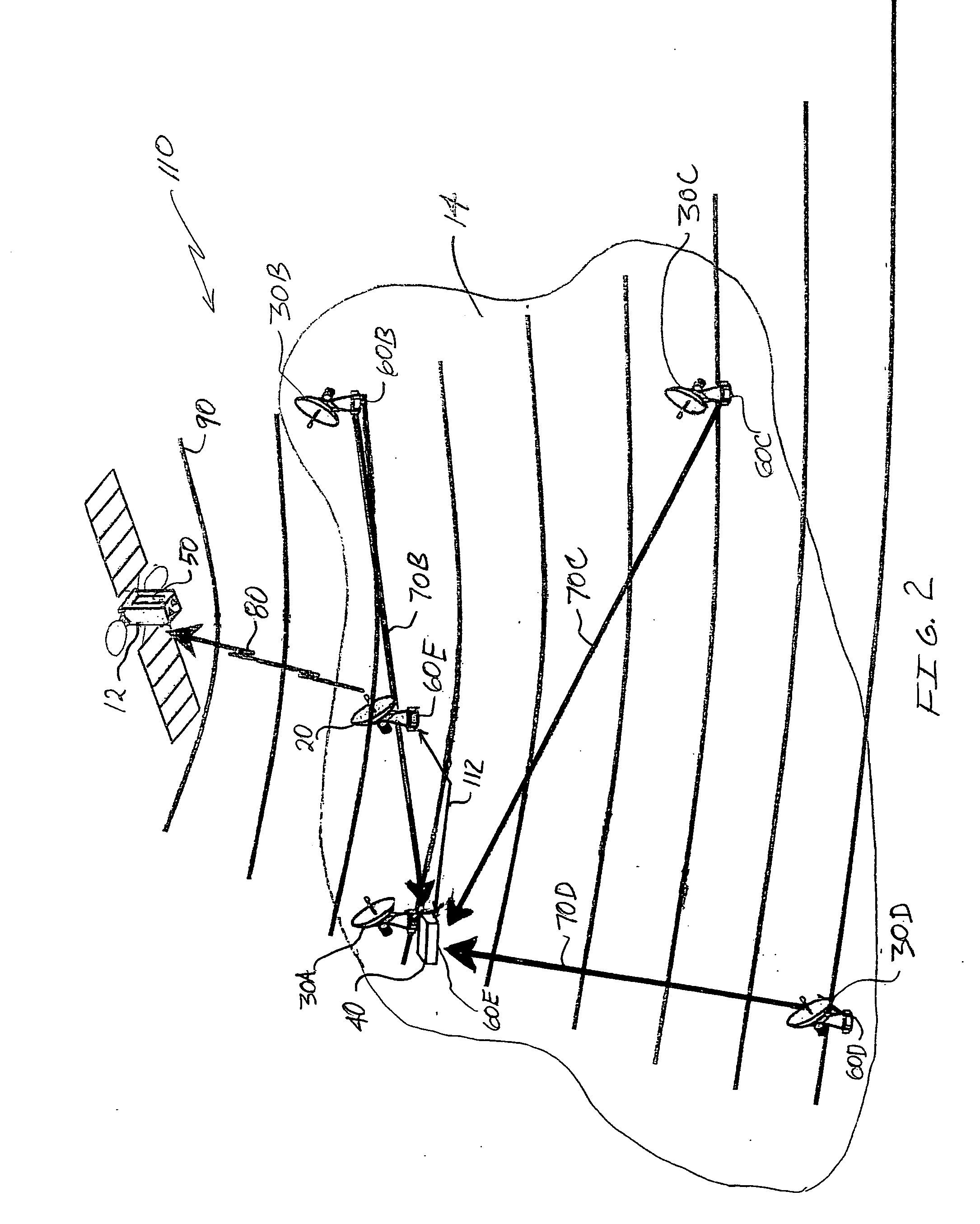
[0019]FIG. 1 shows one embodiment of a satellite position determination system 10 that operates to determine a three-dimensional position of a satellite 12. In the illustrated embodiment, the satellite 12 is in earth orbit, although it is possible that the satellite 12 may not be orbiting the earth. Further, the satellite 12 is in a geosynchronous orbit, although it is possible that the satellite may be in a non-geosynchronous orbit. Regardless of its orbit, the satellite position determination system 10 is configured to accurately determine the three-dimensional position of the satellite 12 relative to a fixed reference point (e.g., a location on the surface of the earth). In this regard, the system 10 may determine the position of the satellite 12 in accordance with a number of coordinate systems including, for example, a Cartesian coordinate system.

[0020] The system 10 includes a ground uplink station 20, four receiver stations 30A-30D, a master station 40, and a transceiver uni...


PUM


Abstract

Systems and methods for accurately determining the position of a satellite such as, for example, a geostationary satellite. In one embodiment, a satellite position determination system (10) includes an uplink station (20), a transceiver (50) onboard the satellite (12), a plurality of receiver stations (30A-30D), and a master station (40). A time stamped message included in an uplink signal (80) is transmitted from the uplink station (20), received by the transceiver (50), and rebroadcast without modification in a ubiquitous regional broadcast signal (90) from the transceiver (50). The message is received by the receiver stations (30A-30D) from the signal (90) and is retransmitted from each receiver station (30A-30D) via dedicated communication links (70A-70D) to the master station (40). The master station (40) determines the three-dimensional position of the satellite based on time differentials of arrival in the retransmitted rebroadcast messages.

Description

RELATED APPLICATION INFORMATION [0001] This application claims priority from U.S. Provisional Application Ser. No. 60 / 669,341 entitled “PASSIVE GEOSTATIONARY SATELLITE POSITION DETERMINATION” filed on Apr. 7, 2005, the entire disclosure of which is incorporated by reference herein.FIELD OF THE INVENTION [0002] The present invention relates generally to the determining the position of a satellite, and more particularly to the determination of the position of a satellite using passive techniques. BACKGROUND OF THE INVENTION [0003] Space-based augmentation systems (SBAS) employing geostationary satellites in geosynchronous orbit around the earth are utilized to improve performance of properly capable Global Positioning System (GPS) devices. In this regard, SBAS often employ differential GPS techniques in order to identify errors in GPS signals and generate correction information that is broadcast by the SBAS to augment conventional GPS signals in order to enhance position determination...

Claims


Application Information

Patent Timeline
IPC IPC(8): G01S3/02H04B7/185G01S19/38
CPCG01S5/06G01S13/878
Inventor BAY, FMWALTON, DAVID E.HEIL, DANIEL J.
Owner LOCKHEED MARTIN CORP
Why Eureka
Try Eureka