Land navigation system

a technology of land navigation and navigation system, applied in navigation instruments, surveying and navigation, instruments, etc., can solve problems such as unadjusted information desir

Inactive Publication Date: 2007-01-11
COBRA ELECTRONICS CORPORATON
View PDF12 Cites 72 Cited by
  • Summary
  • Abstract
  • Description
  • Claims
  • Application Information

AI Technical Summary

Benefits of technology

[0006] The invention has a number of embodiments. In one embodiment, the invention is a navigation unit which has a central processor unit, a communication unit, one or more user input devices, one or more output devices, and a relationship database. The relationship database contains map information and can include stored inputs from the user such as preferences for routes and alert values. The processor unit is programmed to determine a route from one point to another. The communication unit receives information regarding current traffic information, such as current speed of traffic flow, and traffic incidents which affect flow, such as accidents and road construction. The unit is programmed to allow the user to set a value for an alert parameter. In one embodiment, the user can select a value for an alert which if met or exceeded the program code will output an alert and make alternate routes available to the user. An alert parameter can be average speed or time. Thus, a user can select an alert value such as 10 minutes. The selected route will have projected time of arrival or projected average speed, or other parameter value based upon baseline information. As current traffic information is received the program code calculates a revised parameter, such as estimated time of arrival taking into account current traffic conditions. If the revised value of the parameter is equal to or greater than the baseline value of the parameter, plus the alert value, the program outputs an alert to the user. In one embodiment, a comparison of the alternate routes to the current route is outputted and the user can select one of the alternate routes if desired. If the revised value of the parameter does not meet or exceed the baseline value of the parameter, plus the alert value, the program will repeat the calculation at predetermined intervals with the then current traffic information. Thus, the user is alerted to changing traffic conditions that significantly impact planned travel time. Traffic information includes speed over various segments, and incidents at various segments. Incidents are events such as accidents, road construction, flooding, public events, etc.

Problems solved by technology

While navigation units are useful for providing route information from baseline values, e.g. speed limits on sections of road, they have not adequately addressed the desire to provide information about abnormal current conditions affecting the route, and providing the user with alternate routes to the destination.

Method used


Image

  • Land navigation system
  • Land navigation system
  • Land navigation system

Examples


Embodiment Construction

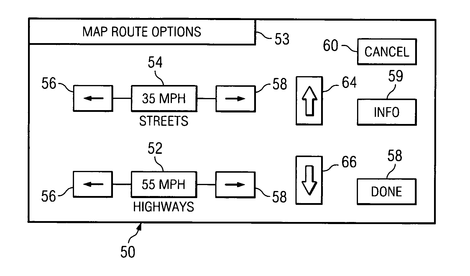
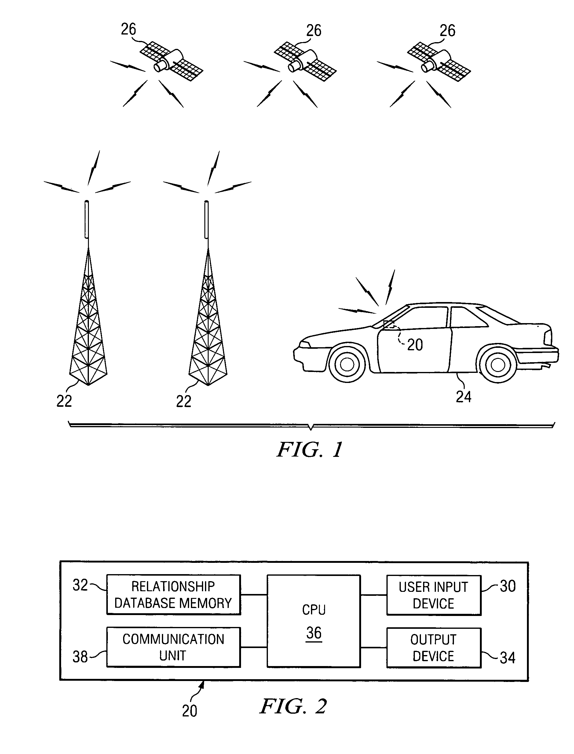
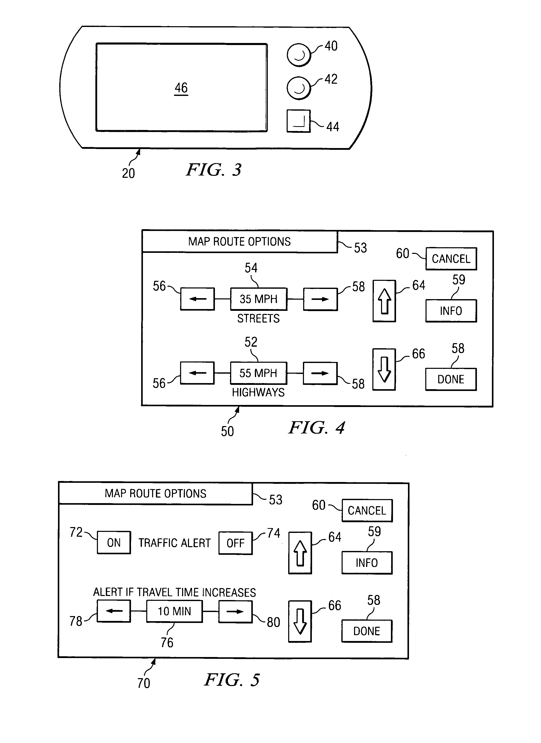
[0024] Referring to FIG. 1, in one embodiment of the invention, a navigation unit 20 is provided. A source or sources of current traffic information is utilized. Current traffic information can be real time information or information which is within a predetermined delay period, or which is within a delay period determined by changes in the conditions of the traffic. Traffic information can include speed information for road segments and incident information, such as traffic accidents, flooded roadways or intersections, road construction, etc. Incidents can be of many types as recognized by the ISO published Event List 14819-2. All or a portion of the various types of traffic information can be reported for a road segment. However, it is recognized that for some roads, current speed information may not be available. Thus current traffic information is the current information to the extent it is available. The current traffic information can be from any source providing such informat...


PUM


Abstract

A navigation unit and system for land navigation particularly useful for vehicle travel. The navigation unit includes a routing program and programs to be used in conjunction with the routing programs. The programs used in conjunction with the routing program process current traffic information for segments of mapping information. The programs provide for a dynamic road speed sensitivity computation which allows the display of current speeds for various segments of mapping information which can be used to display a selected route with a parameter, such as estimated time for the trip, for the route computed based on current travel information. The unit also can contain a program for allowing the user to set an alert value for a parameter, and the program will alert the user when the current route satisfies the alert requirements, and computes one or more alternate routes that the user can select and display.

Description

TECHNICAL FIELD OF THE INVENTION [0001] The invention relates to land navigation systems. In a preferred embodiment, the invention relates to a navigation device employing a GPS device which utilizes traffic information in displaying routes and / or route determinations for vehicles. BACKGROUND OF THE INVENTION [0002] Global positioning technology is the basis of the global positioning system (GPS) which is a satellite system. GPS provides specially coded satellite signals that can be processed in a GPS receiver, enabling the receiver to compute position, velocity and time. Navigation units can include a GPS receiver, a computer processor, and a database of additional information, such mapping information. Navigation units are used by outdoorsmen to locate and to navigate to desired destinations. Navigation units are also used by operators of vehicles to locate their current location and to navigate to desired destinations. Navigation units are also used for informational purposes suc...

Claims


Application Information

Patent Timeline
Patent Type & Authority Applications(United States)
IPC IPC(8): G01C21/30
CPCG01C21/3415G08G1/096861G08G1/096844G08G1/096827
Inventor MARSH, DAVID C.
Owner COBRA ELECTRONICS CORPORATON
Why Eureka
Try Eureka