Method for imaging a sea-surface reflector from towed dual-sensor streamer data

a technology of streamer data and sea surface reflector, which is applied in the field of geophysical prospecting, can solve the problems of difficult to record data outside a selected bandwidth, different acoustic impedance at the interface, drilling wells to determine whether petroleum deposits are present or not,

Active Publication Date: 2010-04-15
PGS GEOPHYSICAL AS
View PDF6 Cites 36 Cited by
  • Summary
  • Abstract
  • Description
  • Claims
  • Application Information

AI Technical Summary

Problems solved by technology

Such seismic reflectors typically are interfaces between subterranean formations having different elastic properties, specifically sound wave velocity and rock density, which lead to differences in acoustic impedance at the interfaces.
Drilling wells to determine whether petroleu

Method used


Image

  • Method for imaging a sea-surface reflector from towed dual-sensor streamer data
  • Method for imaging a sea-surface reflector from towed dual-sensor streamer data
  • Method for imaging a sea-surface reflector from towed dual-sensor streamer data

Examples


Embodiment Construction

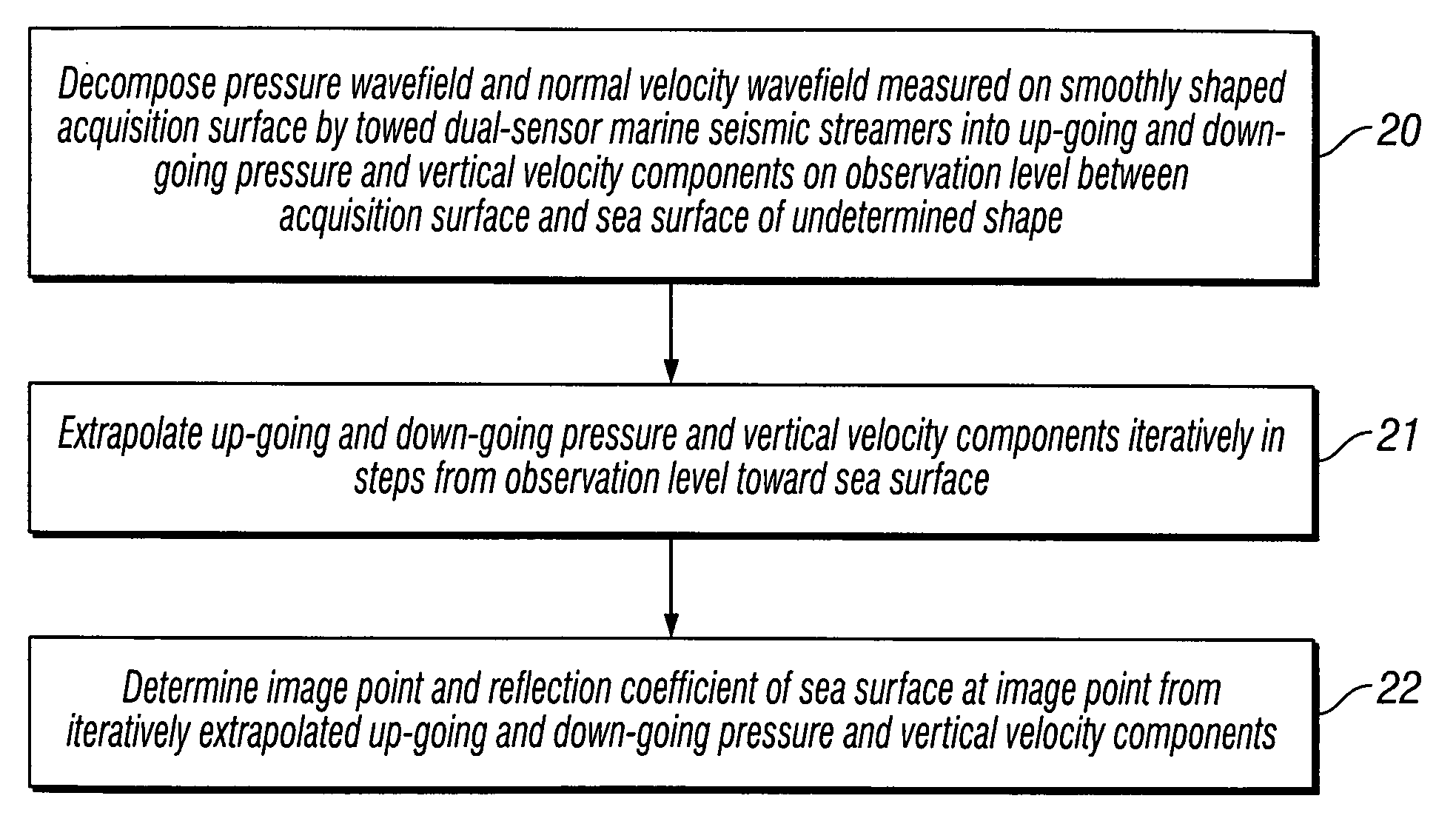
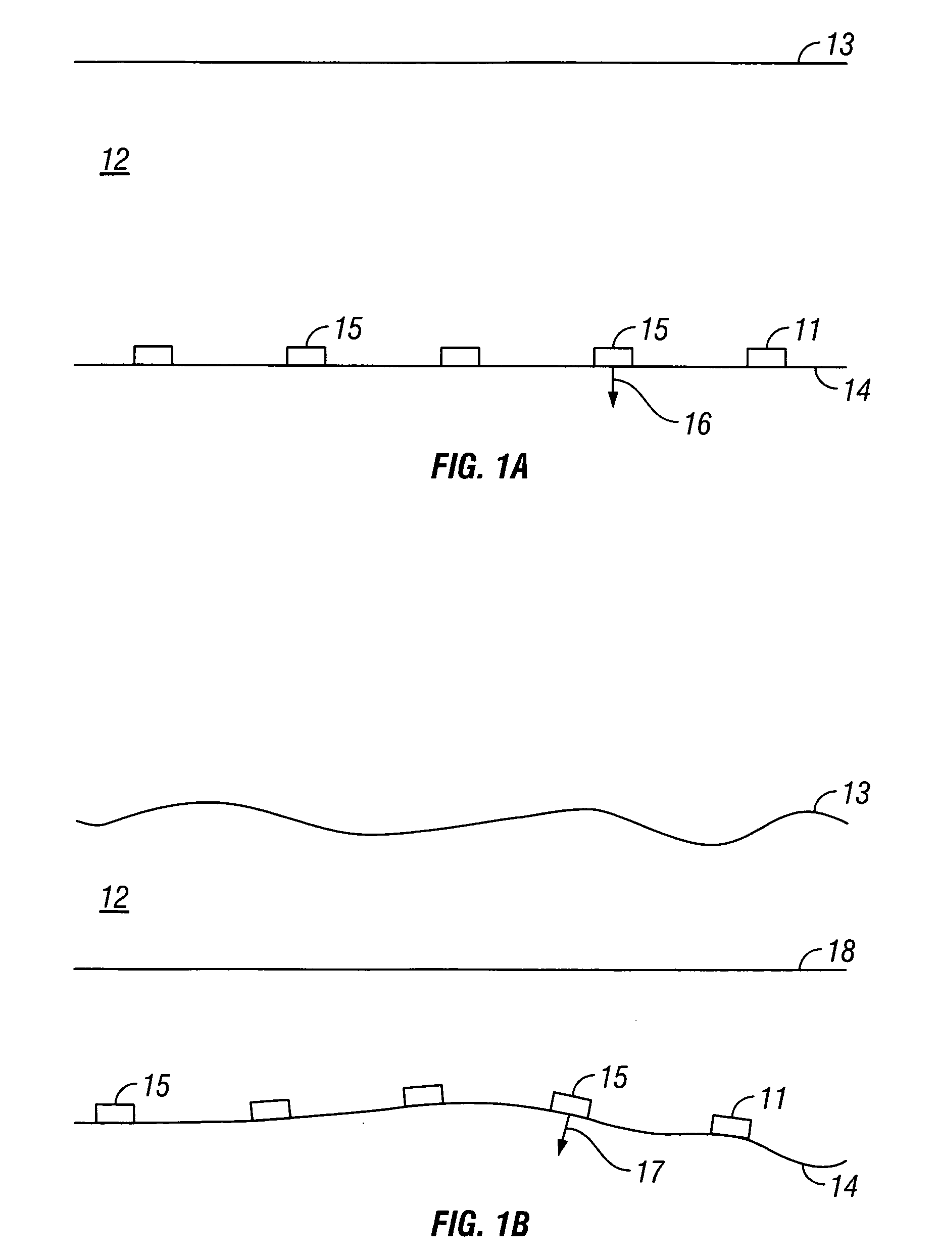
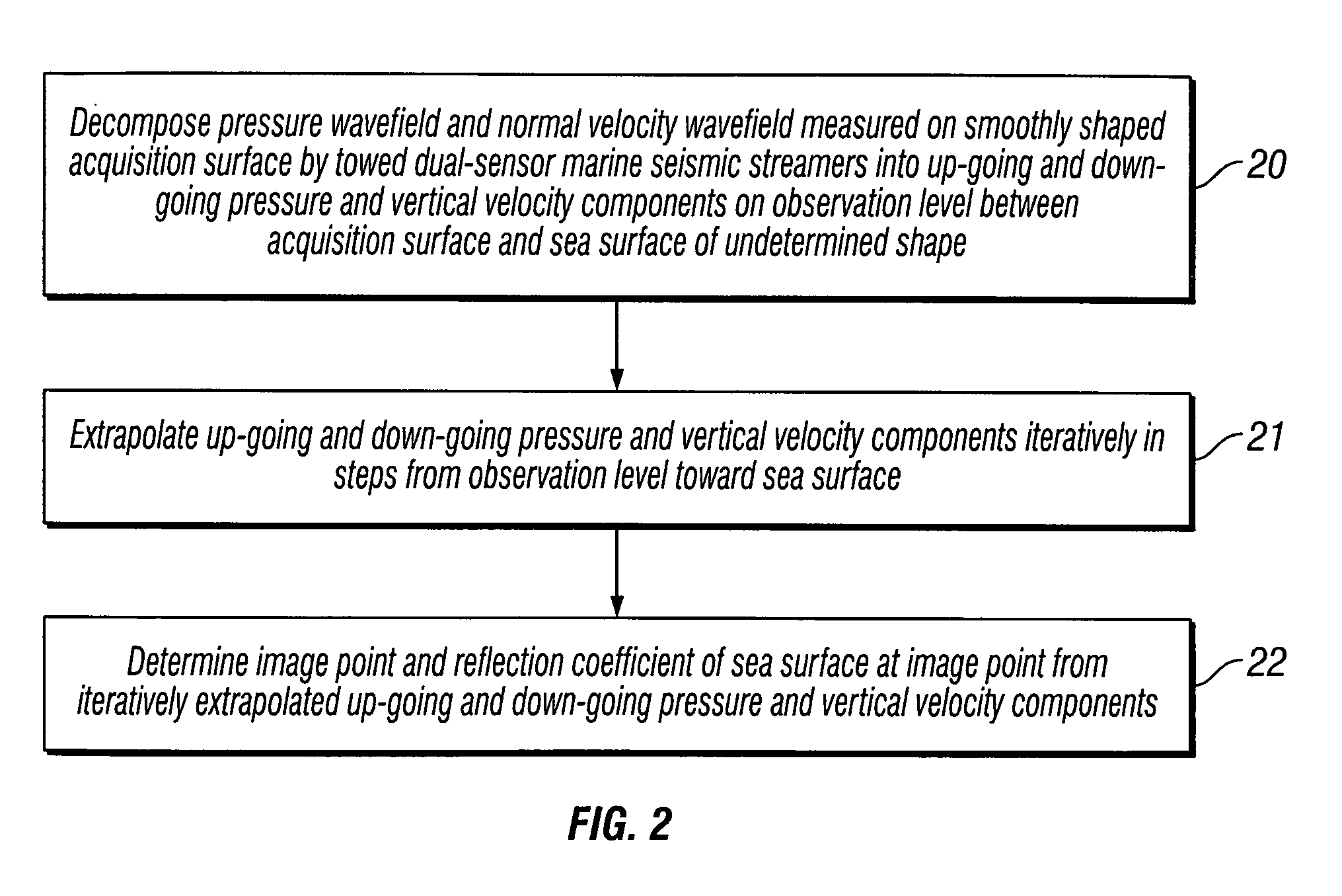
[0028]The invention is a method for imaging the reflector at a sea surface of undetermined shape by extrapolating towed dual-sensor streamer data acquired on a smoothly shaped surface in a marine environment. The present invention employs a multi-part method to determine the topography and the sea-surface reflection coefficient. First, the invention decomposes the wavefield as recorded by receivers on an acquisition surface into its up-going and down-going components on a flat observation level. Second, the invention extrapolates the up-going and down-going wavefields iteratively in steps from the observation level upwards toward the sea surface. Third, the invention calculates the image point and reflection coefficient of the sea surface at the image point from the iteratively extrapolated up-going and down-going wavefields.

[0029]The particle velocity wavefield is commonly acquired using motion sensors, such as geophones or accelerometers, and the pressure wavefield is commonly acq...


PUM


Abstract

A pressure wavefield and a normal velocity wavefield measured on a smoothly shaped acquisition surface by towed dual-sensor marine seismic streamers are decomposed into up-going and down-going pressure and particle velocity components on an observation level between the acquisition surface and a sea surface of undetermined shape. The up-going and down-going pressure and particle velocity components are extrapolated iteratively in steps from the observation level toward the sea surface. An image point and a reflection coefficient of the sea surface at the image point are determined from the iteratively extrapolated up-going and down-going pressure and particle velocity components.

Description

CROSS-REFERENCES TO RELATED APPLICATIONS [0001]Not ApplicableFEDERALLY SPONSORED RESEARCH OR DEVELOPMENT [0002]Not ApplicableSEQUENCE LISTING, TABLE, OR COMPUTER LISTING [0003]Not ApplicableBACKGROUND OF THE INVENTION[0004]1. Field of the Invention[0005]This invention relates generally to the field of geophysical prospecting. More particularly, the invention relates to the field of marine seismic data processing with dual-sensor towed streamers. Specifically, the invention is a method for imaging the sea-surface reflector.[0006]2. Description of the Related Art[0007]In the oil and gas industry, geophysical prospecting is commonly used to aid in the search for and evaluation of subterranean formations. Geophysical prospecting techniques yield knowledge of the subsurface structure of the earth, which is useful for finding and extracting valuable mineral resources, particularly hydrocarbon deposits such as oil and natural gas. A well-known technique of geophysical prospecting is a seis...

Claims


Application Information

Patent Timeline
IPC IPC(8): G01V1/38G01V1/36
CPCG01V1/38
Inventor SOLLNER, WALTER
Owner PGS GEOPHYSICAL AS
Why Eureka
Try Eureka