

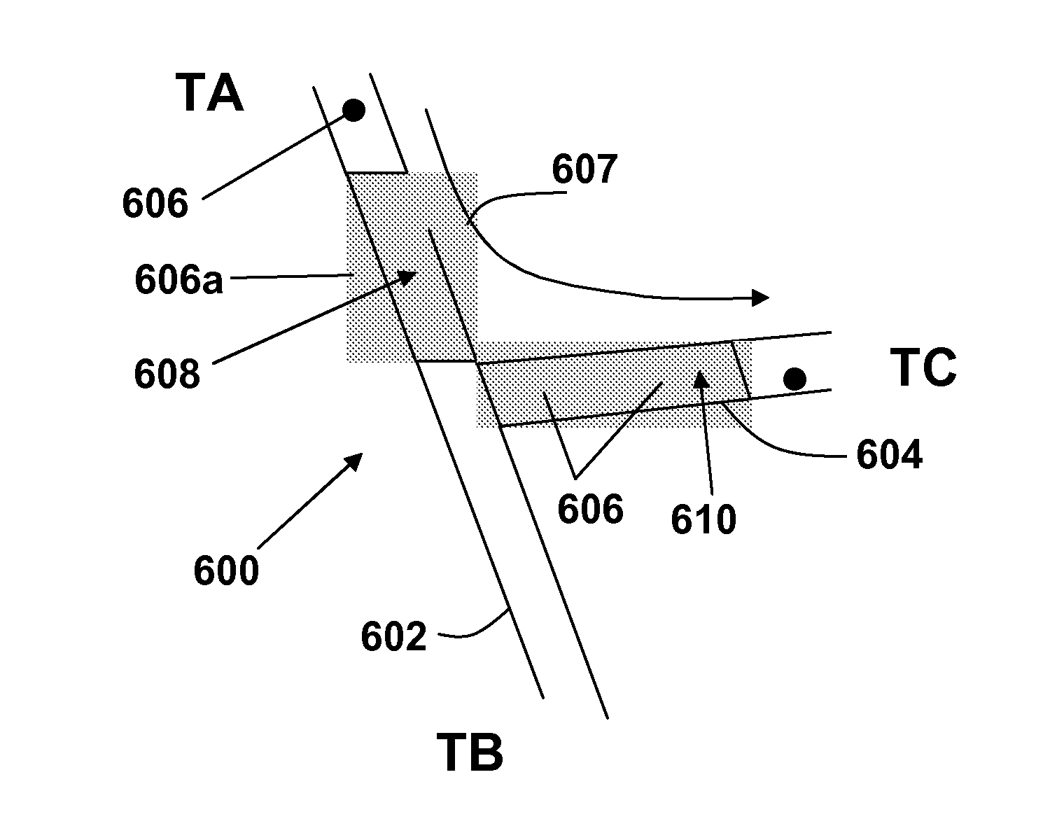
Method of creating map data comprising transit times for intersections
a technology of intersections and transit times, applied in the field of processing positioning data, can solve the problems of considerable cost, and achieve the effect of increasing accuracy and accurate overall tim
- Summary
- Abstract
- Description
- Claims
- Application Information
AI Technical Summary
Benefits of technology
Problems solved by technology
Method used
Image

Examples
Embodiment Construction
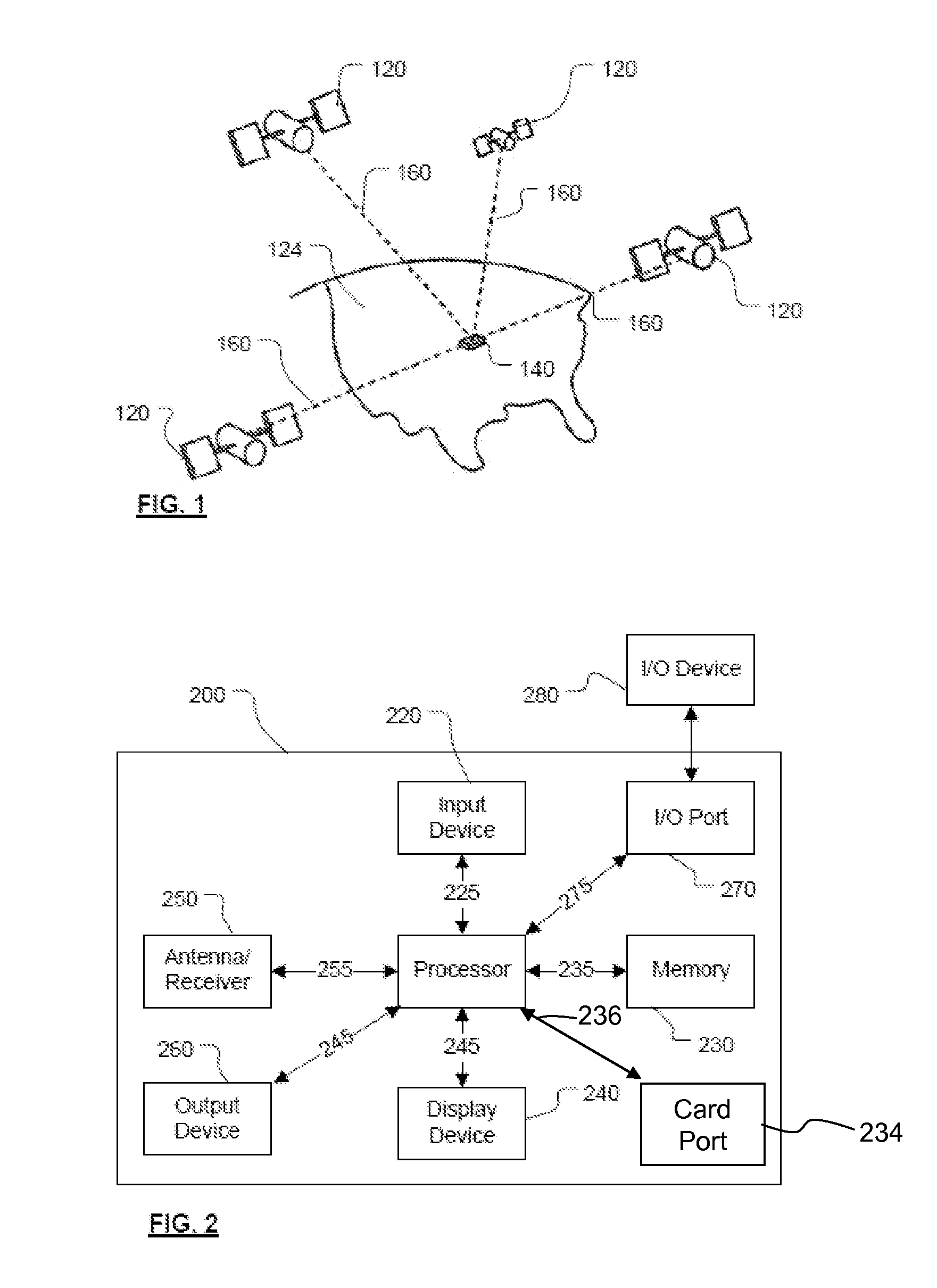
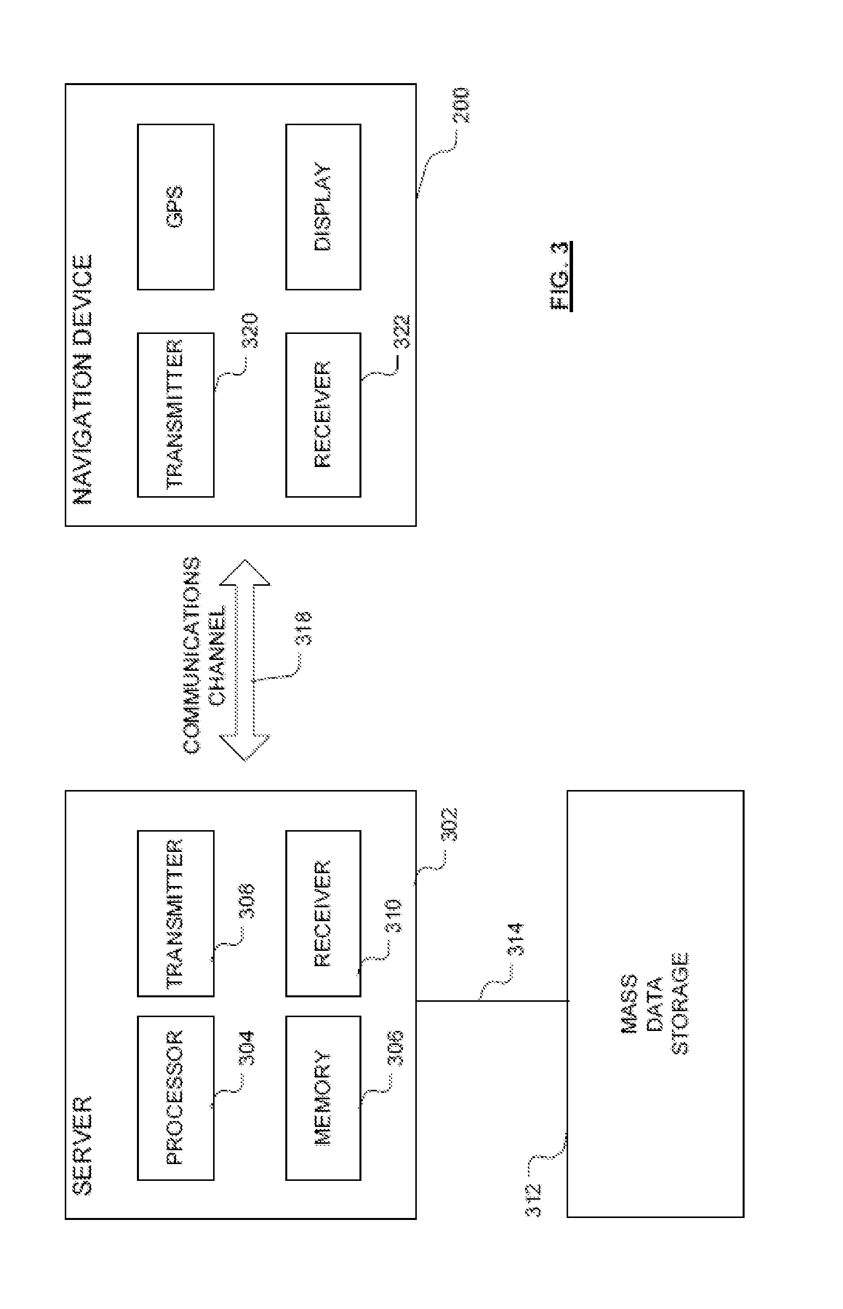
Embodiments of the present invention will now be described with particular reference to a PND (Portable Navigation Device). It should be remembered, however, that the teachings of the present invention are not limited to PND's but are instead universally applicable to any type of processing device that is configured to execute navigation software so as to provide route planning and navigation functionality. It follows therefore that in the context of the present application, a navigation device is intended to include (without limitation) any type of route planning and navigation device, irrespective of whether that device is embodied as a PND, a navigation device built into a vehicle, a map server (such as providing routing and navigation functionality over the internet), or indeed a computing resource (such as a desktop or portable personal computer (PC), mobile telephone or portable digital assistant (PDA)) executing route planning and navigation software.
It will also be apparent ...
PUM
 Abstract
Description
Claims
Application Information