

Three-dimensional urban modeling apparatus and method
a technology of three-dimensional urban modeling and modeling apparatus, applied in the direction of 3d-image rendering, instruments, computing, etc., can solve the problems of deteriorating building accuracy, difficult to accurately identify a certain region, and slightly monotonous images, and achieve the effect of realizing textures
- Summary
- Abstract
- Description
- Claims
- Application Information
AI Technical Summary
Benefits of technology
Problems solved by technology
Method used
Image

Examples
Embodiment Construction
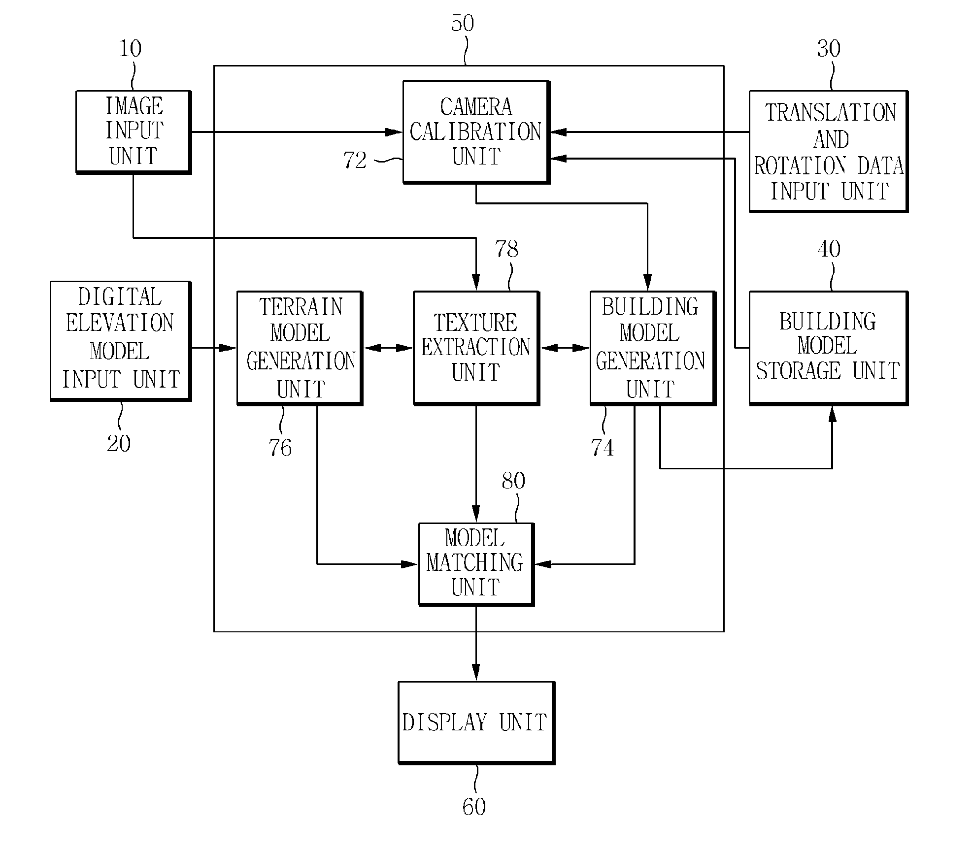
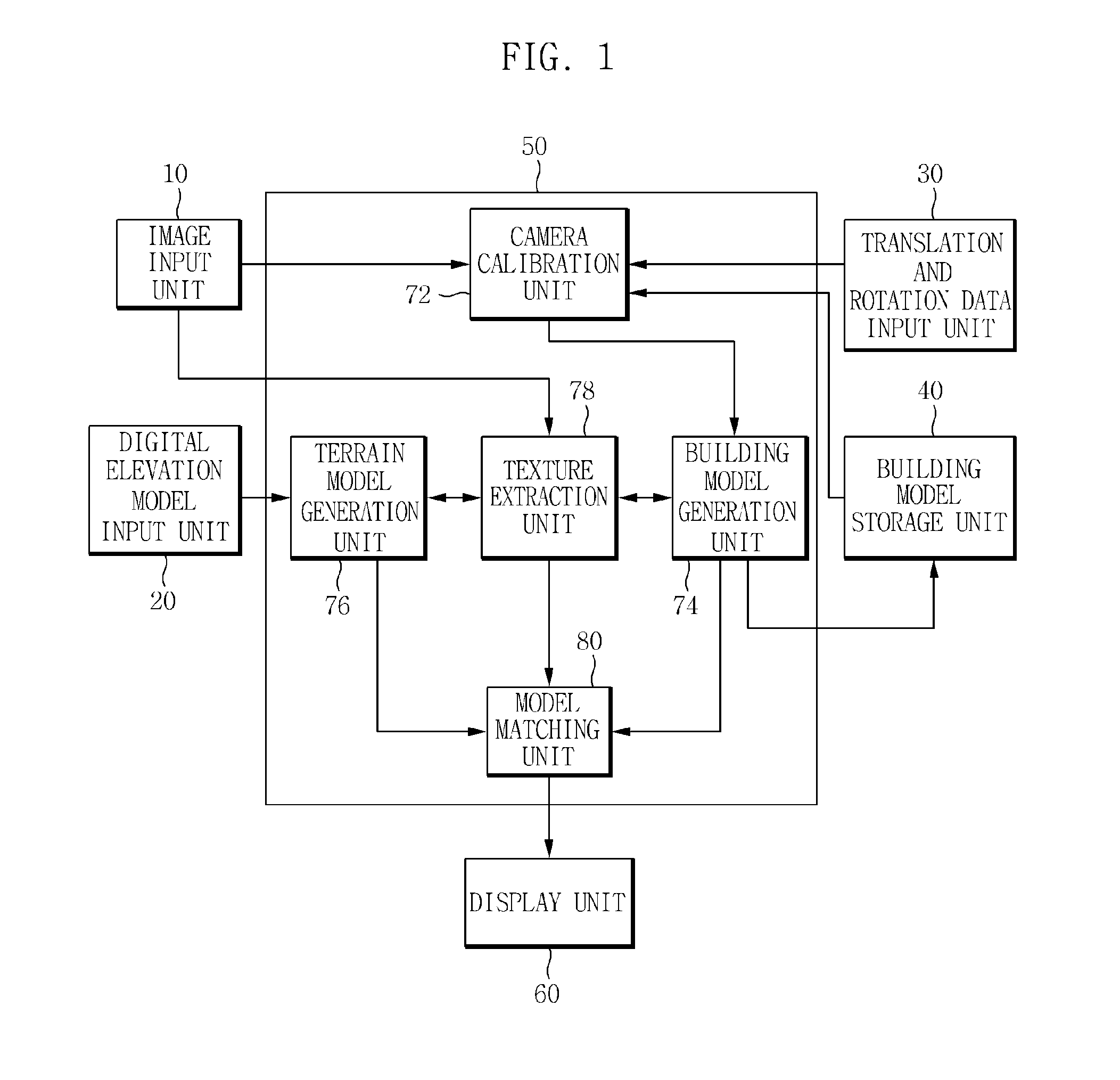
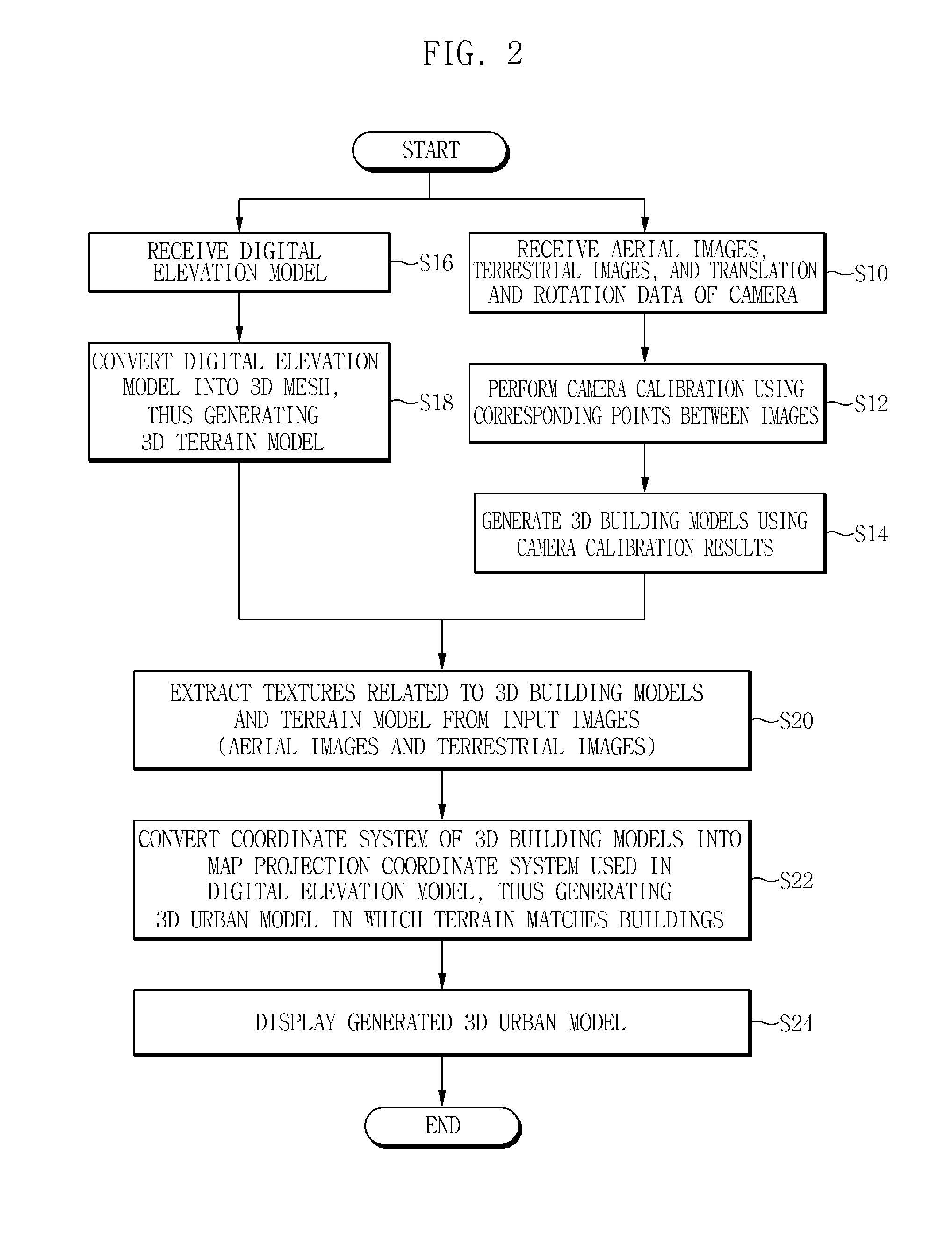
[0038]Hereinafter, embodiments of a 3D urban modeling apparatus and method according to the present invention will be described in detail with reference to the attached drawings. The terms and words used in the present specification and the accompanying claims should not be limitedly interpreted as having their common meanings or those found in dictionaries. Therefore, the embodiments described in the present specification and constructions shown in the drawings are only the most preferable embodiments of the present invention, and are not representative of the entire technical spirit of the present invention. Accordingly, it should be understood that various equivalents and modifications capable of replacing the embodiments and constructions of the present invention might be present at the time at which the present invention was filed.
[0039]In order to generate a 3D model from a plurality of images (for example, aerial images and terrestrial images), the accurate positions and post...
PUM
 Abstract
Description
Claims
Application Information