Method for updating digital maps using altitude information

a technology of altitude information and digital maps, applied in the field of digital maps, can solve the problems of inaccuracy or systematic errors, high cost of digital maps to produce and update, and high cost of displaying and processing road information

Active Publication Date: 2012-01-05
TOMTOM POLSKA
View PDF1 Cites 44 Cited by
  • Summary
  • Abstract
  • Description
  • Claims
  • Application Information

AI Technical Summary

Problems solved by technology

Digital maps are expensive to produce and update, since exhibiting and processing road information is very costly.
Surveying methods or digitizing satellite images have been employed in the past for creating digital maps, but are prone to the introduction of inaccuracies or systematic errors due to faulty or inaccurate input sources or flawed inference procedures.
Once a digital map has been created, it is costly to keep map information up to date, since road geometry changes over time.
One issue associated with such methods for generating and updating digital maps using probe data relates to certain accuracy issues associated with GPS measurements.
GPS systems are designed to be as nearly accurate as possible, however various factors are known to introduce errors.
Added together, these errors cause deviations in the calculated position of the GPS receiver.
Multi-path error is a serious concern for GPS users.
With regard to multi-path, errors introduced by local reflections cannot easily be detected using DOP satellite selection techniques.

Method used


Image

  • Method for updating digital maps using altitude information
  • Method for updating digital maps using altitude information
  • Method for updating digital maps using altitude information

Examples


Embodiment Construction

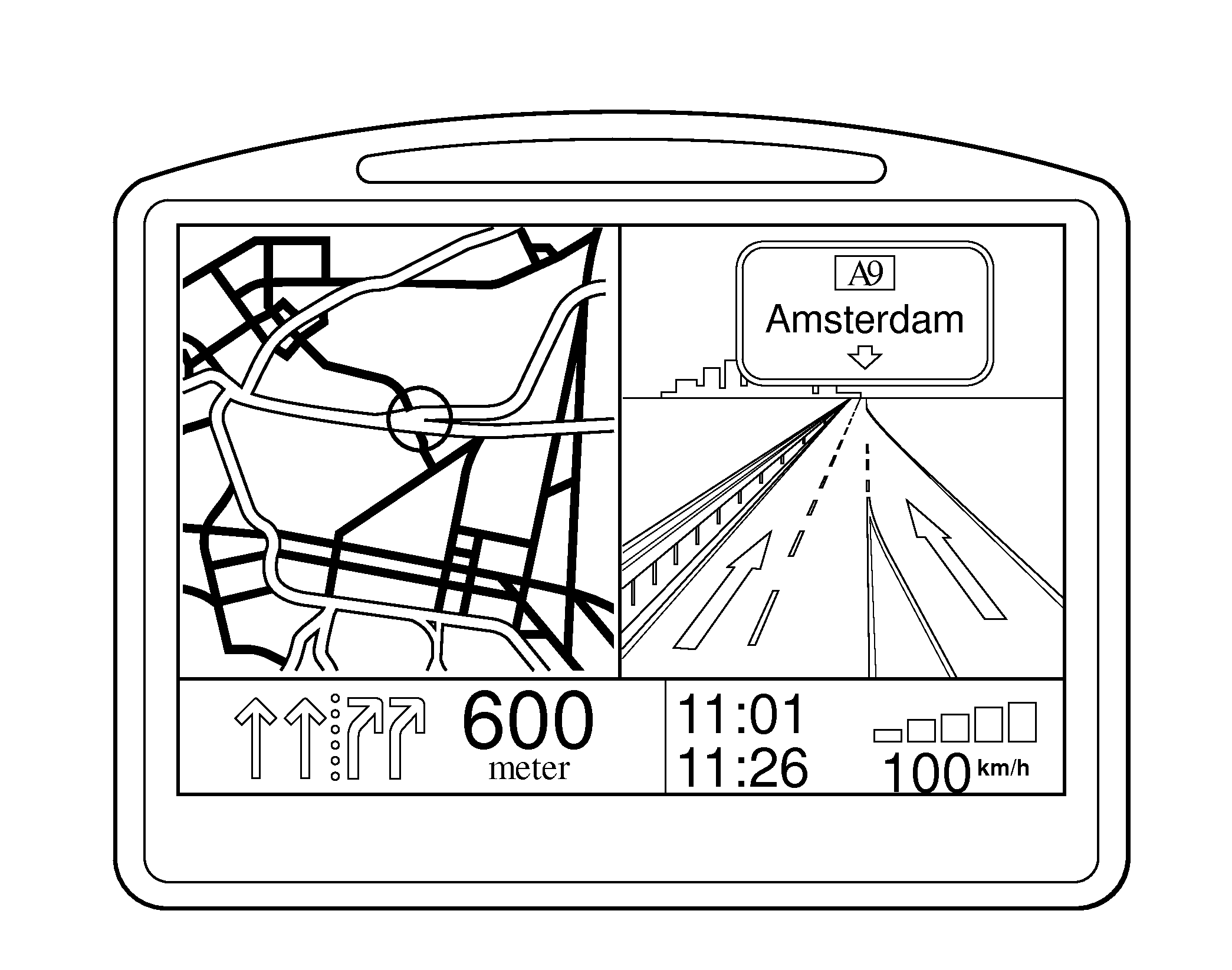
[0033]Referring to the Figures, wherein like numerals indicate like or corresponding parts throughout the several views, this invention pertains to navigation systems and the digital maps used by navigation systems. This invention is applicable to all kinds of navigation systems including, but not limited to, handheld devises, PDAs, mobile telephones with navigation software, and in-car navigation systems built in a vehicle. The invention can be implemented in any type of standard navigation system available on the market, as well as suitable systems which may be developed in the future. Considering in-car navigation systems as an example, like shown in FIG. 1, such devices generally comprise a determination device which may include a GPS (global positioning system) or other GNSS (global navigation satellite system) unit connected to an antenna 14 and arranged to communicate with the plurality of satellites 22, 26 so as to calculate a position from signals 20, 24 received from the s...


PUM


Abstract

This invention relates to a method for updating digital maps and for matching global navigation devices to a digital map. Such navigation devices rely upon GPS signals (20, 24) from satellites (22, 26). One well-documented cause of position error in navigation devices arises from the phenomenon of GPS multi-path. It has been observed that GPS multi-path errors in the latitude / longitude direction are highly correlated with errors in altitude. By comparing altitude value of GPS probe data with reference specifications for altitude, unreliable probe data (outliers) can be easily identified and culled. Such techniques can be used as well by a mobile navigation device to confirm a match to a particular road segment and if not revert to other positioning techniques such as inertial guidance systems and the like. If the local altitude is not reliably known, an estimation can be derived directly from the collected probe data.

Description

CROSS REFERENCE TO RELATED APPLICATIONS[0001]None.COPYRIGHT NOTICE[0002]A portion of the disclosure of this patent document contains material which is subject to copyright protection. The copyright owner has no objection to the facsimile reproduction by anyone of the patent document or the patent disclosure, as it appears in the Patent and Trademark Office patent file or records, but otherwise reserves all copyright rights whatsoever.BACKGROUND OF THE INVENTION[0003]1. Field of the Invention[0004]This invention relates to digital maps of the type for displaying road or pathway information, and more particularly toward a method for updating information contained in a digital map using reliable probe data as well as a method for matching a mobile navigation device to a digital map using only reliable GPS data.[0005]2. Related Art[0006]Personal navigation devices like that shown for example in FIG. 1 utilize digital maps combined with accurate positioning data from GPS or other data st...

Claims


Application Information

Patent Timeline
Patent Type & Authority Applications(United States)
IPC IPC(8): G01C21/26
CPCG09B29/10G01C21/32G09B29/003G01C21/206G01C21/3815G01C21/3841
Inventor KMIECIK, MARCIN MICHALNOWAK, WOJCIECH TOMASZ
Owner TOMTOM POLSKA
Why Eureka
Try Eureka