Systems and methods for generating electronic map displays with points-of-interest based on density thresholds

a technology of density thresholds and electronic map displays, applied in traffic control systems, navigation instruments, instruments, etc., can solve problems such as unappealing to users, user denied the opportunity, and non-provided users of users that are outside the search boundary

Active Publication Date: 2012-08-02
VERIZON PATENT & LICENSING INC
View PDF21 Cites 61 Cited by
  • Summary
  • Abstract
  • Description
  • Claims
  • Application Information

AI Technical Summary

Benefits of technology

[0010]In accordance with one exemplary embodiment, a computer-implemented method for generating an electronic map display is provided. The method comprises determining a route distance based on information for a route; comparing the route distance with a distance threshold; defining a search area when the route distance is less than the distance threshold, the search area including boundaries; calculating, using a processor, a points of interest (POI) density of the search area; comparing the POI density with a first density threshold and a second density threshold; adjusting the boundaries of the search area based on a result of comparing the POI density with the first density threshold and the second density threshold; identifying POIs in the adjusted search area; and providing POI information for an electronic map display, the POI information being associated with one or more POIs identified in the adjusted search area.
[0011]In accordance with another exemplary embodiment, a system for generating an electronic map display is provided. The system comprises an input device for receiving input from a user; a display device for displaying the electronic map display; a processor configured to determine a route distance based on information for a route, compare the route distance with a distance threshold, define a search area when the route distance is less than the distance threshold, the search area including boundaries, calculate a points of interest (POI) densi

Problems solved by technology

As a result, POIs that are outside a search boundary are not provided to the user.
In addition, a user is denied the opportunity to consider POIs that might better fit the user's preferences based on the query and/or based on the route on which the user is driving.
At the same time, when a user expands the geographic scope of search results, a user is often provided with an electronic map display that is crowded with too many POIs that are unappealing to the user.
Further, as the number of POIs represented increases, electronic map displays

Method used


Image

  • Systems and methods for generating electronic map displays with points-of-interest based on density thresholds
  • Systems and methods for generating electronic map displays with points-of-interest based on density thresholds
  • Systems and methods for generating electronic map displays with points-of-interest based on density thresholds

Examples


Embodiment Construction

[0023]Reference will now be made in detail to exemplary embodiments of the disclosure, examples of which are illustrated in the accompanying drawings. Wherever possible, the same reference numbers will be used throughout the drawings to refer to the same or like parts.

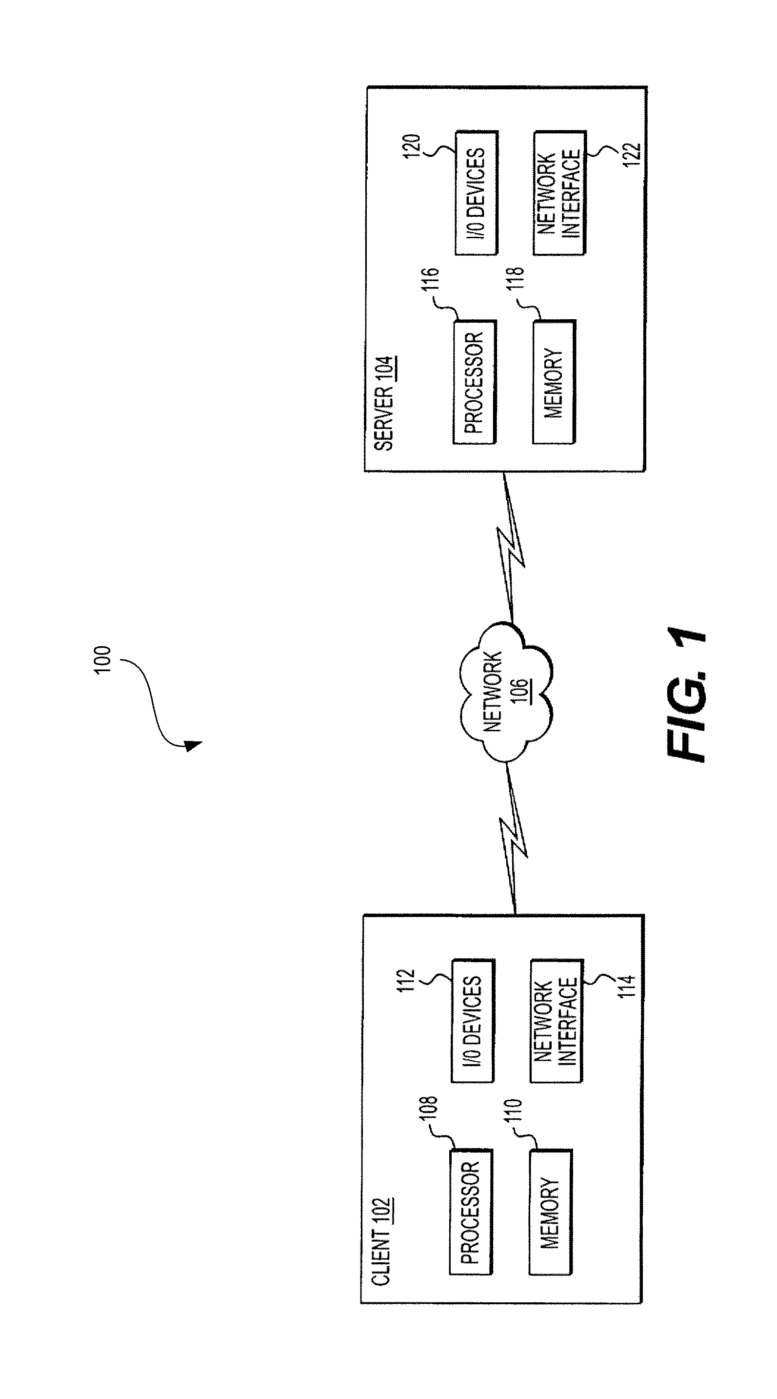
[0024]FIG. 1 is a representation of an exemplary electronic map system 100, consistent with embodiments of the present disclosure. As shown in FIG. 1, electronic map system 100 may include a client 102 and a server 104 connected via a network 106. Although only one client 102 and one server 104 are illustrated in FIG. 1, it will be appreciated that other components may be included in system 100, including a plurality of clients 102 and a plurality of servers 104, which communicate via network 106, alone and / or in combination with other networks.

[0025]By way of example, client 102 may comprise a personal computer (PC), a hand-held computer, a personal digital assistant (PDA), a portable navigation device, a mobile phone...


PUM


Abstract

Methods and systems are provided for generating an electronic map display. In one implementation, a method is provided for determining a route distance based on information for a route, comparing the route distance with a distance threshold, defining a search area when the route distance is less than the distance threshold, the search area including boundaries, calculating, using a processor, a points of interest (POI) density of the search area, comparing the POI density with a first density threshold and a second density threshold, adjusting the boundaries of the search area based on a result of comparing the POI density with the first density threshold and the second density threshold, identifying POIs in the adjusted search area, and providing POI information for an electronic map display, the POI information being associated with one or more POIs identified in the adjusted search area.

Description

BACKGROUND[0001]1. Technical Field[0002]The present disclosure generally relates to the field of computer processing and electronic map displays. More particularly, and without limitation, the present disclosure relates to computerized systems and methods for generating electronic map displays based on, for example, points-of-interest (POI) density, route distance, and / or distances of POIs from reference locations.[0003]2. Background Information[0004]Today, electronic map displays are widely used to convey information about roads, traffic, buildings, landmarks, terrain, etc., related to geographical regions of interest. Interactive maps may allow a user, for example, to access a map of a particular location (e.g., specific address, city, state, country, etc.) and the surrounding locations. After accessing a location, a user may navigate around the location by zooming in and out, and scrolling left, right, up, and down on the map. A user may also use the map to retrieve directions / ro...

Claims


Application Information

Patent Timeline
IPC IPC(8): G01C21/00G06Q30/00H04W4/02H04W4/024
CPCG01C21/3682G01C21/3476H04W4/02H04W4/024G01C21/26G08G1/20
Inventor BEYELER, ERICWANG, TIANYU
Owner VERIZON PATENT & LICENSING INC
Why Eureka
Try Eureka