Aerial survey plane having cover for protecting lens of infrared camera for aerial survey

a technology for infrared cameras and aerial surveys, which is applied in the direction of machine supports, transportation and packaging, and television systems. it can solve the problems of affecting the accuracy of aerial survey results

Inactive Publication Date: 2015-06-11
KOREA INST OF GEOSCI & MINERAL RESOURCES
View PDF14 Cites 10 Cited by
  • Summary
  • Abstract
  • Description
  • Claims
  • Application Information

AI Technical Summary

Benefits of technology

[0054]According to an exemplary embodiment of the present invention, an externally exposed surface of an aerial survey infrared camera, which is externally exposed from the aerial survey plane, may be effectively protected from foreign materials or fragments by a cover for protecting a lens of an infrared camera for an aerial survey.
[0055]In addition, according to an exemplary embodiment related to an aerial survey plane having a cover for protecting a lens of an infrared camera for an aerial survey, a lens of the aerial survey infrared camera may be effectively protected from an external temperature of the aerial survey plane.

Problems solved by technology

The most basic method of photographing is to externally expose a camera of the aerial survey plane (called “plane”) to obtain the desired image, and because this method is very vulnerable to unpredictable situations such as vibrations or sudden shaking of the plane, this method is only used when the aerial survey is performed as a hobby.
For other methods, various supporters are installed on an external surface of the plane and the aerial survey camera is fixed to the supporter, but because of the variation of the center of gravity of the plane due to the uneven distribution of weight, controlling the plane may be more difficult.
In this case, in general, because the weather at low altitudes is bad, an outer surface, especially a lens surface of the aerial survey camera may be damaged because of the bad weather when ascending from the low altitude to the high altitude or descending from the high altitude to the low altitude.
In addition, the aerial survey is normally performed by flying back and forth along a predetermined track as if plowing in a farm, and because the turning radius is considerably large, the amount of time that the camera is exposed to the external atmosphere is also considerably long.
As described, the outer surface of the aerial survey camera may be damaged due to a locally bad weather even when the camera is exposed while the aerial survey plane is rotating.
Further, the outer surface of the aerial survey camera may be damaged by foreign materials such a sand from a runway when the plane takes-off or lands for the aerial survey.

Method used


Image

  • Aerial survey plane having cover for protecting lens of infrared camera for aerial survey
  • Aerial survey plane having cover for protecting lens of infrared camera for aerial survey
  • Aerial survey plane having cover for protecting lens of infrared camera for aerial survey

Examples


Embodiment Construction

[0067]Hereinafter, an embodiment of the present invention is described in detail with reference to the accompanying drawings.

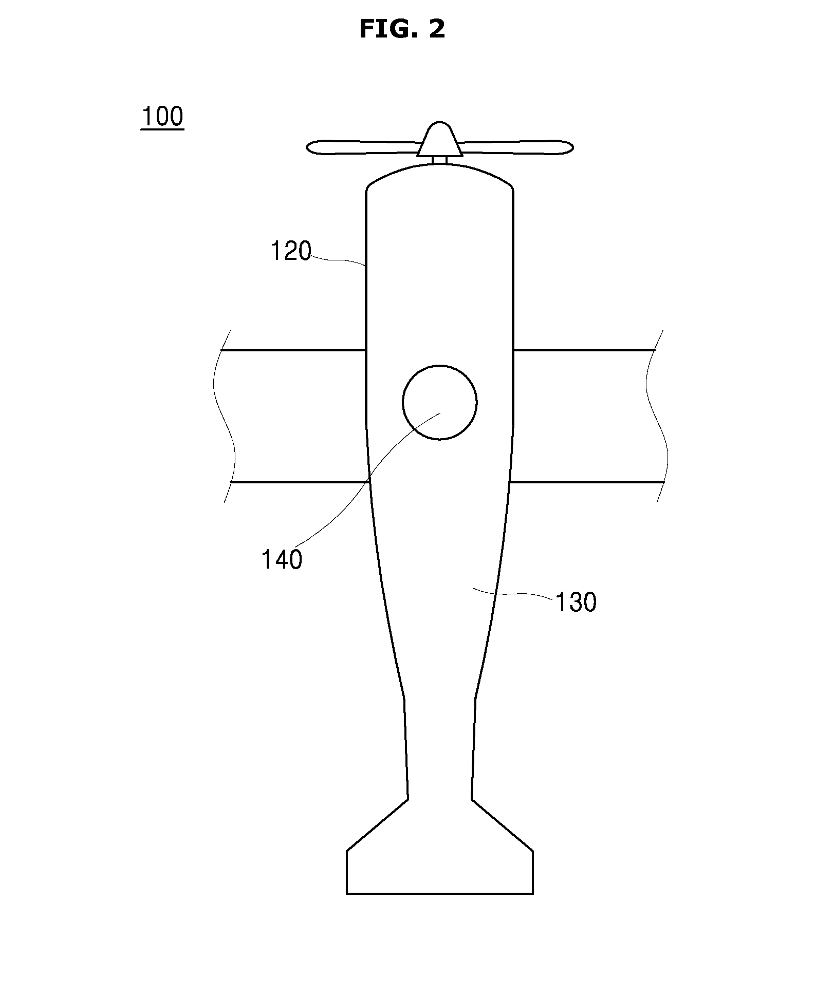
[0068]FIG. 4 is a side sectional view illustrating an aerial survey infrared camera (hereinafter, referred to as “aerial survey camera”) illustrated in FIG. 3 having an altered height to describe an exemplary embodiment of the present invention.

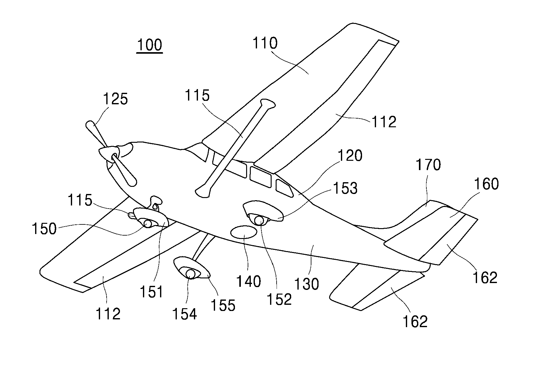
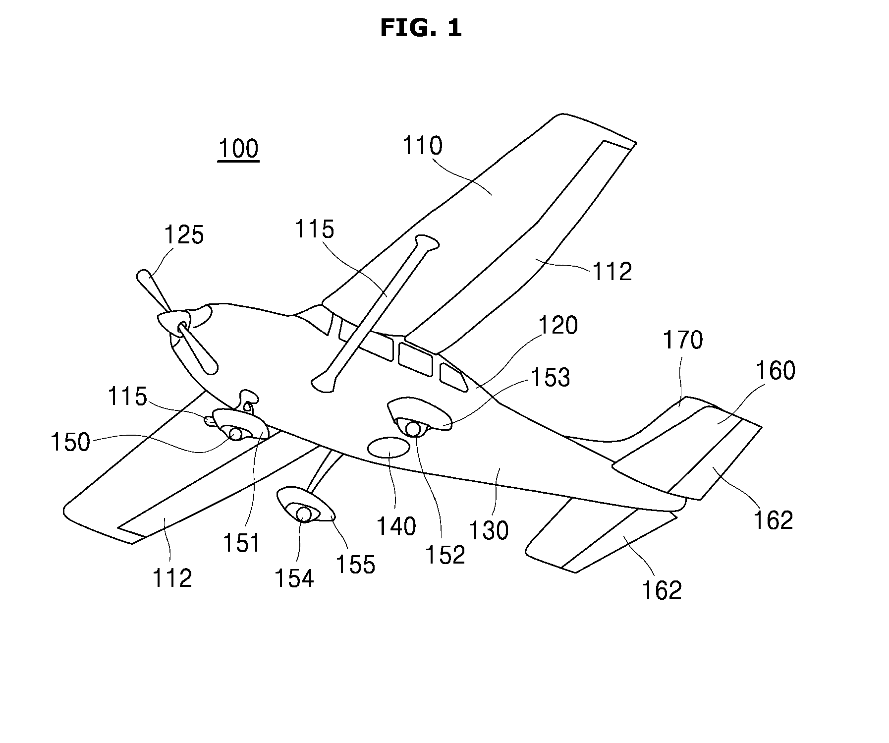
[0069]According to FIG. 4, the height of an aerial survey camera 200 fixedly installed in an aerial survey plane 100, and in this case, the aerial survey camera 200 is lifted up and down by lifting parts 257 and 267 formed on supports 255 and 265, respectively, which are vertically inserted on a supporting plate 240. In FIG. 4, the supports 255 and 265 are preferably formed vertical to shock absorbing units 250 and 260.

[0070]In FIG. 4, screw type lifting parts 257 and 267 are illustrated, and to move the aerial survey camera 200 up and down by the lifting parts 257 and 267, for example, control handles 259 and 269 may b...


PUM


Abstract

An aerial survey plane having a cover for protecting a lens of an infrared camera for an aerial survey according to an exemplary embodiment of the present invention includes: an aerial survey observation window; an aerial survey infrared camera; at least one shock absorbing part to absorb shock applied to the aerial survey infrared camera; at least one support vertically provided on the shock absorbing part; a lifting part to lift and lower the aerial survey infrared camera; a protective cover provided between the aerial survey infrared camera and the bottom surface of the fuselage of the aerial survey plane and having a size to cover the aerial survey observation window; at least one motor to move the protective cover toward any one direction; and a controller to remotely control the opening and the closing of the protective cover.

Description

CROSS-REFERENCE TO RELATED APPLICATION[0001]This application claims the benefit under 35 U.S.C. §119 of Korean Patent Application No. 10-2013-0153233 filed on Dec. 10, 2013 in the Korean Intellectual Property Office, the entirety of which disclosure is incorporated herein by reference.BACKGROUND OF THE INVENTION[0002]1) Field of the Invention[0003]The present invention relates to an aerial survey plane having a cover for protecting a lens of an infrared camera for an aerial survey, and more particularly, to an aerial survey plane having a damage protecting cover for preventing a damage to a photographic lens of an infrared camera, which is used for an aerial survey, externally exposed from the aerial survey plane.[0004]2) Background of Related Art[0005]Aerial survey is a method of collecting geomatics or planimetric features of a remote area, and should be distinguished from satellite surveys because of its better resolution.[0006]The aerial survey obtains an image of a target locat...

Claims


Application Information

Patent Timeline
Patent Type & Authority Applications(United States)
IPC IPC(8): H04N5/225H04N5/33H04N7/18
CPCH04N5/2252H04N5/33H04N7/183B64D47/08H04N23/51G01C11/02F16M11/00
Inventor HAN, JONG-GYUSUNG, KI-SUNGLEE, SUNG-SOONYEON, YEONG-KWANGKIM, JEONG-CHAN
Owner KOREA INST OF GEOSCI & MINERAL RESOURCES
Why Eureka
Try Eureka