Method and system for characterization of subsurface cavities using joint inversion of gravity and ground penetrating radar data

a technology of subsurface cavities and radar data, applied in the direction of reradiation/reflection, gravitational wave measurement, radio wave reradiation/reflection, etc., can solve the problems of acute geohazard, large population loss, and a risk to developed land

Inactive Publication Date: 2016-10-27
KING FAHD UNIVERSITY OF PETROLEUM AND MINERALS
View PDF1 Cites 11 Cited by
  • Summary
  • Abstract
  • Description
  • Claims
  • Application Information

AI Technical Summary

Problems solved by technology

Subsurface cavities are hazardous due to their susceptibility to ground surface subsidence, which can cause great losses to the population that occupies the land above them as described in Benson, A. K., “Applications of ground penetrating radar in assessing some geological hazards: examples of groundwater contamination, faults, cavities”, Journal of Applied Geophysics, vol.
The presence of cavities features in the subsurface rock and their potential collapse pose an acute geohazard and constitute a risk to developed land.
Drilling is a most common method of site investigation in an attempt to detect and characterize physical parameters of subsurface cavities such as porosity and water saturation but it is expensive.
To date there have not been attempts to combine GPR and gravity petrophysical methods to estimate porosity and water saturation of cavity filling materials.

Method used


Image

  • Method and system for characterization of subsurface cavities using joint inversion of gravity and ground penetrating radar data
  • Method and system for characterization of subsurface cavities using joint inversion of gravity and ground penetrating radar data
  • Method and system for characterization of subsurface cavities using joint inversion of gravity and ground penetrating radar data

Examples


Embodiment Construction

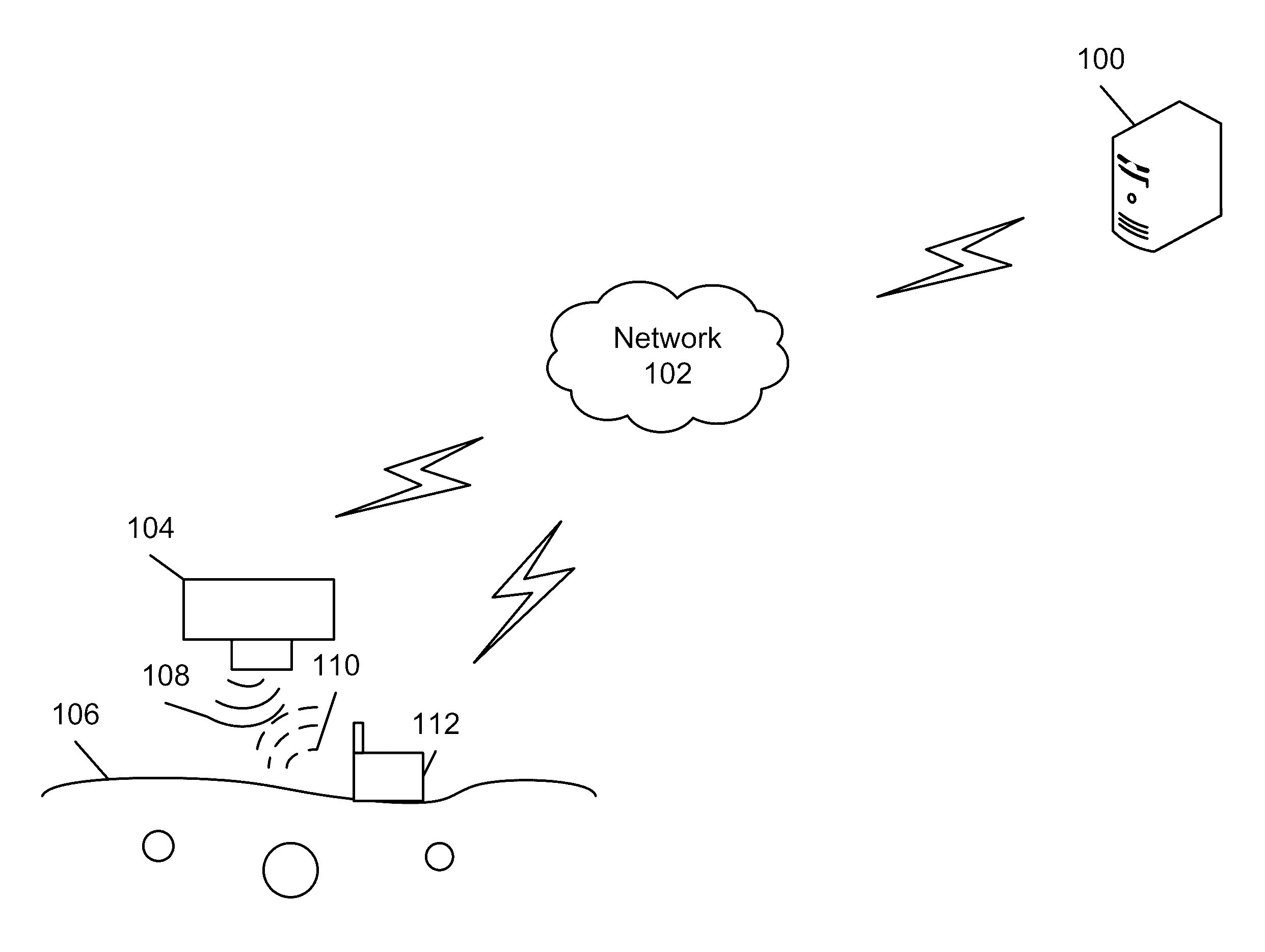
[0045]Referring now to the drawings, wherein like reference numerals designate identical or corresponding parts throughout several views, the following description relates to a subsurface cavities system and associated methodology for characterizing subsurface cavities using gravity and ground penetrating radar data.

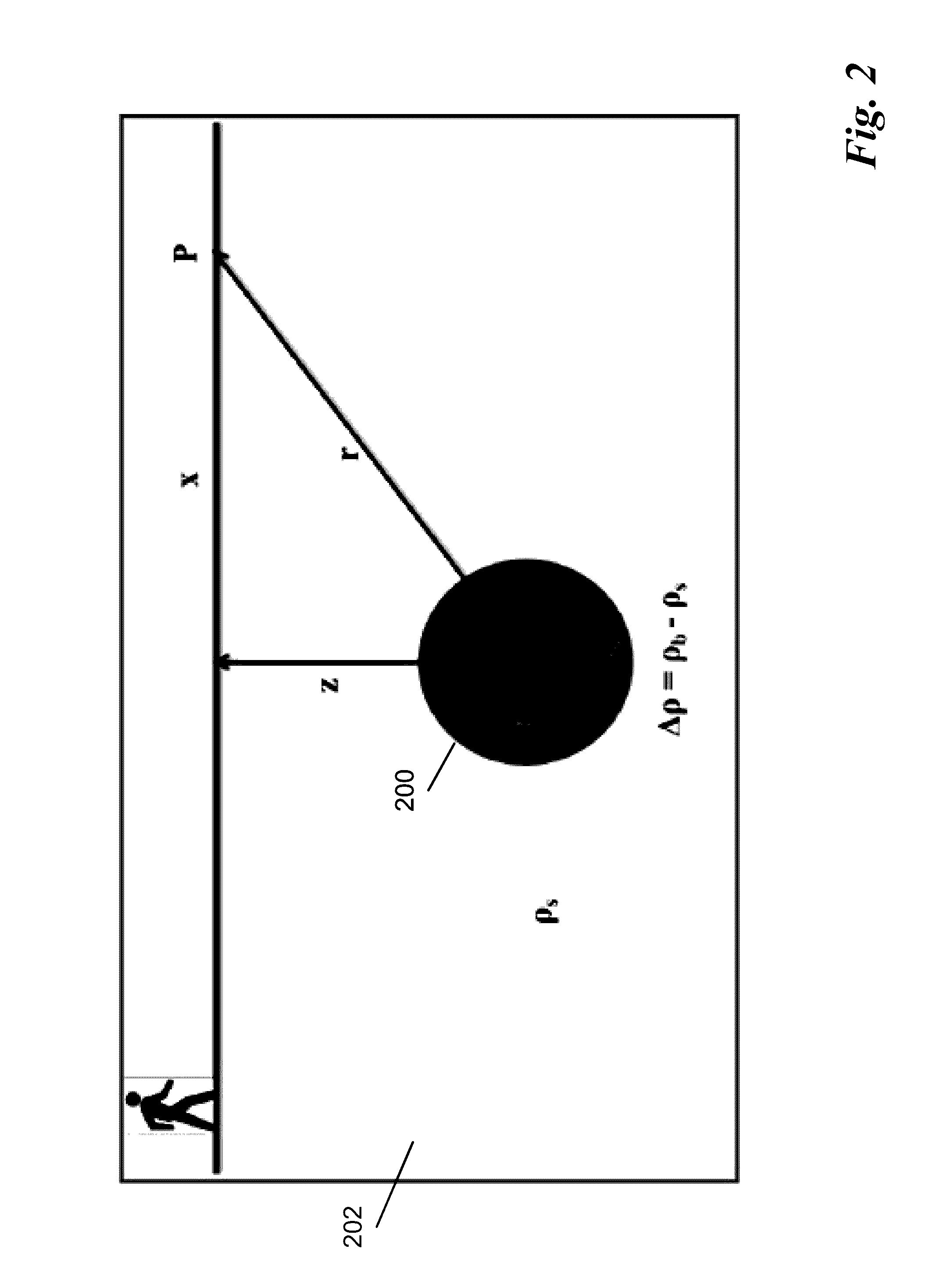
[0046]Detection of cavities is possible using geophysical methods because the presence of a cavity changes the physical properties of the subsurface rocks and causes a physical contrast between the cavity materials and the surrounding environment. Gravity methods measure a lateral variation in the vertical component of the gravitational field at the Earth's surface. The lateral variation in the vertical component of the gravitational field is due to the subsurface density distribution. Moreover, the gravity methods are appropriate to the investigation of subsurface geological features, such as tracing of geological boundaries and mapping of sedimentary basins. The caviti...


PUM


Abstract

A system and associated methodology determines the porosity and water saturation of a cavity using a joint inversion of gravity and ground penetrating radar data. The system exhibits high accuracy. In one embodiment, the cavity is spherical.

Description

TECHNICAL FIELD[0001]The present disclosure relates to methods and systems for characterization of subsurface cavities.BACKGROUND[0002]Geophysics improves our understanding of subsurface geological features. During the middle of the 20th century, ground penetrating radar (GPR) and gravity methods were rapidly developed to investigate subsurface problems as described in Reynolds, J. M, An introduction to applied and environmental geophysics, Wiley, 1997. However, the last three decades have featured the most important achievements in application of both the GPR and gravity methods in several fields, such as archaeology, engineering and environmental science. The use of GPR has increased in detecting and identifying many subsurface features, such as mineshafts, pipelines, ore lodes, cavities, groundwater, and buried rock valleys as described in Chamberlain, A. T., Sellers, W., Proctor, C. and Coard, R., “Cave detection in limestone using ground penetrating radar”, Journal of archaeolo...

Claims


Application Information

Patent Timeline
Patent Type & Authority Applications(United States)
IPC IPC(8): G01S13/88G01V3/12G01V7/00
CPCG01S13/885G01V3/12G01V7/00
Inventor AL-SHUHAIL, ABDULLATIF A.ABDULLAH, FATHI M.
Owner KING FAHD UNIVERSITY OF PETROLEUM AND MINERALS
Why Eureka
Try Eureka