

System and method for combining geographical and economic data extracted from satellite imagery for use in predictive modeling
a satellite imagery and economic data technology, applied in the field of image analysis, can solve the problems of large urban development challenges, large availability of up-to-date information, and inability to manage urban development in a sustainable manner
- Summary
- Abstract
- Description
- Claims
- Application Information
AI Technical Summary
Benefits of technology
Problems solved by technology
Method used
Image

Examples
Embodiment Construction
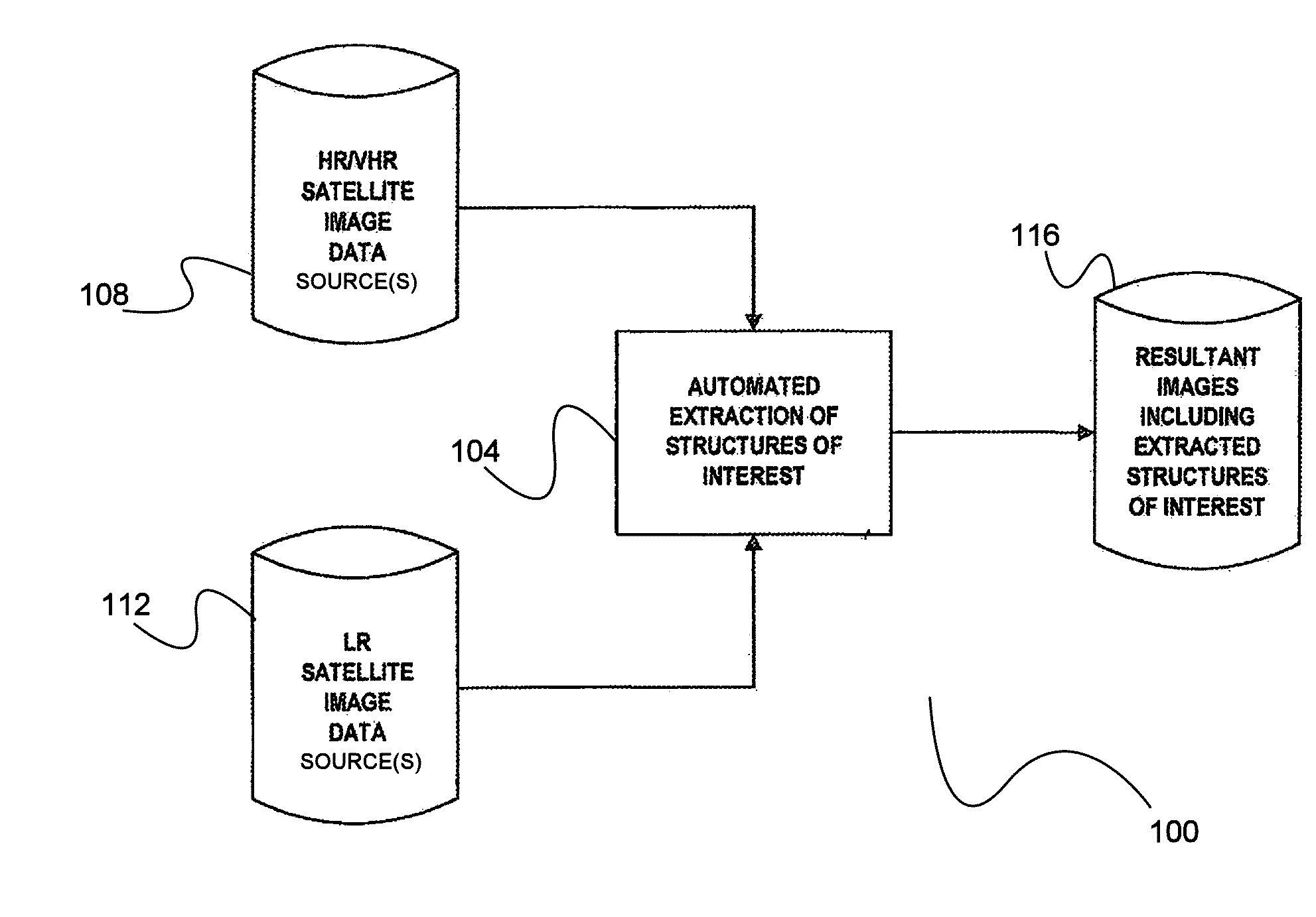
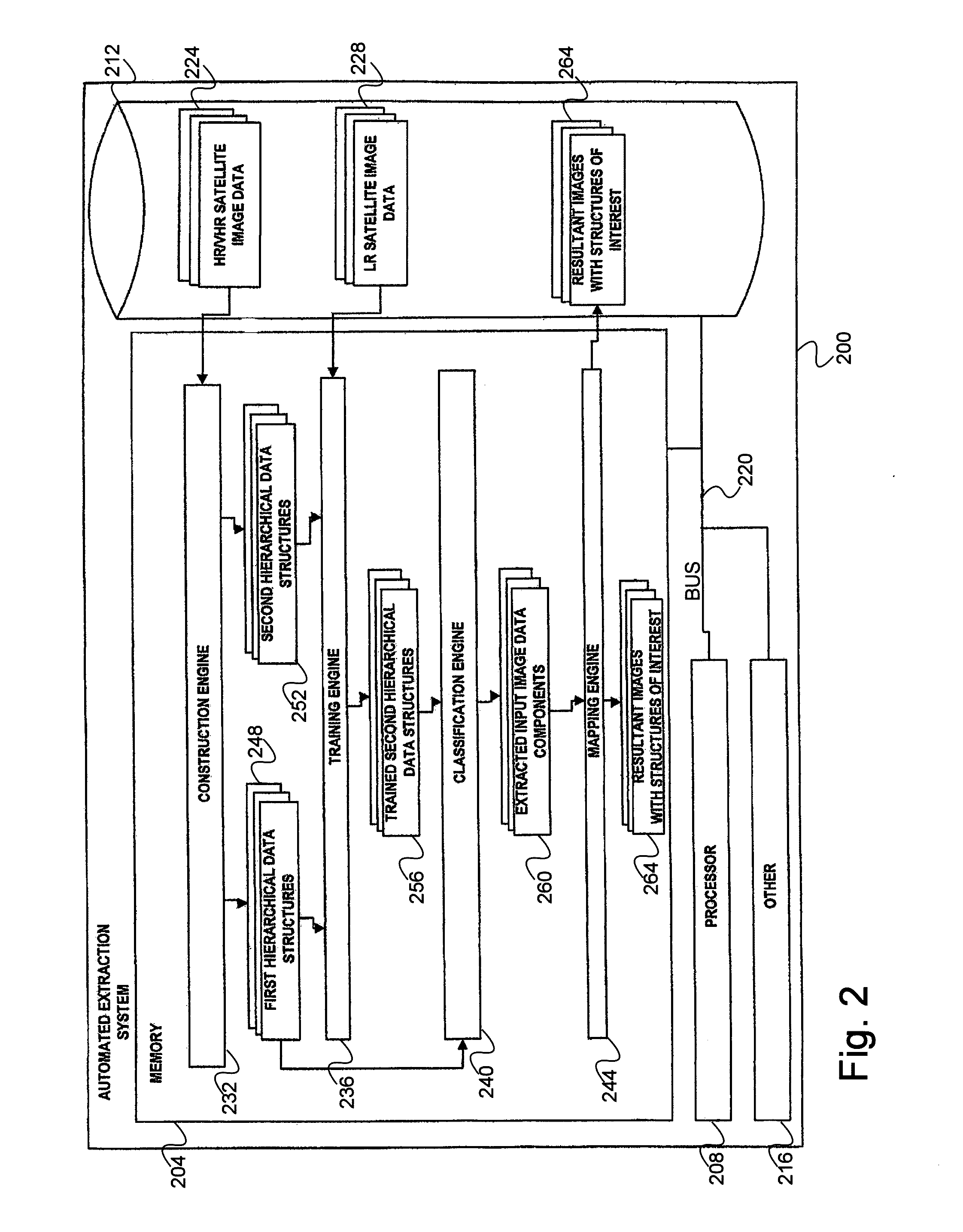
[0041]Accordingly, the inventor has conceived and reduced to practice, in preferred embodiments of the invention, a system and method for combining geographic and economic data extracted from satellite imagery for use in predictive modeling.
[0042]One or more different inventions may be described in the present application. Further, for one or more of the inventions described herein, numerous alternative embodiments may be described; it should be understood that these are presented for illustrative purposes only. The described embodiments are not intended to be limiting in any sense. One or more of the inventions may be widely applicable to numerous embodiments, as is readily apparent from the disclosure. In general, embodiments are described in sufficient detail to enable those skilled in the art to practice one or more of the inventions, and it is to be understood that other embodiments may be utilized and that structural, logical, software, electrical and other changes may be made...
PUM
 Abstract
Description
Claims
Application Information