
Navigational Device and Methods

Active Publication Date: 2018-09-20
TREKACE TECH LTD
View PDF3 Cites 12 Cited by
  • Summary
  • Abstract
  • Description
  • Claims
  • Application Information

AI Technical Summary

Benefits of technology

The present invention is a wearable navigation device for sports, extreme, and military scenarios. It provides tactile instructions to guide users to their destination while considering extreme circumstances and conditions. The device is easy to use and can work seamlessly with other navigational applications or devices.

Problems solved by technology

These available practices are not practical for certain types of extreme, sport and military navigation scenarios and conditions.
Often, they are ineffective in directing the user to his target accurately, on time and safely.
Most prior art systems relay and employ subjective skills such as cognitive abilities (e.g. intelligence, perception of space, natural orienteering, etc.) and weak, easy to disrupted, senses such as vision and sound: The resulting navigation experience of prior art devices is that they are demanding and often fail due to environmental disturbances to the user.
Moreover, while navigating on an unmarked route at natural / wild / hostile environments, it becomes a difficult task even for professionals.
This costs them time, disqualification in competitions and military courses, their professional reputation, and may even create grave danger at hostile military scenarios while stopping and illuminating the map.
Holding and reading a physical map is a practice which is impractical for sport, extreme and military navigation scenarios and conditions, as it requires the hiker, athlete or soldier to continuously stop and open an actual map and thus costing them time, disqualification in competitions and military courses, their professional reputation, and may cause grave danger at hostile military scenarios while stopping and illuminating the map.
Visual directions—as in holding and reading a physical map, this practice is irrelevant for sport, extreme and military navigation scenarios and conditions as it requires the hiker, athlete or soldier to continuously stop and look at the actual map and thus costing them time, disqualification in competitions and / or military courses, their professional reputation, and may create grave danger at hostile military scenarios while stopping and using an illuminated screen.
These applications hold the same described limitations and are even less practical as they employ tiny wrist-fitted screen, obliging the hiker, athlete or soldier to watch and focus on tiny visual indications while they are at a hectic environment requiring their optimal attention.
Verbal sound directions—this practice is irrelevant or less practical for sport, extreme and military navigation scenarios and conditions as it requires the hiker, athlete or soldier to focus on listening to the instructions while they are at a noise-hectic environment and need to be listening to their sound-rich environment, such as radio communication, conversations, potential threats, targets, animals in hunting, the weather, and even music, in the case of some athletes.
In other words, in the intense context of real life the hiker, athlete or soldier act in, they practically cannot differentiate between the concentrated vibrations and thus to translate the vibrations to actual directions; as the vibrations are limited to a too narrow area on the wrist.

Method used


Image

  • Navigational Device and Methods
  • Navigational Device and Methods
  • Navigational Device and Methods

Examples


Embodiment Construction

[0094]In the detailed description, numerous specific details are set forth in order to provide a thorough understanding of the invention. However, it will be understood by those skilled in the art that these are specific embodiments and that the present invention may be practiced also in different ways that embody the characterizing features of the invention as described and claimed herein.

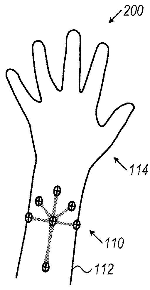
[0095]Reference is now made to FIG. 1, which is a simplified schematic illustration of a tactile instructions system 100 for navigation, in accordance with an embodiment of the present invention.

[0096]The Present invention includes a computerized mobile device 120 (e.g. laptop 140, tablet, Smartphone 120, etc.) carried by the user, which is adapted to process navigation information, and that is adapted to communicate (by wire or wireless) with at least one device 110. The device may be constructed and configured to provide at least one tactile stimulus to an arm 110 of the user. The tactile stimul...


PUM


Abstract

The present invention provides a wearable navigation forearm-band device for intuitive navigation of a user to his destination, the device including at least four tactile stimulus providers, each adapted to impact on different areas of a forearm of a user to provide a specific direction of movement of the user, wherein the device is adapted to receive commands from a communication apparatus to activate said vibration indicators response to a position of the user.

Description

FIELD OF THE INVENTION[0001]The present invention relates generally to portable navigation devices and methods, and more specifically to wearable devices for navigation.BACKGROUND OF THE INVENTION[0002]At present, extreme, sports and military navigation are practiced either by memorizing a route on a map, by holding and reading a physical map, or by following visual and / or sound directions of a given navigation computerized application. These available practices are not practical for certain types of extreme, sport and military navigation scenarios and conditions. Often, they are ineffective in directing the user to his target accurately, on time and safely.[0003]Most prior art systems relay and employ subjective skills such as cognitive abilities (e.g. intelligence, perception of space, natural orienteering, etc.) and weak, easy to disrupted, senses such as vision and sound: The resulting navigation experience of prior art devices is that they are demanding and often fail due to en...

Claims


Application Information

Patent Timeline
IPC IPC(8): G08B7/06G01C21/36
CPCG08B7/066G01C21/3652G09B21/003G09B21/004A61F9/08G09B21/00
Inventor GABBAY, RONEN IZIDOR
Owner TREKACE TECH LTD
Learn More