Vehicle Traffic and Charge Management System Using Autonomous Cluster Networks of Vehicle Charging Stations
- Summary
- Abstract
- Description
- Claims
- Application Information
AI Technical Summary
Benefits of technology
Problems solved by technology
Method used
Image
Examples
Embodiment Construction
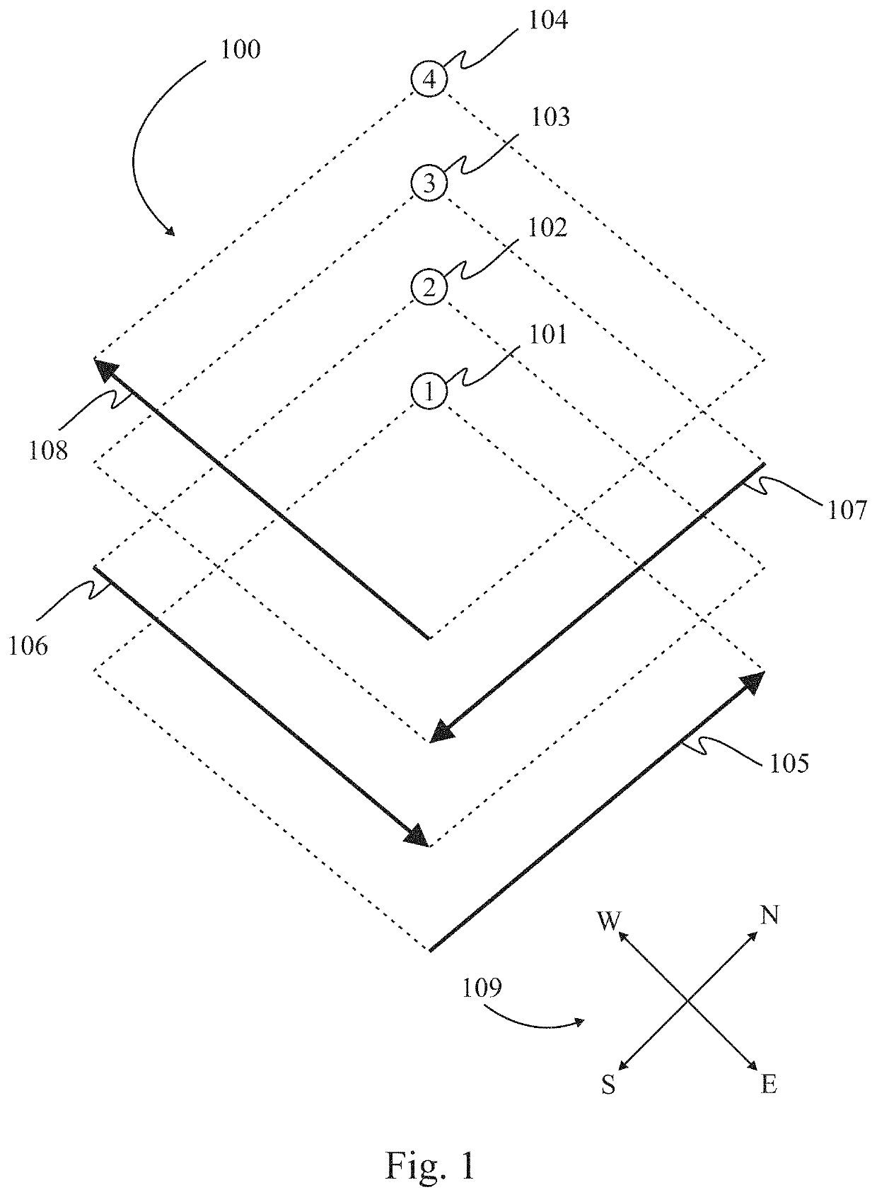
[0043]FIG. 1 is an illustration of a proposed droneway 100 according to one embodiment of the present invention. For the system described herein, a droneway is a range of altitude designated for only drone travel. For example, an altitude of say 100 feet to 400 feet (30 m to 120 m) above ground level may be reserved in a droneway system with four or more levels. The droneway shown in FIG. 1 comprises four levels: A first level 101 is designated for drones traveling generally northward as indicated by arrow 105, a second level 102 is designated for drones traveling generally eastward as indicated by arrow 106, a third level 103 is designated for drones traveling generally southward as indicated by arrow 107, and a fourth level 104 is designated for drones traveling generally westward as indicated by arrow 108. The directions indicated in this embodiment are used just as an example and are not a set standard. Each level is specified at a different altitude, and the distance between le...
PUM
 Abstract
Description
Claims
Application Information
 - R&D
- Intellectual Property
- Life Sciences
- Materials
- Tech Scout
- Unparalleled Data Quality
- Higher Quality Content
- 60% Fewer Hallucinations
Browse by: Latest US Patents, China's latest patents, Technical Efficacy Thesaurus, Application Domain, Technology Topic, Popular Technical Reports.
© 2025 PatSnap. All rights reserved.Legal|Privacy policy|Modern Slavery Act Transparency Statement|Sitemap|About US| Contact US: help@patsnap.com


