

Positioning system and method for determining an operating position of an aerial device
a positioning system and aerial device technology, applied in the direction of distance measurement, instruments, construction, etc., can solve the problems of requiring much experience and good skills of the operating crew, the need to correct the positioning error of the vehicle loses valuable time, and the method is still error-prone, so as to achieve reliable positioning and less error-prone and demanding
- Summary
- Abstract
- Description
- Claims
- Application Information
AI Technical Summary
Benefits of technology
Problems solved by technology
Method used
Image

Examples
Embodiment Construction
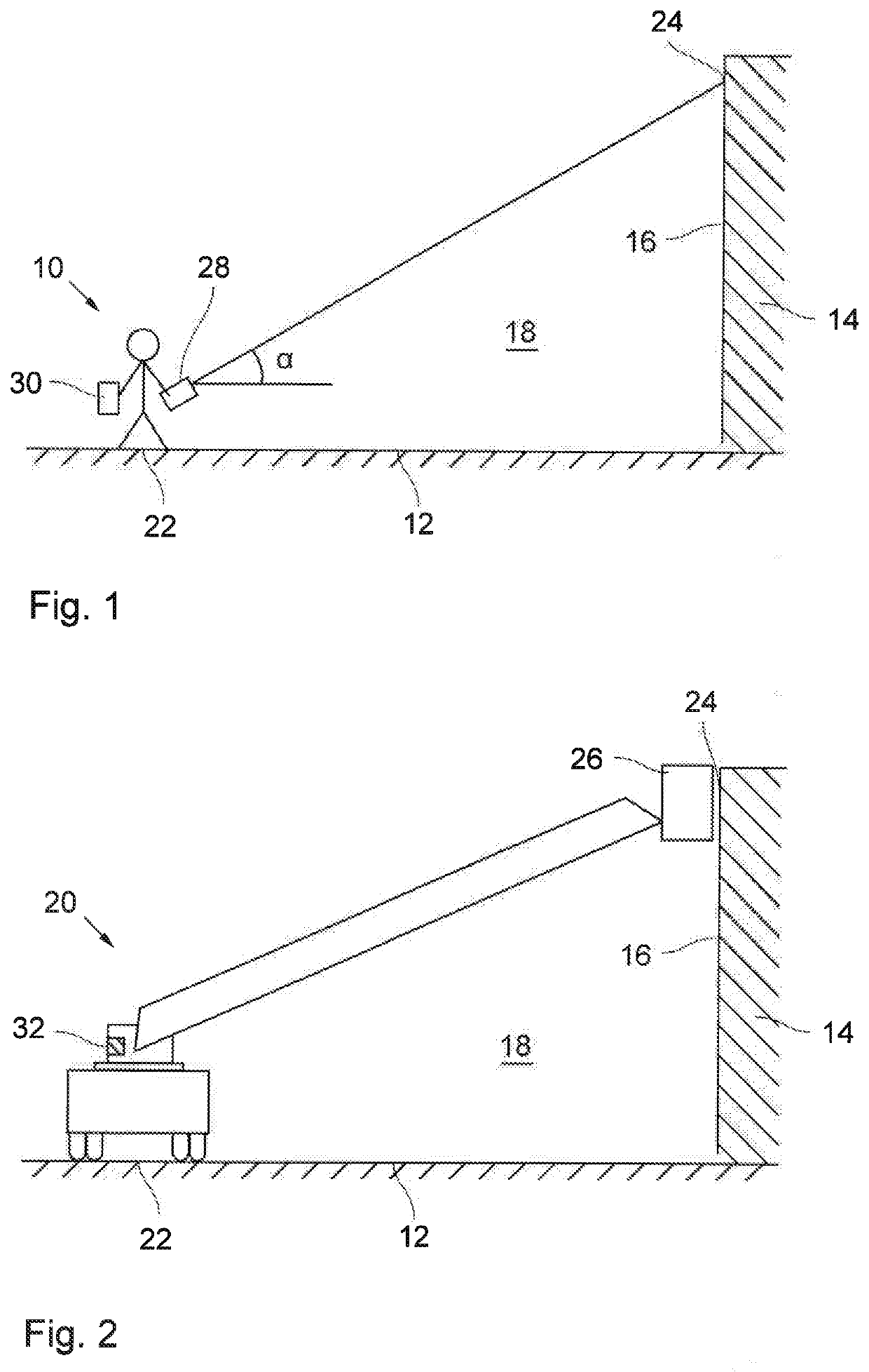
[0038]FIG. 1 shows an operator 10 standing on a ground 12 on which a building 14 is located. The horizontal plane of the ground 12 and the vertical wall 16 of the building 14 delimit an environmental space 18 in parts. The operator 10 is confronted with the task to find a suitable operating position of an aerial device 20, which is turnable telescopic ladder on top of a firefighting vehicle. It is noted that the present invention is not limited to this kind of aerial device but can also be applied to other kinds of aerial devices for other purposes. Moreover, it is noted that all elements in the figures are shown schematically under neglection of their relative dimensions.
[0039]To find the operating position, the operator 10 positions himself at a roughly estimated operation position, from which distance measurements can be taken, as will be described in more detail in the following. The point at which the operator is located is marked as a first point 22 on the ground 12 in FIG. 1....
PUM
 Abstract
Description
Claims
Application Information