Efficient flight planning for regions with high elevation terrain

a high-altitude, flight planning technology, applied in flight plan management, automatic aircraft landing aids, aircraft traffic control, etc., can solve the problems of increasing fuel consumption, and affecting the efficiency of flight operations

Active Publication Date: 2021-11-18
THE BOEING CO
View PDF0 Cites 1 Cited by
  • Summary
  • Abstract
  • Description
  • Claims
  • Application Information

AI Technical Summary

Benefits of technology

[0004]In a first aspect, a method for determining a flight plan from an origin to a destination for an aircraft, includes: determining one or more regions that intersect an initial flight path and comprise at least one terrain feature having an elevation greater than an elevation threshold; for each respective region in the one or more regions: determining a flight area within the respective region based on the initial flight path and an elevation threshold line, wherein the elevation threshold line indicates a portion of the respective region in which all terrain is below the elevation threshold in a safe descent direction for the respective region; determining one or more segments of the initial flight path in the respective region that comprise one or more terrain features having an elevation greater than the elevation threshold; and determining a modified flight path for each respective segment of the one or more segments of the initial flight path in the respective region by: determining a plurality of descent gradients from a plurality of positions along the respective segment and from an estimated cruise altitude to an altitude threshold based on an estimated descent time from the estimated cruise altitude to the altitude threshold; and moving the respective segment of the initial flight path in the safe descent direction if any of the plurality of descent gradients would collide with any of the one or more terrain features along the respective segment, wherein the modified flight path for the respective region is between the initial flight path and the elevation threshold line within the flight area of the respective region.
[0005]Other aspects provide processing systems configured to perform the aforementioned methods as well as those described herein; non-transitory, computer-readable media comprising instructions that, when executed by one or more processors of a processing system, cause the processing system to perform the aforementioned methods as well as those described herein; a computer program product embodied on a computer readable storage medium comprising code for performing the aforementioned methods as well as those further described herein; and a processing system comprising means for performing the aforementioned methods as well as those further described herein.

Problems solved by technology

This is because it is generally desirable to descend as quickly as possible to a safe altitude and then to land at a nearby airport and high elevation terrain features may frustrate those objectives.
Consequently, flight paths in regions with high elevation terrain features tend to be longer and less direct, which significantly impacts the efficiency of flight operations.
For example, longer flight paths mean increased fuel use and increased wear on aircraft components, which lead to overall higher operating costs, higher environmental impacts, and less availability of aircraft for operations.
Further, longer flight paths mean longer flight times for customers, which leads to lower satisfaction.

Method used


Image

  • Efficient flight planning for regions with high elevation terrain
  • Efficient flight planning for regions with high elevation terrain
  • Efficient flight planning for regions with high elevation terrain

Examples


example clauses

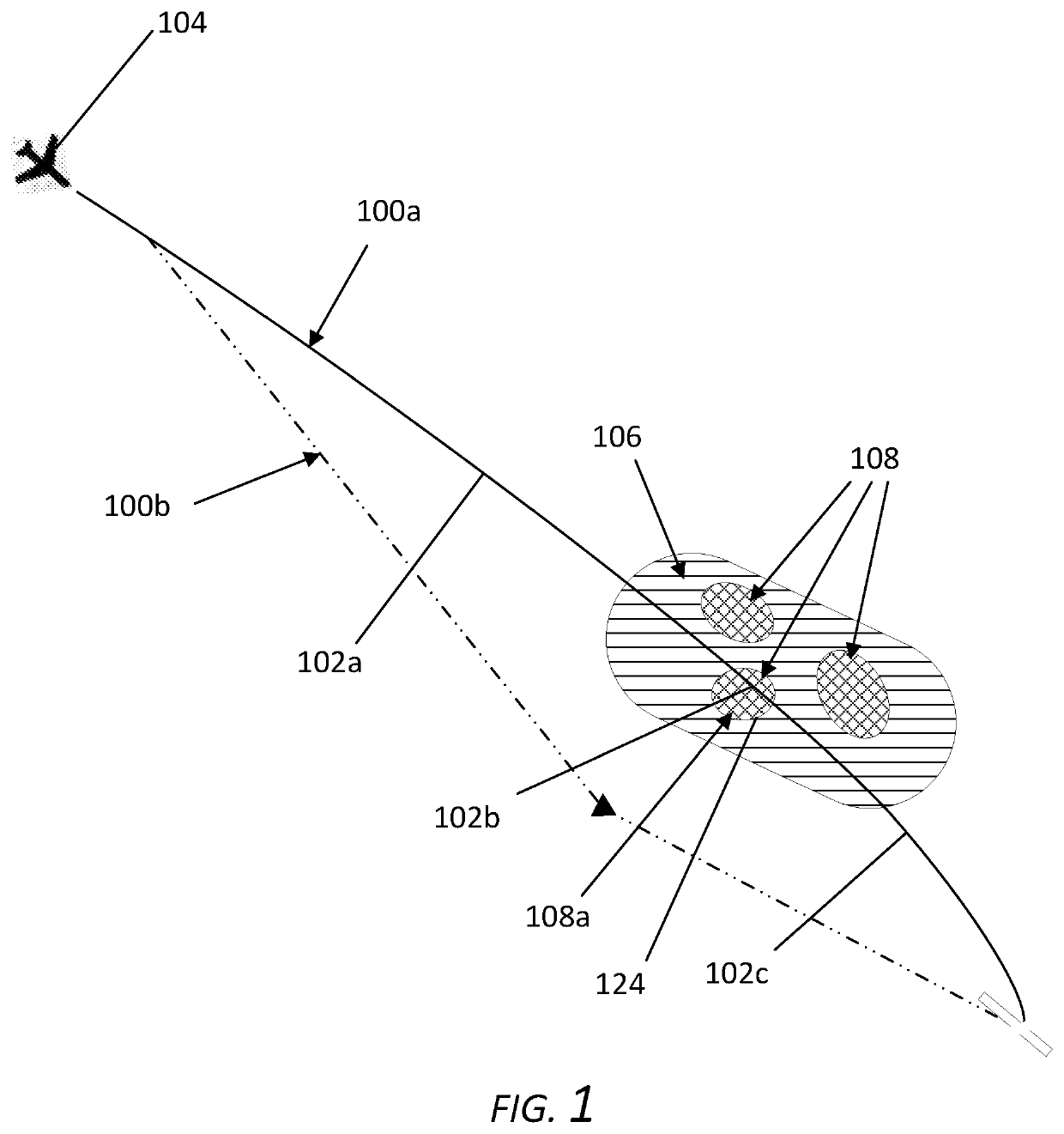
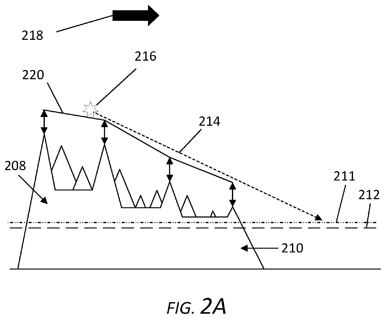
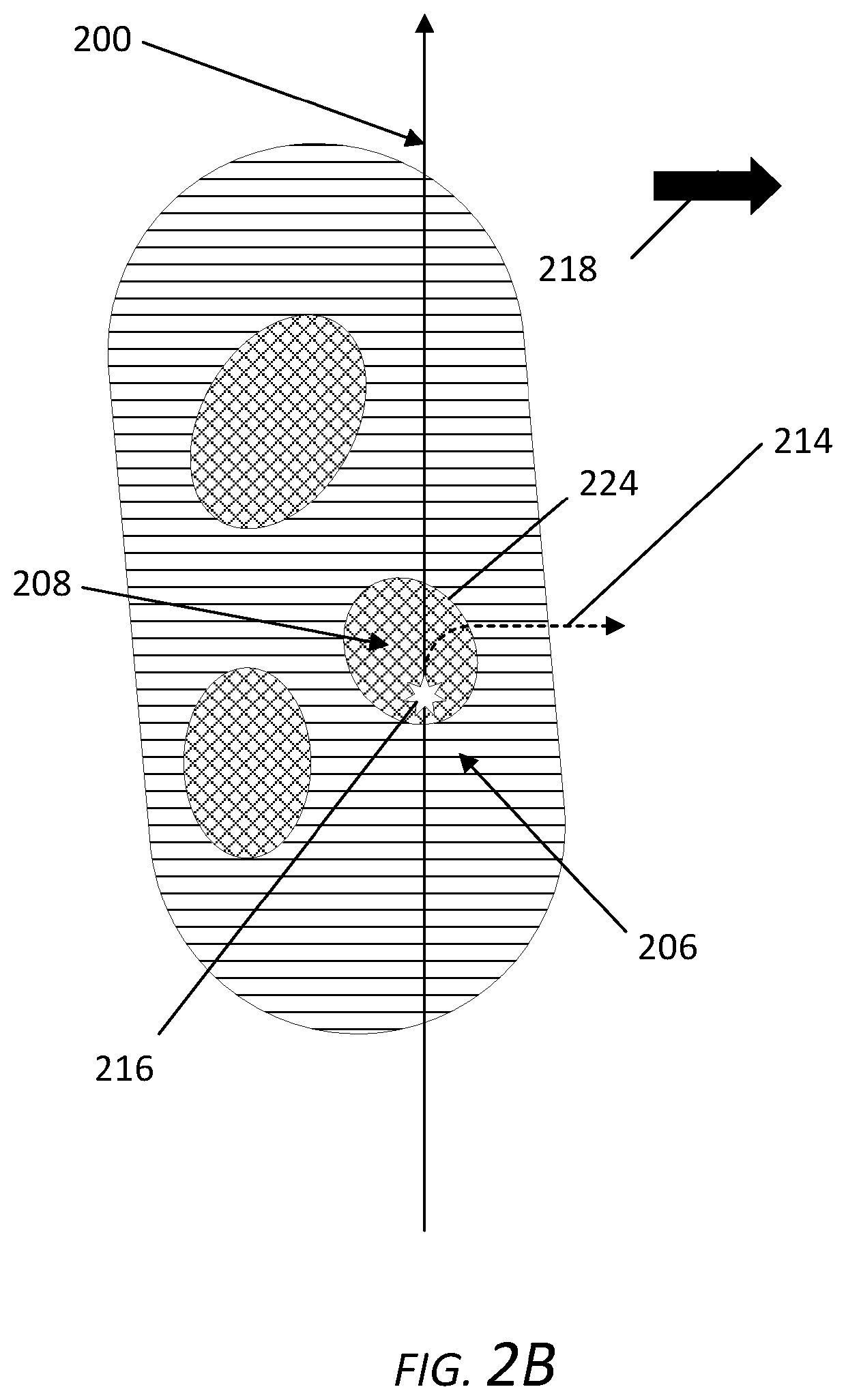
[0140]Clause 1: A method for determining a flight plan from an origin to a destination for an aircraft, comprising: determining one or more regions that intersect an initial flight path and comprise at least one terrain feature having an elevation greater than an elevation threshold; for each respective region in the one or more regions: determining a flight area within the respective region based on the initial flight path and an elevation threshold line, wherein the elevation threshold line indicates a portion of the respective region in which all terrain is below the elevation threshold in a safe descent direction for the respective region; determining one or more segments of the initial flight path in the respective region that comprise one or more terrain features having an elevation greater than the elevation threshold; and determining a modified flight path for each respective segment of the one or more segments of the initial flight path in the respective region by: determin...


PUM


Abstract

Certain aspects of the present disclosure provide a method for determining a flight plan for an aircraft, including: determining one or more regions that intersect an initial flight path and comprise at least one terrain feature having an elevation greater than an elevation threshold; for each respective region: determining a flight area based on the initial flight path and an elevation threshold line; determining one or more segments of the initial flight path that comprise one or more terrain features having an elevation greater than the elevation threshold; and determining a modified flight path for each respective segment by: determining a plurality of descent gradients along the respective segment; and moving the respective segment of the initial flight path in the safe descent direction if any of the plurality of descent gradients would collide with any of the one or more terrain features.

Description

INTRODUCTION[0001]Aspects described herein relate to systems and methods for determining more efficient flight plans while maintaining safe descent options when flying over or near high elevation terrain features.[0002]Conventional flight planning systems avoid plotting flight paths over or near high elevation terrain features to reduce the risk posed by such terrain features in the event of an unplanned descent, such as in the case of a rapid descent in response to an unexpected cabin depressurization event. This is because it is generally desirable to descend as quickly as possible to a safe altitude and then to land at a nearby airport and high elevation terrain features may frustrate those objectives. Consequently, flight paths in regions with high elevation terrain features tend to be longer and less direct, which significantly impacts the efficiency of flight operations. For example, longer flight paths mean increased fuel use and increased wear on aircraft components, which l...

Claims


Application Information

Patent Timeline
Patent Type & Authority Applications(United States)
IPC IPC(8): G08G5/00G08G5/02G08G5/04
CPCG08G5/0039G08G5/025G08G5/0091G08G5/0086G08G5/045G08G5/003G08G5/0047G08G5/0021
Inventor SHU-ZHONG CABOS, RALF RENEKNEUPER, NILS
Owner THE BOEING CO
Why Eureka
Try Eureka