
Method and system for spatial evaluation of field and crop performance
a spatial evaluation and field technology, applied in the field of agriculture, can solve the problems of limiting the utility of data, preventing accurate predictions regarding the heritable component of crop performance, and not being optimally suited to the accounting of g.time.e. variation,
- Summary
- Abstract
- Description
- Claims
- Application Information
AI Technical Summary
Problems solved by technology
Method used
Image

Examples
Embodiment Construction
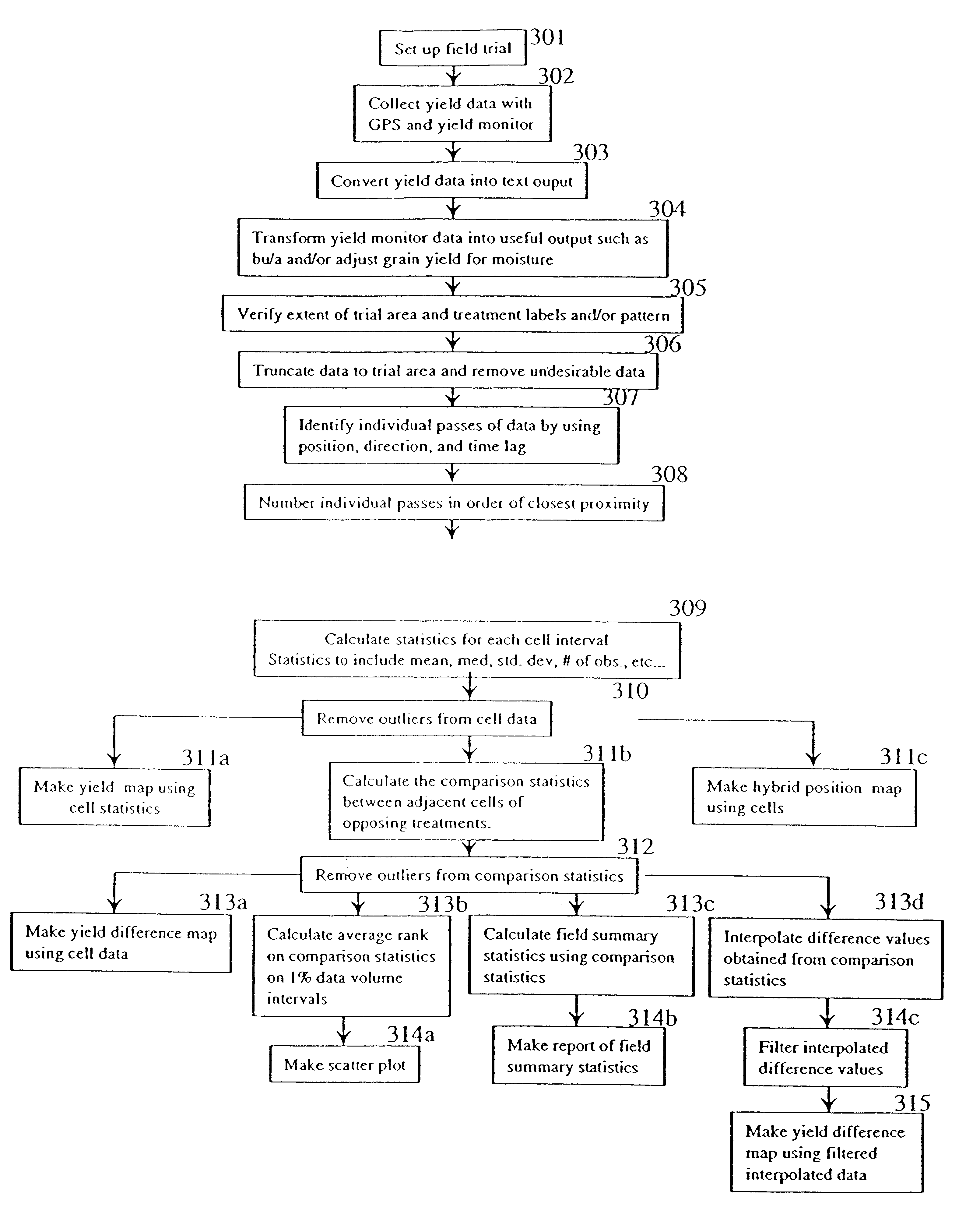
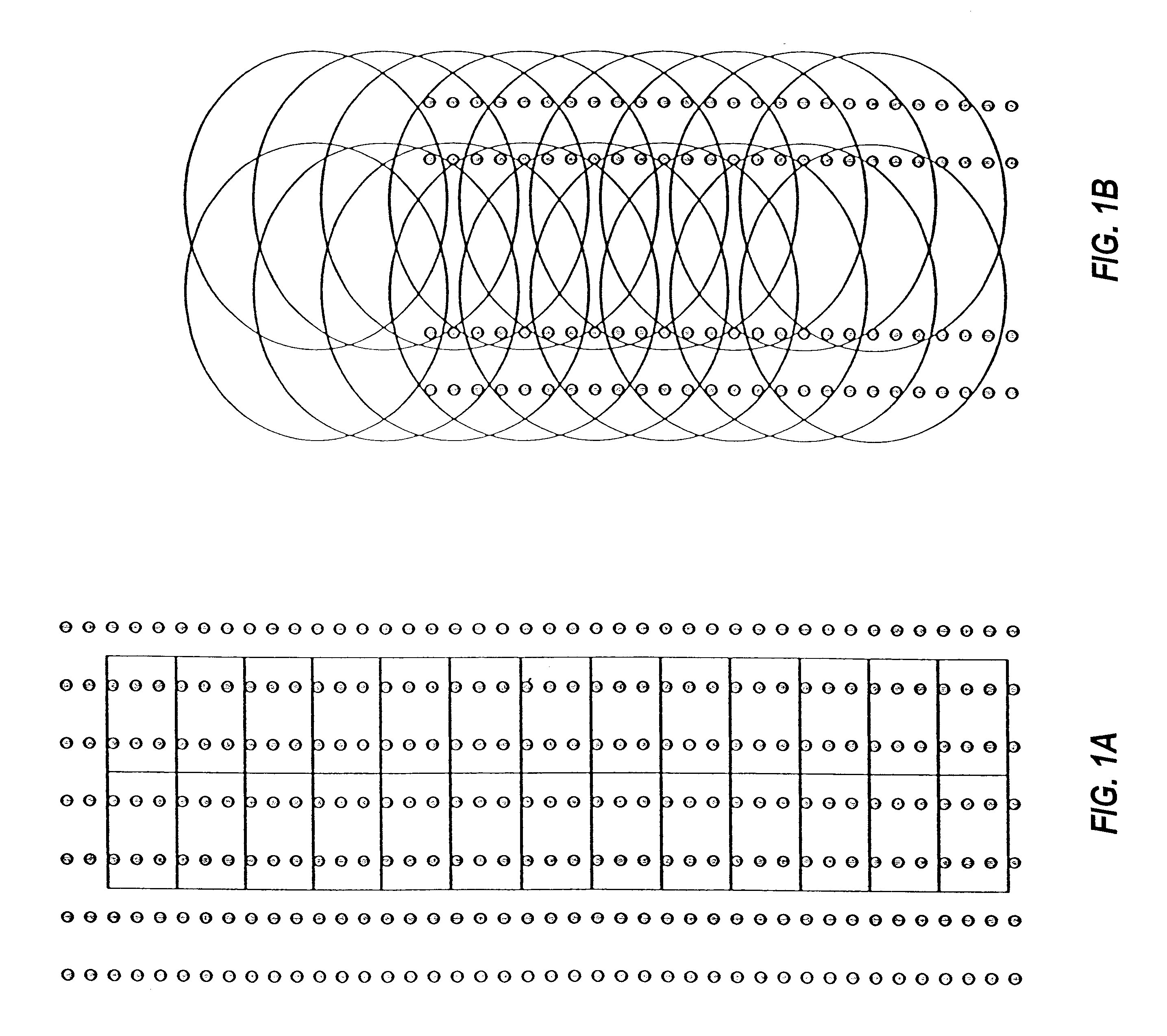
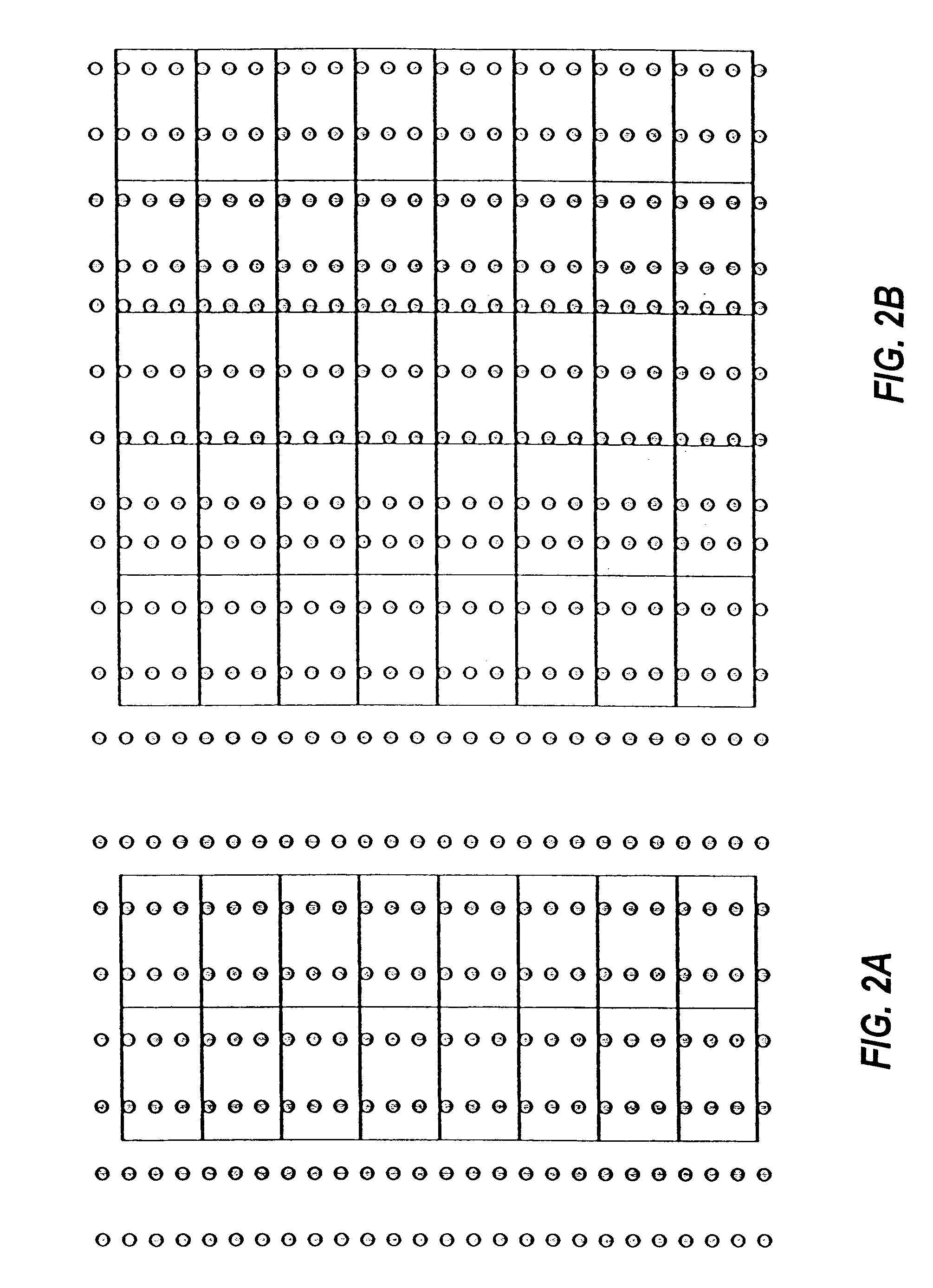
The current invention seeks to overcome limitations in the prior art by providing a technique for the cell (length unit) based comparison of field characteristics. Through use of comparisons, the current invention better characterizes genotype by environment (G.times.E) interaction by allowing a smaller area of comparison. The invention also represents an advance over the prior art in that it can be used to analyze crop data in a non-uniform grid pattern. The method allows production of data maps for commercial agricultural production fields which look unlike conventional maps. This is because previous maps include interpolated data that are typically calculated from larger regions, which can result in less sensitivity.
The distinction and benefits of the current method relative to the prior art can be seen in FIG. 1. The current method comprises designation of specific cells in which sampled data does not overlap (FIG. 1A), providing a more accurate analysis. The prior art method (F...
PUM
 Abstract
Description
Claims
Application Information