System and method for estimating impedance time through a road network

a technology of road network and impedance time, applied in the direction of distance measurement, navigation instruments, instruments, etc., can solve problems such as traffic experience potential delays, and achieve the effect of improving shortest distance routes

Inactive Publication Date: 2005-02-15
GARMIN
View PDF13 Cites 26 Cited by
  • Summary
  • Abstract
  • Description
  • Claims
  • Application Information

AI Technical Summary

Benefits of technology

FIG. 8 illustrates a flow chart of a method for improving shortest distance routes in accordance with an embodiment of the present invention.

Problems solved by technology

The node impedance may indicate a potential delay that traffic experiences when traveling through a node.

Method used


Image

  • System and method for estimating impedance time through a road network
  • System and method for estimating impedance time through a road network
  • System and method for estimating impedance time through a road network

Examples


Embodiment Construction

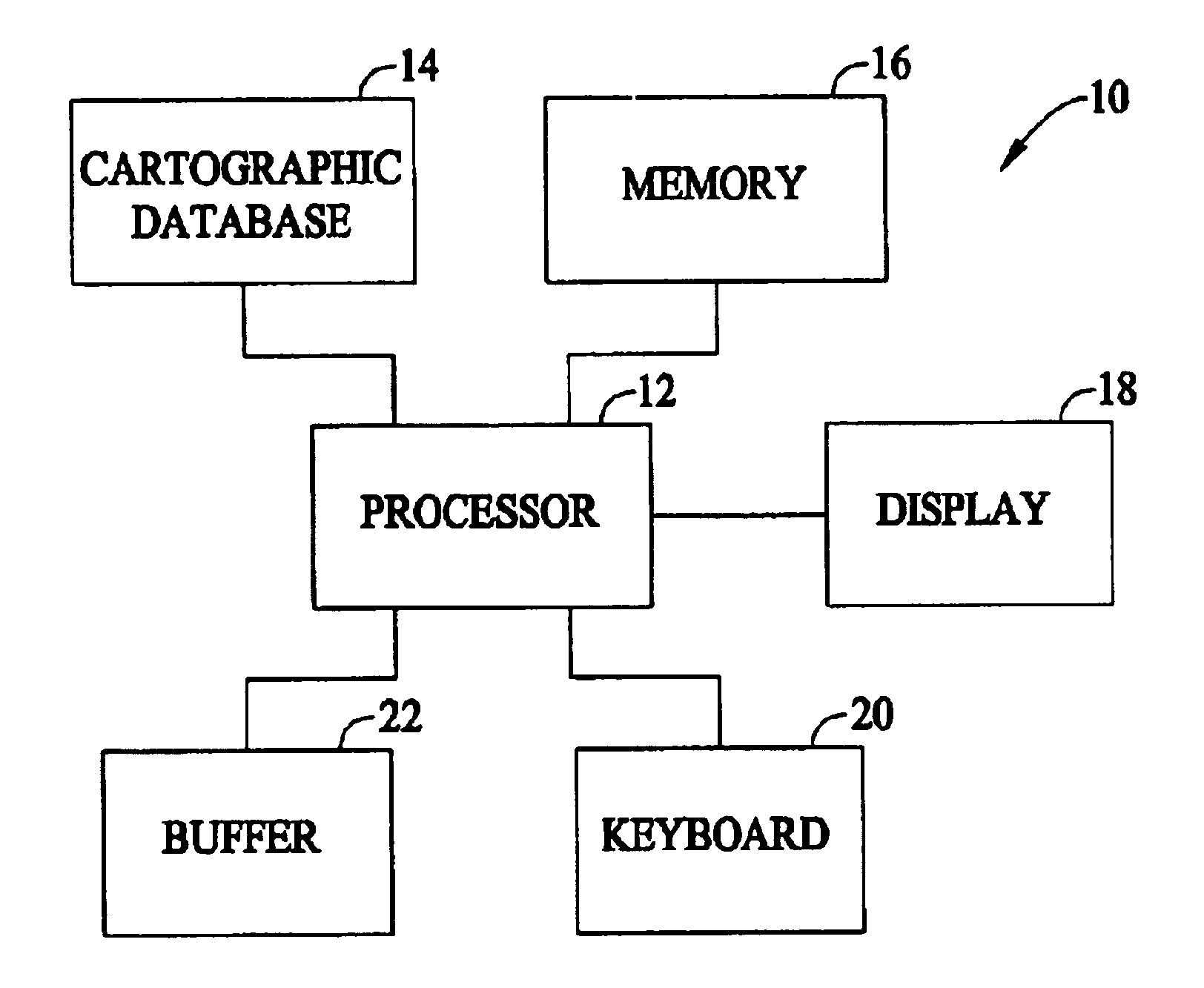
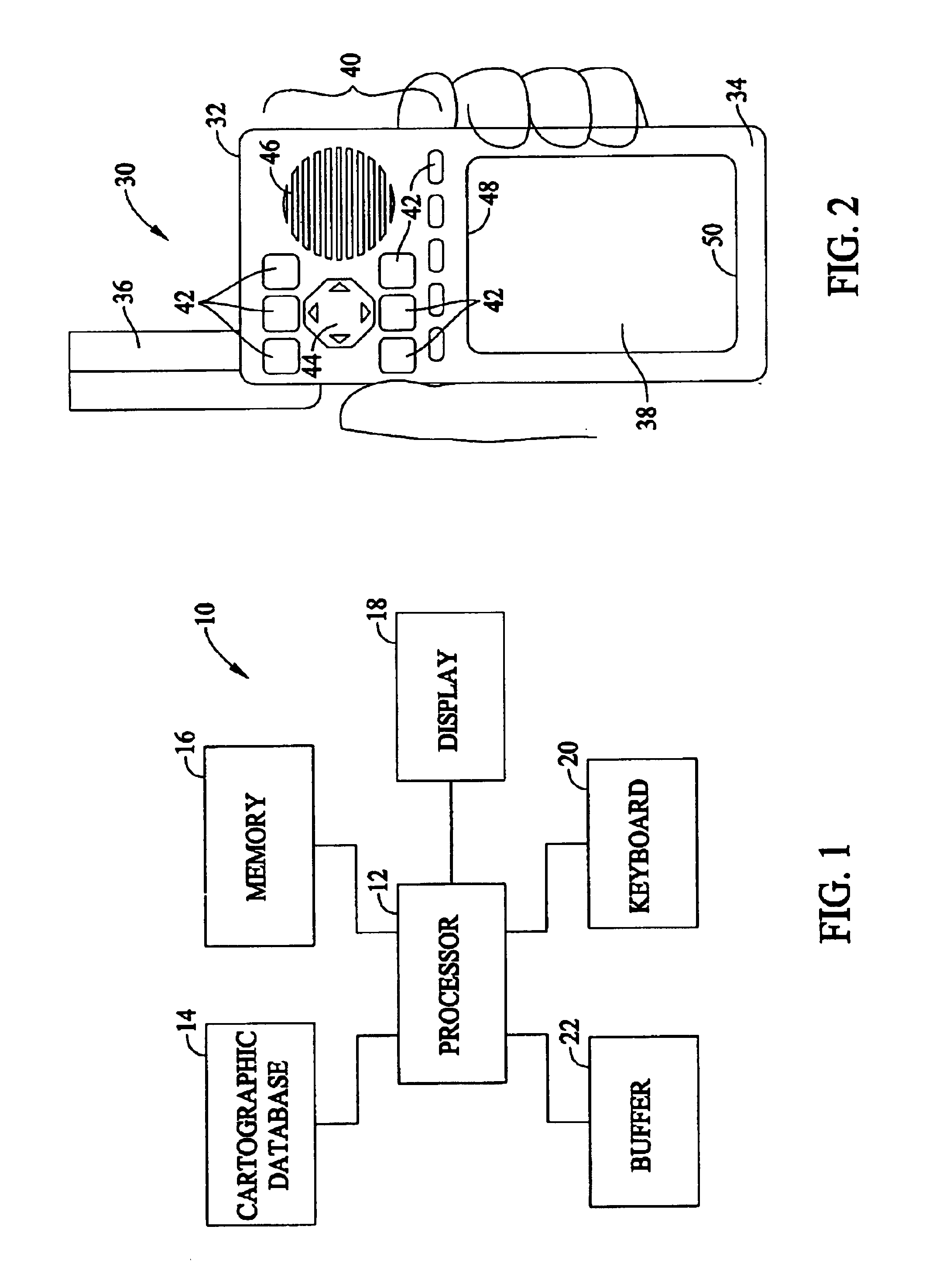
FIG. 1 illustrates a system 10 formed in accordance with an embodiment of the present invention. The system 10 includes at least one processor 12 for carrying out various processing operations discussed below in more detail. The processor 12 is connected to a cartographic database 14, memory 16, a display 18, a keyboard 20, and a buffer 22. Optionally, more than one processor 12 may be included. The cartographic database 14 may store data indicative of a roadway network (in full or in part) used in connection with embodiments of the present invention. The memory 16, while illustrated as a single block, may comprise multiple discrete memory locations and / or discs for storing various types of routines and data utilized and / or generated by embodiments of the present invention. The buffer 22 represents a memory storage area that may be within memory 16 or separate therefrom. Buffer 22 is used to temporarily store data and / or routines used in connection with embodiments of the present in...


PUM


Abstract

A method and apparatus are provided for estimating an impedance through a node at an intersection between roads in a roadway network. The impedance may be measured in time or distance, for example. Characteristic information describes at least one feature of the intersecting roads. One or more pieces of characteristic information may impact the impedance of traffic through an intersection and are used to estimate the impedance through the node. Examples of characteristic information are speed information, road-type, network routing level, intersection angle information, one-way, and cross traffic turn information. An impedance factor, or a cost, is assigned to each piece of characteristic information. The cost may be positive if the characteristic information adds impedance to the node, or negative if the characteristic information subtracts impedance from the node.

Description

BACKGROUND OF THE INVENTIONCertain embodiments of the present invention relate to navigational route planning. In particular, certain embodiments of the present invention relate to determining a route through a road network.Route planning devices are well known in the field of navigational instruments. Several algorithms utilized by planning devices calculate the route from one of the source and / or destination locations or from both simultaneously. Conventional planning algorithms operate based on a predefined stored data structure including data indicative of a geographic region containing the source and destination locations.Some devices implement a straight line approach in determining the distance between source and destination locations. In the straight line approach, the processor creates a straight line from the present location to the final destination and measures that straight line distance. For example, if a desired destination is on a mountain, the straight line distance...

Claims


Application Information

Patent Timeline
Patent Type & Authority Patents(United States)
IPC IPC(8): G01C21/32G01C21/28G08G1/0968
CPCG01C21/32G08G1/096883G08G1/096838G08G1/096811
Inventor BEESLEY, DARIN J.CHILDS, MICHAEL
Owner GARMIN
Why Eureka
Try Eureka