
Perspective view primary flight display with terrain-tracing lines and method

a technology of primary flight display and perspective view, applied in the field of vehicle display, can solve the problems of obstructing the operator's view of other information on the same display, and the display may not provide sufficient information for the vehicle operator

Active Publication Date: 2007-05-01
HONEYWELL INT INC
View PDF18 Cites 36 Cited by
  • Summary
  • Abstract
  • Description
  • Claims
  • Application Information

AI Technical Summary

Benefits of technology

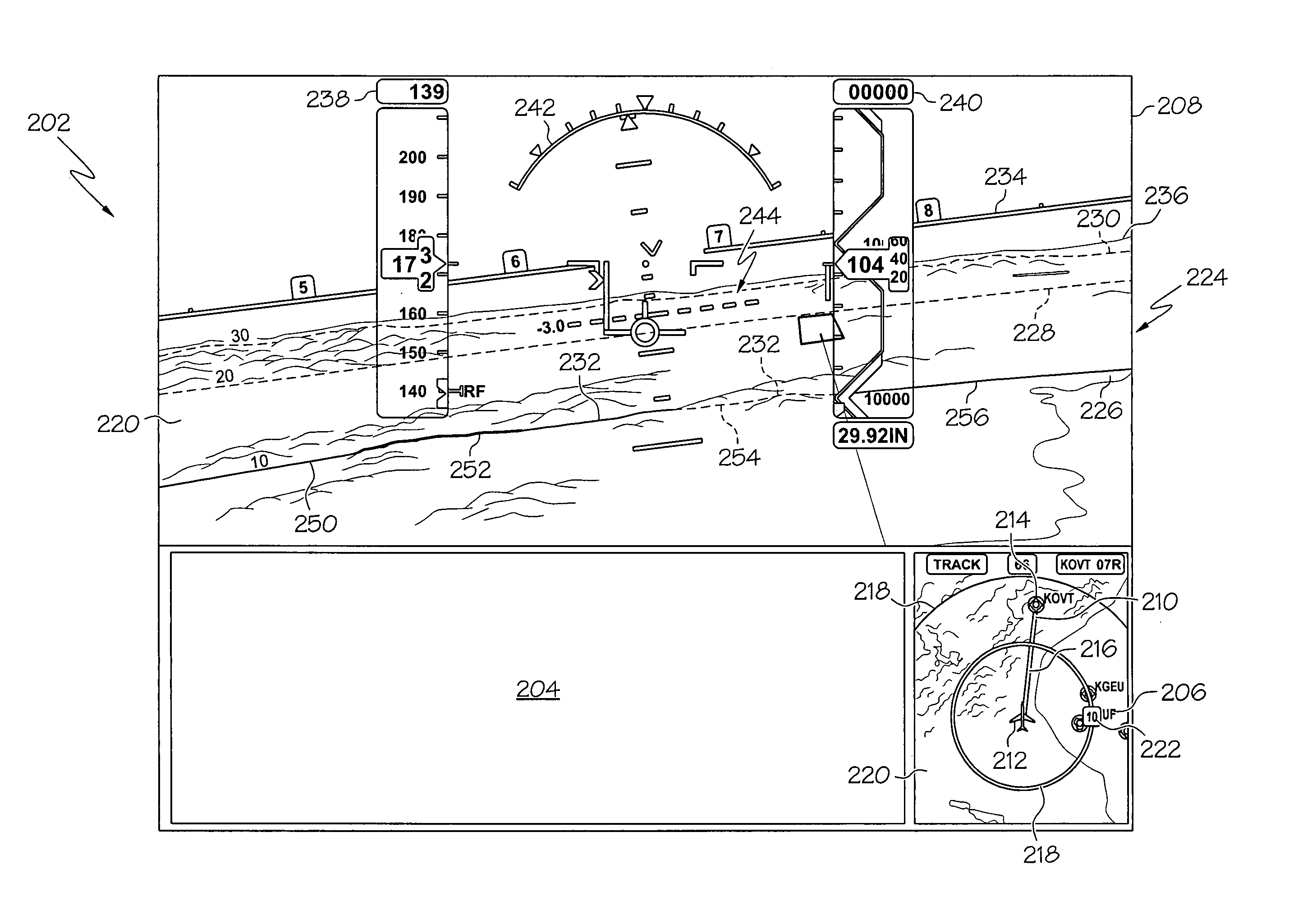
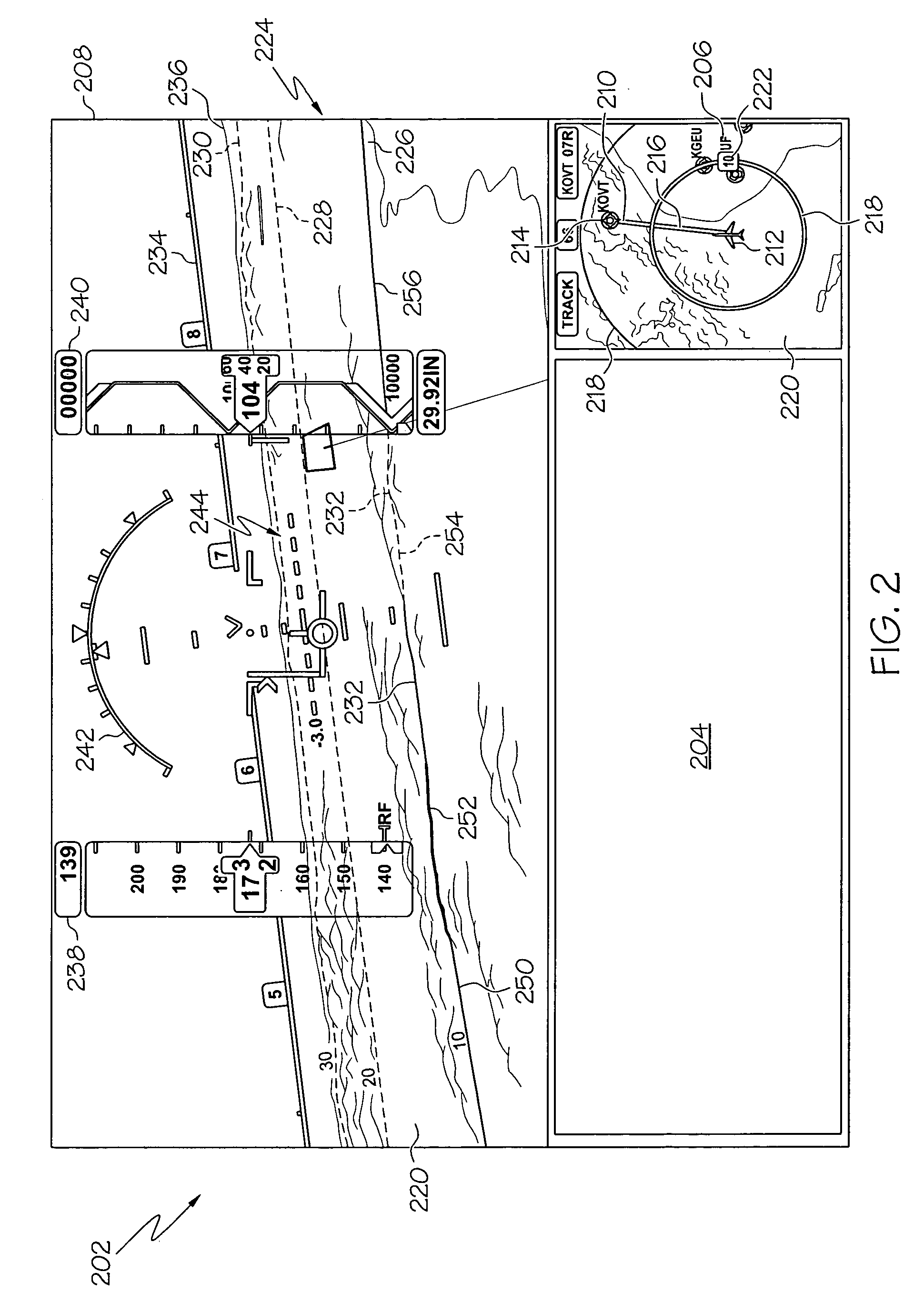
The patent describes a display system for aircraft that can show a perspective view of the terrain and navigation data, along with lines that represent the ground-referenced range and the vehicle-referenced range. The system can also display the terrain-tracing lines in different configurations and colors. The technical effect of this system is that it provides a more realistic and useful display for the pilot during flight, making it easier to navigate the terrain and avoid obstacles.

Problems solved by technology

For example, in some instances, the display may not provide sufficient information for a vehicle operator to determine a distance between the vehicle and a point or an object on the terrain.
In these cases, the planes intrude into the visual space of the display, are always shown in the display, and may obstruct the operator's view of other information on the same display.

Method used


Image

  • Perspective view primary flight display with terrain-tracing lines and method
  • Perspective view primary flight display with terrain-tracing lines and method
  • Perspective view primary flight display with terrain-tracing lines and method

Examples


Embodiment Construction

[0011]The following detailed description is merely exemplary in nature and is not intended to limit the invention or the application and uses of the invention. Furthermore, there is no intention to be bound by any expressed or implied theory presented in the preceding technical field, background, brief summary or the following detailed description. Additionally, although the invention is described below as being implemented in aircraft, it will be appreciated that any other manned or unmanned vehicles, such as watercraft and spacecraft may alternatively incorporate the invention.

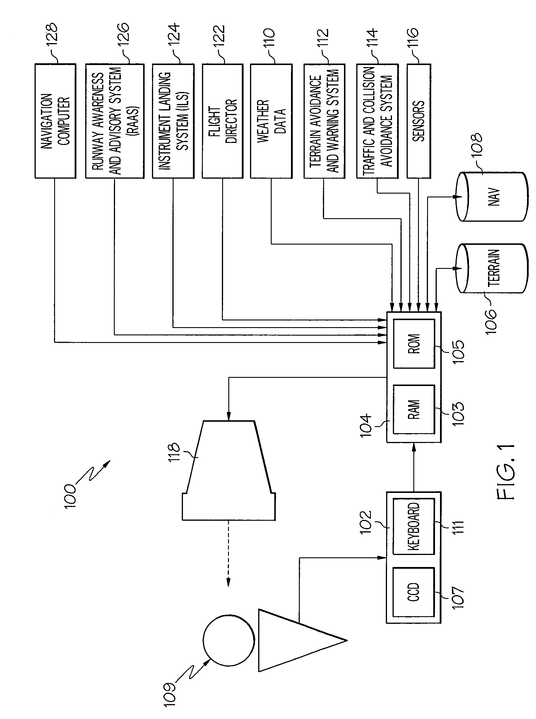
[0012]The present invention may be described in terms of functional block diagrams and various processing steps. It should be appreciated that such functional blocks may be realized in many different forms of hardware, firmware, and / or software components configured to perform the various functions. For example, the present invention may employ various integrated circuit components, e.g., memory elements, di...


PUM


Abstract

A display system and method are provided for a vehicle that includes a processor and a display. The processor is adapted to receive terrain data and navigation data operable, in response thereto, to supply one or more image rendering display commands. The display device is coupled to receive the image rendering display commands and operable, in response thereto, to simultaneously render (i) a perspective view image representative of the terrain data and the navigation data and (ii) one or more terrain-tracing lines.

Description

TECHNICAL FIELD[0001]The present invention relates to a display for a vehicle and, more particularly, to a system and method for displaying distance or time information in a forward-looking perspective display.BACKGROUND[0002]Modern multifunctional map displays, particularly those used in vehicles, such as aircraft, watercraft, or spacecraft, are capable of displaying a considerable amount of information such as vehicle position, attitude, navigation, target, and terrain information. Most modern displays additionally allow a vehicle flight plan to be displayed from different views, either a lateral view, a vertical view, or perspective views which can be displayed individually or simultaneously on the same display. The lateral view, generally known as a lateral map display, is basically a top-view of the aircraft flight plan, and may include, for example, a top-view aircraft symbol, waypoint symbols, line segments that interconnect the waypoint symbols, and range rings. The lateral ...

Claims


Application Information

Patent Timeline
Patent Type & Authority Patents(United States)
IPC IPC(8): G06T17/00
CPCG01C23/00
Inventor HE, GANGFEYEREISEN, THEA L.WYATT, IVAN S.
Owner HONEYWELL INT INC
Learn More