
Methods for assigning geocodes to street addressable entities

Active Publication Date: 2008-01-29
TAMIRAS PER PTE LTD LLC
View PDF13 Cites 160 Cited by
  • Summary
  • Abstract
  • Description
  • Claims
  • Application Information

AI Technical Summary

Benefits of technology

[0022]Optionally, the accuracy of geocoding may be improved by applying an address registration technique. Multi-unit buildings, addressable entities with multiple buildings, landmarks and / or addressable entities with known addresses may be registered in a registration database. In some cases, this registration database may be used to pre-assign addresses to addressable entities with known addresses before addresses are assigned to other addressable entities.

Problems solved by technology

These approaches, however are very expensive and time-consuming to implement on a large scale.
These approaches, however, often produce inaccurate geocodes.
Unfortunately, the above assumptions often fail, and the resulting geocodes are inaccurate.
In some cases, the data is collected and entered into the Street Map Database using errorprone manual techniques, so it is not uncommon to find errors in data purchased from some Street Map Database providers.
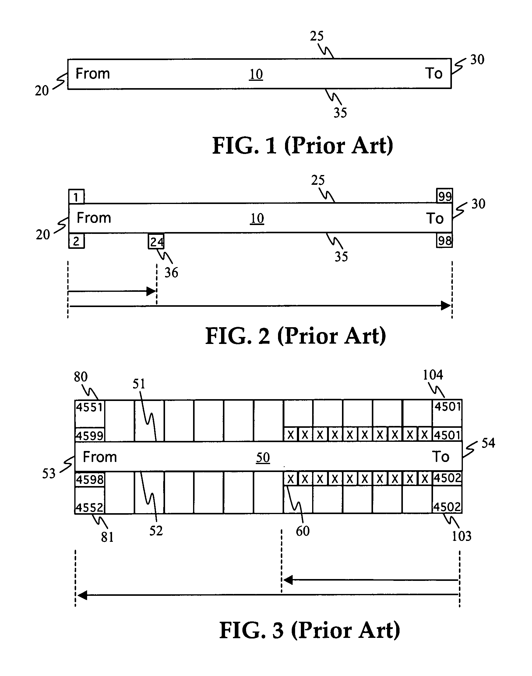
Thus, if the Street Map database contains errors, such as incorrect endpoint addresses or locations, then the results of Address Interpolation will also be inaccurate.
Because these assumptions are not always satisfied, inaccurate results are produced.
For example, when this Address Interpolation technique is applied to more complex map scenarios, it may produce unacceptable results.
The above example illustrates how errors in the Street Map database can produce inaccurate geocodes when using Address Interpolation.
It is also evident that if the street segment is curved or if the residences are not actually located right next to the street, then the geocodes generated by Address Interpolation will be inaccurate.
Other sources of inaccuracies are non-uniform spacing of lots along a street segment, or non-uniform distribution of addresses along a segment.
This method, however, suffers from the disadvantage that it requires the explicit geocoding of the parcels in latitude and longitude so that the latitude and longitude values can be correlated with the APN (Assessor Parcel Number) or PIN (Parcel Identifier Number) in a property-tax related database.
Because access to property-tax databases is controlled by local jurisdiction, the ability to access property tax databases is inconsistent.
These inconsistencies can introduce both technical and logistical issues.
For others, property data is limited to paper or raster scans and thus not usable as source for geocoding.

Method used


Image

  • Methods for assigning geocodes to street addressable entities
  • Methods for assigning geocodes to street addressable entities
  • Methods for assigning geocodes to street addressable entities

Examples


Embodiment Construction

[0041]The following definitions provide a clear and definite interpretation of various terms used in the context of the present description.

[0042]Geocoding—Globally Unique and Locally Unique, Implicit and Explicit

[0043]A geocode is a code that specifies a single geographical position of some entity. Geocoding is the process that assigns a geographical position, such as a pair of latitude-longitude coordinates, to some entity or, equivalently, to a unique identifier of such an entity (e.g., a street address, intersection, region name, or landmark name). Entities are buildings, structures, lots, properties, or other geographical regions. In some cases, large regions may be geocoded. For example, a zip code region, uniquely identified by its zip+4 code, may be geocoded based on the geographic position of the centroid of the zip code region. Similarly, when a house is geocoded, a single position somewhere in or near the house is selected and associated with a unique identifier, such as ...


PUM


Abstract

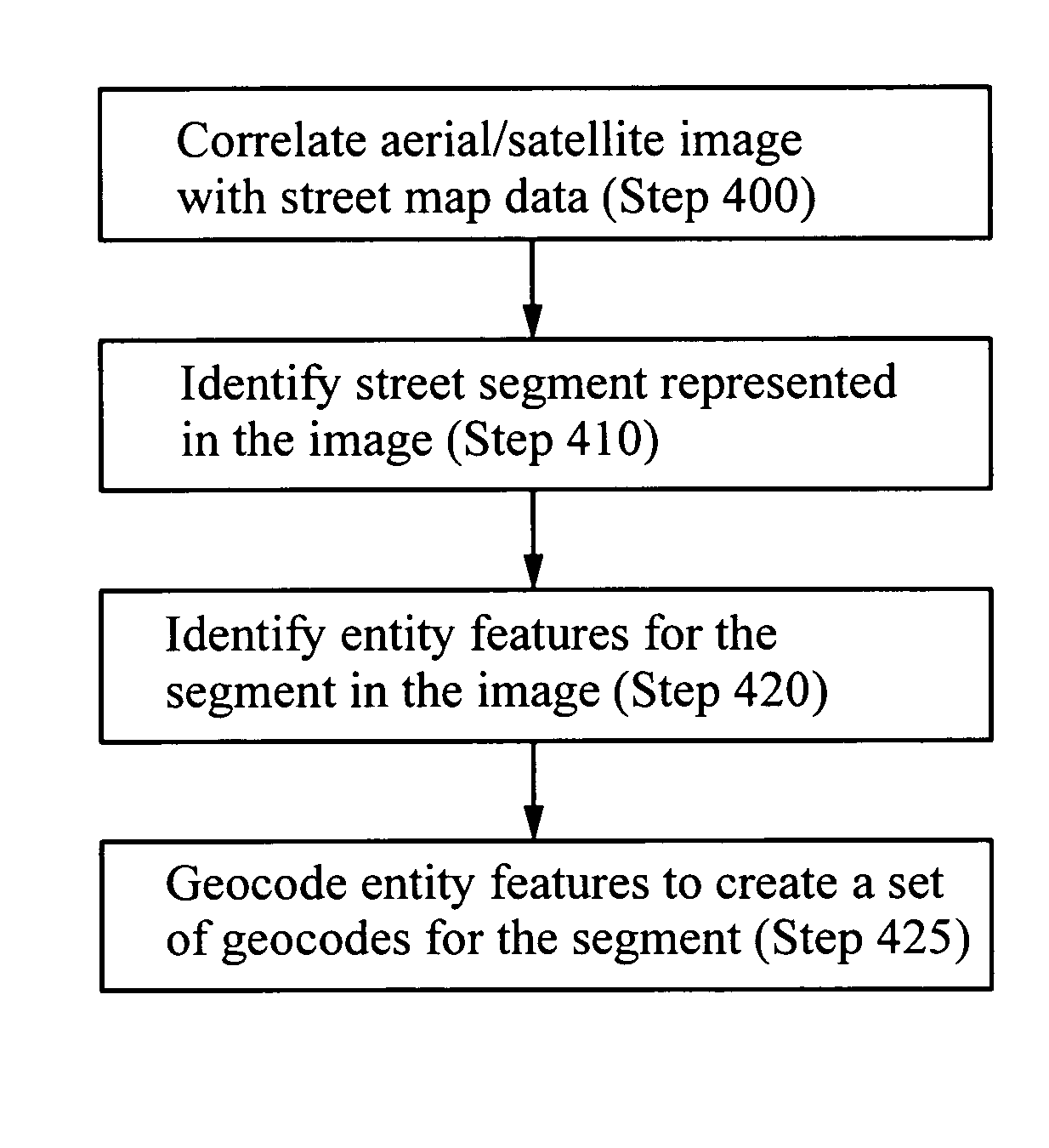
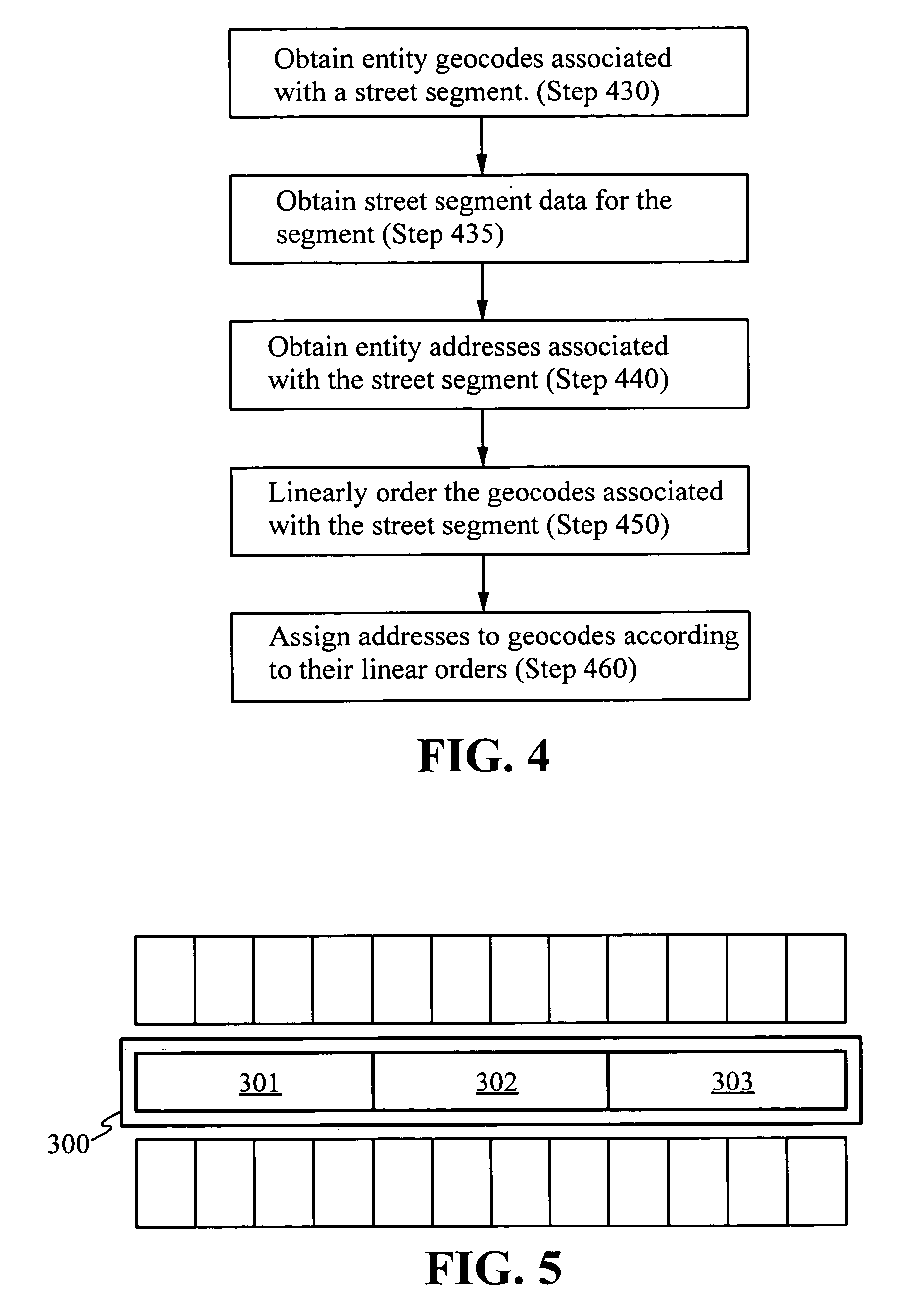
A method for assigning of geocodes to addresses identifying entities on a street includes ordering a set of entity geocodes associated with a street segment based on ordering criteria such as the linear distance of the geocodes along the length of the street segment. Assignable addresses are matched with the ordered geocodes creating a correspondence between a numerical order of the assignable addresses and a linear order of the ordered set of geocodes, consistent with address range direction data and street segment side data. The geocodes may be implicit or explicit, locally unique or globally unique. The set of entity geocodes may be obtained by identifying image features in aerial imagery corresponding to streets and buildings and correlating this information with data from a street map database.

Description

CROSS-REFERENCE TO RELATED APPLICATIONS[0001]This application claims priority from U.S. provisional patent application No. 60 / 426,568 filed Nov. 15, 2002, which is incorporated herein by reference.FIELD OF THE INVENTION[0002]This invention relates generally to methods for assigning geocodes to entities such as buildings, structures, lots, and other geographical regions which may be identified by street addresses.BACKGROUND OF THE INVENTION[0003]A geocode is a geographical location associated with an entity such as a building, structure, parcel, lot, or other geographical region. Often such entities are identified by a street address, in which case the entities are called street-addressable entities. Geocoding is the process that associates a specific geographical location, such as a pair of latitude-longitude coordinates, with the street address or other identifier of the entity. Geocodes help in enhancing our understanding of geographic relationships between addressable entities on...

Claims


Application Information

Patent Timeline
IPC IPC(8): G06K9/00G01V3/38G06F19/00G06K9/34G06K9/46G06K9/66G01C21/26
CPCG01C21/32G01C21/3852G01C21/3867
Inventor ZOKEN, JACK M.DEVDHAR, PRASHANT P.
Owner TAMIRAS PER PTE LTD LLC
Learn More