

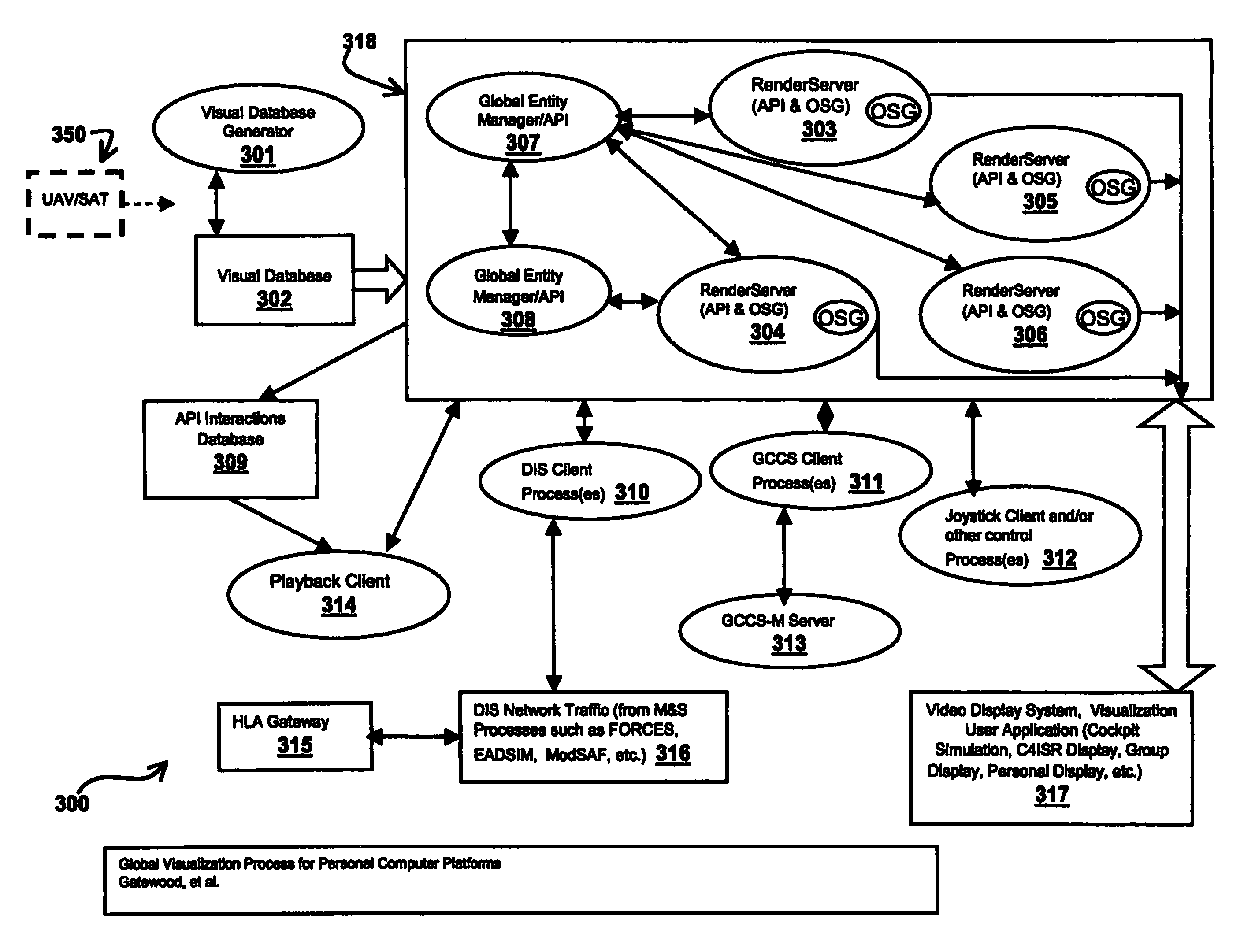
Global visualization process for personal computer platforms (GVP+)
a technology of personal computers and visualization processes, applied in the field of optimal visualization of complex scenarios, can solve the problems of unacceptably low update rate and small data input range, and achieve the effects of accurate and rapid visualization of an area, high resolution, and convenient us
- Summary
- Abstract
- Description
- Claims
- Application Information
AI Technical Summary
Benefits of technology
Problems solved by technology
Method used
Image

Examples
examples
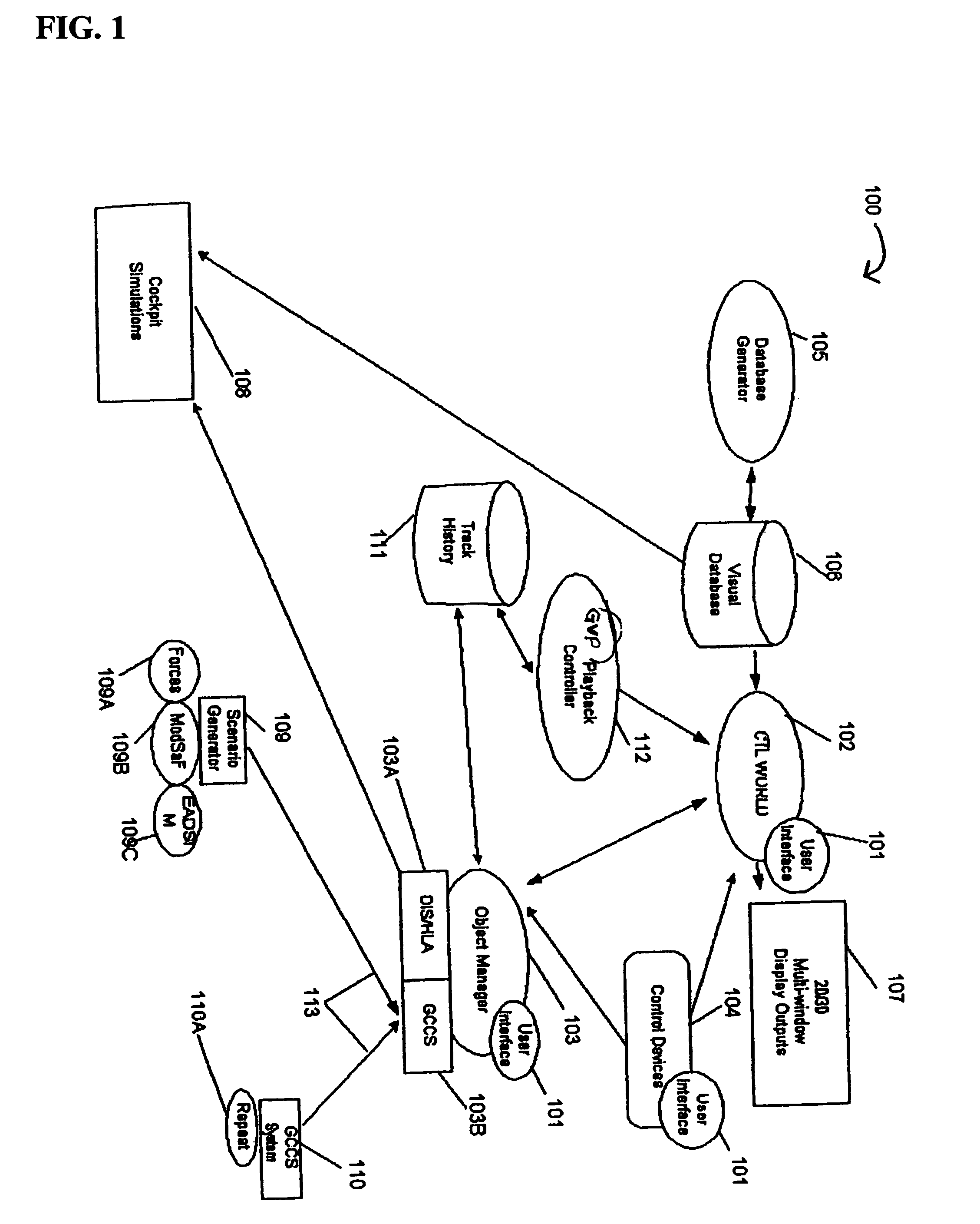
[0136]Models suitable for flight simulator operation as out-the-window displays. Because GVP is fully compliant with “round-world” geometry standards, interfaces are facilitated in interactions between simulation models such as DIS that incorporate operational position data in the simulation. The GVP model type and construction and the GVP CTL World display software comprise a standard or uniform product type suitable for “high end” military flight training simulators.
Unmanned Airborne Vehicle (UAV) and UCAV systems. GVP is suitable for training, multi-platform command and control, reconnaissance and surveillance processes, planning and rehearsal, and rapid prototyping applications.
Interactive visualization during tactical flight operations. Applications range from mission rehearsal including while deployed or airborne to operational exploitation of near real time tactical intelligence. GVP-based displays, by providing a full visualization context for mission depiction, may also pro...
PUM
 Abstract
Description
Claims
Application Information