
Identifying geographic-areas based on change patterns detected from high-resolution, remotely sensed imagery

a technology of high-resolution, remotely sensed imagery and geographic areas, applied in scene recognition, instruments, navigation instruments, etc., can solve the problems of unsearched, unsearched, unsearched, etc., and achieve the effect of avoiding unsearched, avoiding unsearched, and avoiding unsearched

Inactive Publication Date: 2011-08-16
UNIVERSITY OF MISSOURI
View PDF3 Cites 14 Cited by
  • Summary
  • Abstract
  • Description
  • Claims
  • Application Information

AI Technical Summary

Benefits of technology

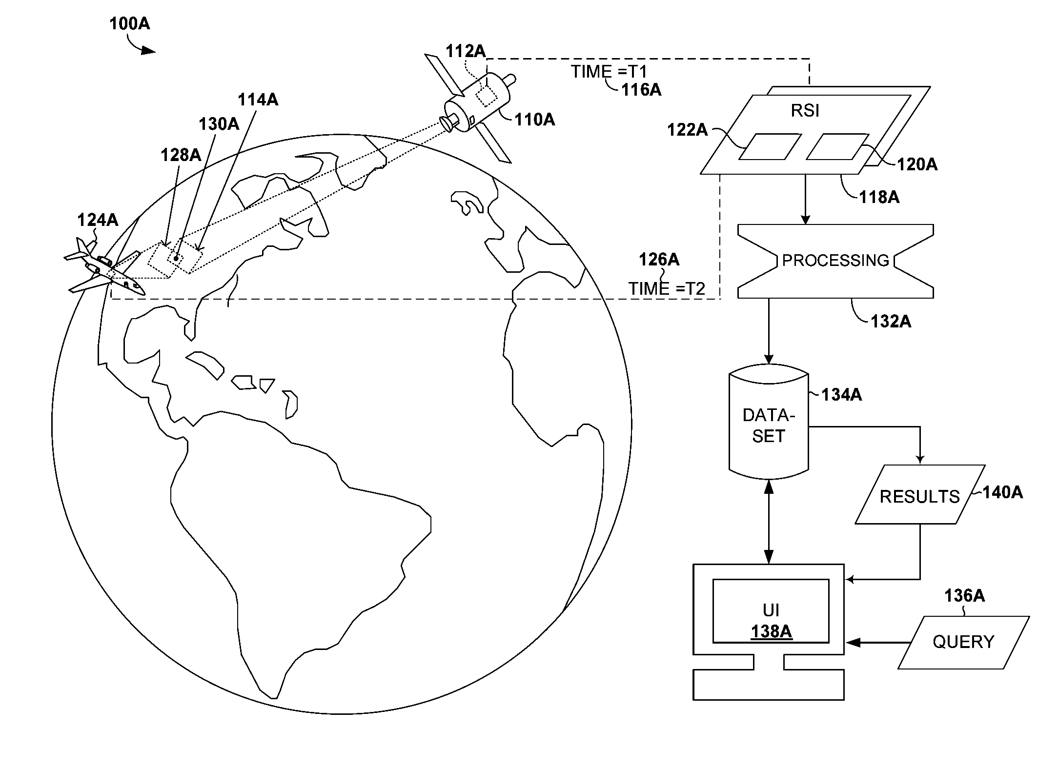
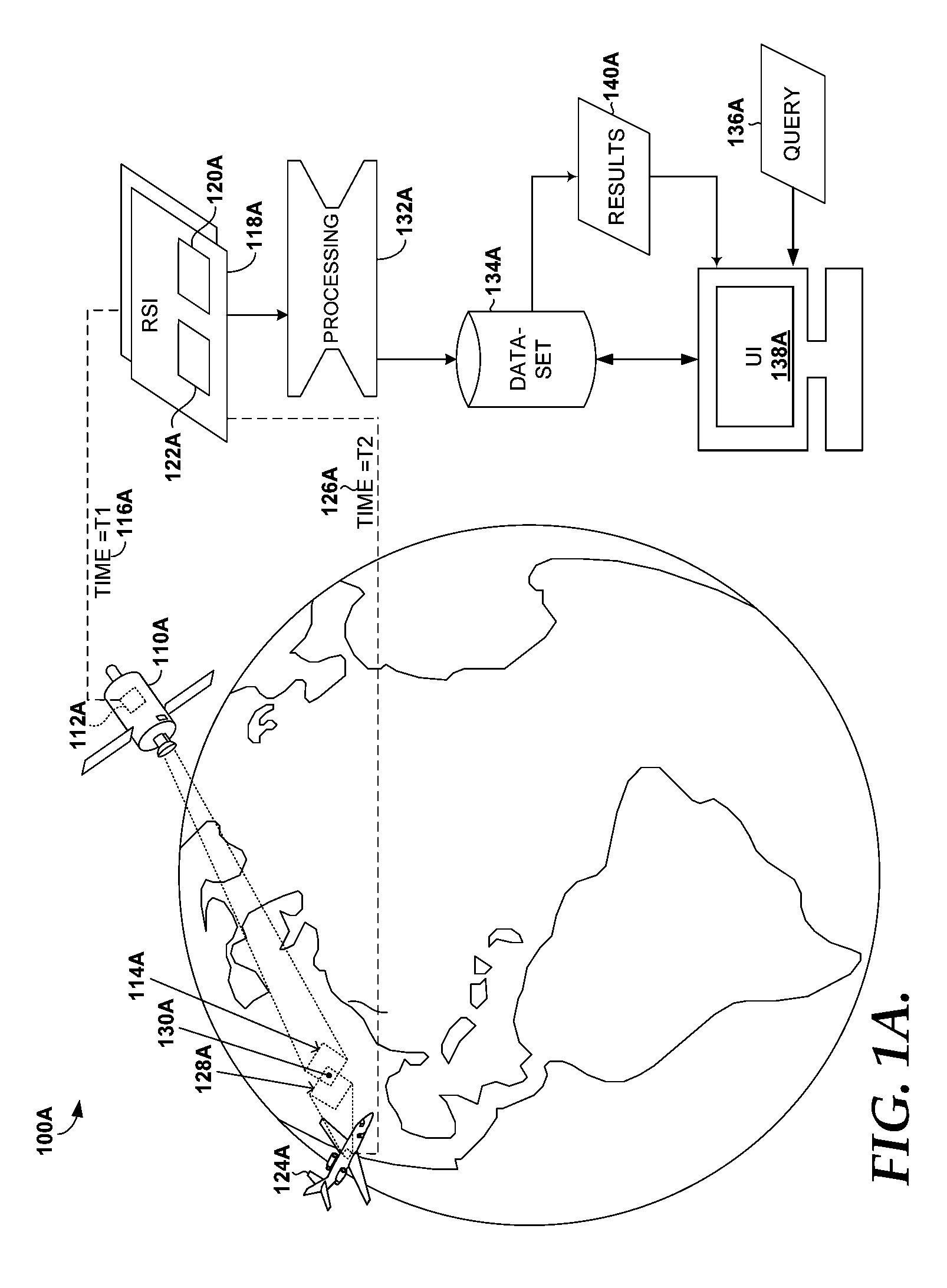
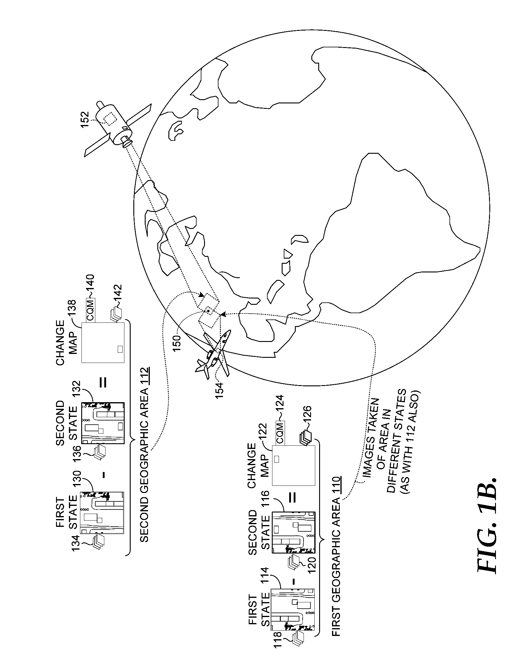
The patent describes how to use high-resolution satellite imagery to identify objects that have changed on the ground. This technology can help in various applications such as monitoring forest health, detecting crop damage, and identifying construction projects.

Problems solved by technology

If a person were armed only with images that depicted the area at various states, the individual might not know where to even begin looking for the road.
This given area of land (not to exclude water) might be vast, such that an individual would not even know where to start looking.
Moreover, even if an individual did know where to look, the individual might only see the constructed road, which might not be relevant because the road might have been present for any number of years (assuming that the individual is interested in finding areas that have changed over time).
In many situations today, a great deal of remotely sensed imagery sits idle, unsearched, and unused because there is simply too much information to even start analyzing.

Method used


Image

  • Identifying geographic-areas based on change patterns detected from high-resolution, remotely sensed imagery
  • Identifying geographic-areas based on change patterns detected from high-resolution, remotely sensed imagery
  • Identifying geographic-areas based on change patterns detected from high-resolution, remotely sensed imagery

Examples


Embodiment Construction

[0068]Throughout the description of our technology, several acronyms, shorthand notations, and terms are used to aid the understanding of certain concepts pertaining to the associated system and services. These acronyms and shorthand notations are intended to help provide an easy methodology of communicating the ideas expressed herein and are not meant to limit the scope of our technology unless we clearly say so. The table below does not include a full definition. A full definition of any term can only be gleaned by giving consideration to the full breadth of this patent.

[0069]Sometimes, we use different terms to refer to similar or the same things. We do not necessarily mean to implicate a difference per se; but are constrained by certain statutory requirements that apply to patents and patent applications. For example, claims must use proper antecedent basis. Sometimes, satisfying this rule can lead to wordiness, whereas using a different word helps make referring to prior terms ...


PUM


Abstract

A method, system, and medium are provided for identifying terrestrial objects that have changed in a certain manner. One embodiment of the method includes receiving a query that includes one or more inputs, which are related to 1) a first terrestrial object (“first object”) and 2) source change-detection information that describes change associated with the first object; applying the query to a dataset that includes indexed information that describes the imagery; based on the one or more inputs, receiving a query result by identifying a set of regions in the dataset that are respectively associated with change information that is similar to that of the source change-detection information; and presenting on a presentation device indications of at least a portion of the identified set of regions.

Description

CROSS REFERENCE TO RELATED APPLICATIONS[0001]This application claims the benefit of U.S. Provisional Application No. 61 / 106,803, filed Oct. 20, 2008 and U.S. Provisional Application No. 61 / 105,955, filed Oct. 16, 2008, which are both expressly incorporated by reference herein in their entirety.[0002]Also, much of this disclosure is shared with the following U.S. patent applications, filed on even date herewith, one of which is this application:[0003]TitleFiling DateDETECTING GEOGRAPHIC-AREA CHANGE USINGOct. 20, 2008HIGH-RESOLUTION, REMOTELY SENSEDIMAGERYIDENTIFYING GEOGRAPHIC AREAS BASED ONOct. 20, 2008CHANGE PATTERNS DETECTED FROM HIGH-RESOLUTION, REMOTELY SENSED IMAGERYSTORING CHANGE FEATURES DETECTED FROMOct. 20, 2008HIGH-RESOLUTION, REMOTELY SENSEDIMAGERYVISUALIZING GEOGRAPHIC-AREA CHANGEOct. 20, 2008DETECTED FROM HIGH-RESOLUTION,REMOTELY SENSED IMAGERYREVISING IMAGERY SEARCH RESULTS BASEDOct. 20, 2008ON USER FEEDBACKSTATEMENT REGARDING FEDERALLY SPONSORED RESEARCH[0004]This inv...

Claims


Application Information

Patent Timeline
Patent Type & Authority Patents(United States)
IPC IPC(8): G06F17/00G06V20/13
CPCG06K9/0063G06K9/6253G06F16/29G06F16/5854G06V20/13G06V10/945G06V30/422G06F18/22G06F18/40
Inventor DAVIS, CURTIS HERBERTKLARIC, MATTHEW NICHOLASSCOTT, GRANT JASONSHYU, CHI-REN
Owner UNIVERSITY OF MISSOURI
Learn More